TopoQuest Logo
Do you find TopoQuest useful?
Help keep TopoQuest running and adding new maps/features by donating!
Bitcoin:  19c7KJd3qBynnjoSw5npx9KScwjBe4ifkT
Litecoin:  LXs6TkuXGGXo1vDsWCkWVdjQX94eUKd6ui
Home View Maps Find Maps Find Places Resources & Links


Indiantown, Florida Topographic Map

USGS Map Title: Indiantown, FL
USGS Map MRC: 27080A4
DRG (GeoTIFF) Download: o27080a4.tif


Neighboring USGS Topographic Map Quads:


  Bluefield, FL  
27080B5
 

  Indiantown NW, FL  
27080B4
 

  Palm City, FL  
27080B3
 

  Barley Barber Swamp, FL  
27080A5
 

  Indiantown, FL  
27080A4
 

  Indiantown SE, FL  
27080A3


  West of Rood, FL  
26080H3


Map MRC Location:

N28°
W81°
N28°
W80°
H8 H7 H6 H5 H4 H3 H2 H1
G8 G7 G6 G5 G4 G3 G2 G1
F8 F7 F6 F5 F4 F3 F2 F1
E8 E7 E6 E5 E4 E3 E2 E1
D8 D7 D6 D5 D4 D3 D2 D1
C8 C7 C6 C5 C4 C3 C2 C1
B8 B7 B6 B5 B4 B3 B2 B1
A8 A7 A6 A5 A4 A3 A2 A1
N27°
W81°
N27°
W80°

Indiantown, FL USGS 1:24K Topographic Map Preview:
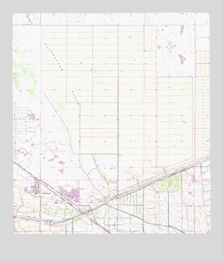
Indiantown, FL USGS Topographic Map
Click on map above to begin viewing in our Map Viewer.

This topographic map contains these locations and features:
Feature Name Type Latitude Longitude GNIS ID View Map
Booker Park Fire DepartmentBuildingN27.0230°W80.4828°2331203View Map
Evangelical Haitian Church of the NazareneChurchN27.0196°W80.4627°2449389View Map
Evergreen First Baptist ChurchChurchN27.0271°W80.4832°2449390View Map
Family Worship CenterChurchN27.0202°W80.4567°2449391View Map
First United Methodist ChurchChurchN27.0236°W80.4638°2449392View Map
Grasslands Golf and Country ClubLocaleN27.0365°W80.4790°2449384View Map
Hope Rural SchoolSchoolN27.0281°W80.4705°303778View Map
Indian Town BridgeBridgeN27.0123°W80.4539°303548View Map
IndiantownPopulated PlaceN27.0273°W80.4856°294216View Map
Indiantown AirportAirportN27.0322°W80.4358°309511View Map
Indiantown Baptist ChurchChurchN27.0236°W80.4638°2449393View Map
Indiantown Census Designated Place (historical)CensusN27.0386°W80.4699°2402613View Map
Indiantown Middle SchoolSchoolN27.0225°W80.4771°298367View Map
Indiantown Post OfficePost OfficeN27.0203°W80.4677°2449385View Map
Indianwood Manufactured Housing CommunityPopulated PlaceN27.0315°W80.4751°2449387View Map
Martin CountyCivilN27.0816°W80.3985°308550View Map
Martin County Fire Rescue Station 24BuildingN27.0285°W80.4794°2331416View Map
Martin County Public Library System Indiantown Branch LibraryBuildingN27.0213°W80.4670°2449383View Map
Martin County Sheriff's Office Indiantown SubstationBuildingN27.0286°W80.4795°2331521View Map
Rowland CanalCanalN27.0156°W80.4823°294133View Map
Saint Lucie CanalCanalN27.0314°W80.4056°307562View Map
Sheltras Trailer ParkPopulated PlaceN27.0229°W80.4691°2449386View Map
Village of IndiantownCivilN27.0347°W80.4825°2791523View Map
Warfield Elementary SchoolSchoolN27.0242°W80.4826°298368View Map
WCNO-FM (Palm City)TowerN27.1226°W80.3889°309095View Map
WKGR-FM (Fort Pierce)TowerN27.1226°W80.3889°308985View Map
WOVV-FM (Fort Pierce)TowerN27.1226°W80.3889°308984View Map
WPBF-TV (Tequesta)TowerN27.1217°W80.3945°309214View Map
WTVX-TV (Fort Pierce)TowerN27.1226°W80.3889°309173View Map
WWFR-FM (Okeechobee)TowerN27.1226°W80.3889°309089View Map

Note: Coordinates in the location and feature list above are referenced to NAD83 datum.


Copyright (C) 2008-2024 Ryan Niemi / Sunset Dynamics ... All Rights Reserved