TopoQuest Logo
Do you find TopoQuest useful?
Help keep TopoQuest running and adding new maps/features by donating!
Bitcoin:  19c7KJd3qBynnjoSw5npx9KScwjBe4ifkT
Litecoin:  LXs6TkuXGGXo1vDsWCkWVdjQX94eUKd6ui
Home View Maps Find Maps Find Places Resources & Links


Indian Cove, Oregon Topographic Map

USGS Map Title: Indian Cove, OR
USGS Map MRC: 45120C5
DRG (GeoTIFF) Download: o45120c5.tif


Neighboring USGS Topographic Map Quads:


  Moro, OR  
45120D6
 

  Harmony, OR  
45120D5
 

  Esau Canyon, OR  
45120D4
 

  Rosebush, OR  
45120C6
 

  Indian Cove, OR  
45120C5
 

  Indian Spring, OR  
45120C4
 

  Kent, OR  
45120B6
 

  Horseshoe Bend, OR  
45120B5
 

  Shoestring Ridge, OR  
45120B4


Map MRC Location:

N46°
W121°
N46°
W120°
H8 H7 H6 H5 H4 H3 H2 H1
G8 G7 G6 G5 G4 G3 G2 G1
F8 F7 F6 F5 F4 F3 F2 F1
E8 E7 E6 E5 E4 E3 E2 E1
D8 D7 D6 D5 D4 D3 D2 D1
C8 C7 C6 C5 C4 C3 C2 C1
B8 B7 B6 B5 B4 B3 B2 B1
A8 A7 A6 A5 A4 A3 A2 A1
N45°
W121°
N45°
W120°

Indian Cove, OR USGS 1:24K Topographic Map Preview:
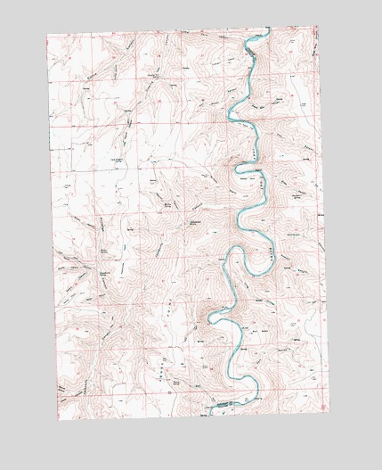
Indian Cove, OR USGS Topographic Map
Click on map above to begin viewing in our Map Viewer.

This topographic map contains these locations and features:
Feature Name Type Latitude Longitude GNIS ID View Map
Barnet CanyonValleyN45.2587°W120.6200°1117252View Map
Brown CanyonValleyN45.3112°W120.6056°1118125View Map
Bull BasinBasinN45.2776°W120.5334°1118268View Map
Cottonwood SpringSpringN45.3123°W120.5630°1119354View Map
Cow CanyonValleyN45.3401°W120.5306°1119418View Map
Dipping Vat CanyonValleyN45.3743°W120.5703°1119950View Map
Dipping Vat SpringSpringN45.3598°W120.5747°1119954View Map
Dunlap CanyonValleyN45.2990°W120.6134°1120217View Map
Fern HollowValleyN45.2671°W120.5462°1120675View Map
Gooseberry SpringSpringN45.2969°W120.6051°1121253View Map
Grass CanyonValleyN45.3260°W120.5273°1121304View Map
Hawkins SpringSpringN45.3201°W120.5114°1121671View Map
Hayes CanyonValleyN45.2598°W120.6117°1121696View Map
Indian CoveValleyN45.3651°W120.5364°1122203View Map
Jackknife CanyonValleyN45.3160°W120.5417°1122344View Map
Little Ferry CanyonValleyN45.3710°W120.5362°1123192View Map
Lon Eakin FlatFlatN45.3435°W120.5362°1123361View Map
Long HollowValleyN45.2973°W120.5470°1123422View Map
Lucy Payne CanyonValleyN45.3479°W120.5903°1123613View Map
Lucy Payne SpringSpringN45.3335°W120.5928°1123614View Map
Marlin CanyonValleyN45.3123°W120.5670°1123774View Map
Marlin SpringSpringN45.3183°W120.5745°1123776View Map
Minton CoveBasinN45.3271°W120.5370°1124250View Map
Nat Wheat CanyonValleyN45.3529°W120.5364°1124599View Map
North CanyonValleyN45.2985°W120.6070°1124729View Map
Pearson CanyonValleyN45.3007°W120.5239°1125264View Map
Peddicord PointRidgeN45.3029°W120.5939°1125270View Map
Penny SpringSpringN45.2613°W120.5695°1125292View Map
Piano Box CanyonValleyN45.3515°W120.5356°1125352View Map
Rutledge CanyonValleyN45.2876°W120.5928°1126381View Map
S A CanyonValleyN45.2998°W120.5484°1160544View Map
Shellrock CanyonValleyN45.3068°W120.5262°1126864View Map
Sproul CanyonValleyN45.2901°W120.6017°1127460View Map
Sproul PointSummitN45.2890°W120.6184°1136777View Map
Steers CanyonValleyN45.2985°W120.6109°1127578View Map
Turner CanyonValleyN45.3637°W120.5967°1128313View Map
Warm SpringSpringN45.3041°W120.6043°1128645View Map
Wilson PointSummitN45.3237°W120.5495°1136915View Map

Note: Coordinates in the location and feature list above are referenced to NAD83 datum.


Copyright (C) 2008-2024 Ryan Niemi / Sunset Dynamics ... All Rights Reserved