TopoQuest Logo
Do you find TopoQuest useful?
Help keep TopoQuest running and adding new maps/features by donating!
Bitcoin:  19c7KJd3qBynnjoSw5npx9KScwjBe4ifkT
Litecoin:  LXs6TkuXGGXo1vDsWCkWVdjQX94eUKd6ui
Home View Maps Find Maps Find Places Resources & Links


Iantha, Missouri Topographic Map

USGS Map Title: Iantha, MO
USGS Map MRC: 37094E4
DRG (GeoTIFF) Download: o37094e4.tif


Neighboring USGS Topographic Map Quads:


  Garland, KS  
37094F5
 

  Bronaugh, MO  
37094F4
 

  Sheldon, MO  
37094F3
 

  Liberal, MO  
37094E5
 

  Iantha, MO  
37094E4
 

  Lamar North, MO  
37094E3
 

  Mindenmines, MO  
37094D5
 

  Nashville, MO  
37094D4
 

  Lamar South, MO  
37094D3


Map MRC Location:

N38°
W95°
N38°
W94°
H8 H7 H6 H5 H4 H3 H2 H1
G8 G7 G6 G5 G4 G3 G2 G1
F8 F7 F6 F5 F4 F3 F2 F1
E8 E7 E6 E5 E4 E3 E2 E1
D8 D7 D6 D5 D4 D3 D2 D1
C8 C7 C6 C5 C4 C3 C2 C1
B8 B7 B6 B5 B4 B3 B2 B1
A8 A7 A6 A5 A4 A3 A2 A1
N37°
W95°
N37°
W94°

Iantha, MO USGS 1:24K Topographic Map Preview:
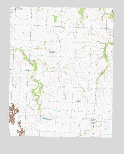
Iantha, MO USGS Topographic Map
Click on map above to begin viewing in our Map Viewer.

This topographic map contains these locations and features:
Feature Name Type Latitude Longitude GNIS ID View Map
Barton City CemeteryCemeteryN37.5775°W94.4724°713707View Map
Barton City School (historical)SchoolN37.5784°W94.4750°746174View Map
Bryan School (historical)SchoolN37.5906°W94.4025°746177View Map
Excelsior School (historical)SchoolN37.5912°W94.4386°746178View Map
Farmer School (historical)SchoolN37.5442°W94.4044°746179View Map
Gardner Farms Lake DamDamN37.5850°W94.4119°763038View Map
HannonPopulated PlaceN37.6225°W94.4941°729900View Map
IanthaPopulated PlaceN37.5170°W94.3977°720066View Map
Iantha CemeteryCemeteryN37.5250°W94.4052°720067View Map
Iantha Census Designated PlaceCensusN37.5155°W94.3973°2587081View Map
Logue LakeReservoirN37.5177°W94.4561°721430View Map
Logue Lake DamDamN37.5184°W94.4586°763628View Map
Mayo LakeReservoirN37.5850°W94.4119°763039View Map
Prairie Star School (historical)SchoolN37.5498°W94.4777°746175View Map
Township of Barton CityCivilN37.6064°W94.4393°766274View Map
Township of CentralCivilN37.5185°W94.4159°766275View Map
Triumph School (historical)SchoolN37.6214°W94.4744°746173View Map
VerdellaPopulated PlaceN37.6064°W94.4386°728165View Map
Verdella ChurchChurchN37.5770°W94.4397°728166View Map
West Union School (historical)SchoolN37.5206°W94.4683°746176View Map
WimmerPopulated PlaceN37.5303°W94.4797°741363View Map

Note: Coordinates in the location and feature list above are referenced to NAD83 datum.


Copyright (C) 2008-2024 Ryan Niemi / Sunset Dynamics ... All Rights Reserved