TopoQuest Logo
Do you find TopoQuest useful?
Help keep TopoQuest running and adding new maps/features by donating!
Bitcoin:  19c7KJd3qBynnjoSw5npx9KScwjBe4ifkT
Litecoin:  LXs6TkuXGGXo1vDsWCkWVdjQX94eUKd6ui
Home View Maps Find Maps Find Places Resources & Links


Hylas, Virginia Topographic Map

USGS Map Title: Hylas, VA
USGS Map MRC: 37077F6
DRG (GeoTIFF) Download: o37077f6.tif


Neighboring USGS Topographic Map Quads:


  Dabneys, VA  
37077G7
 

  Montpelier, VA  
37077G6
 

  Hanover Academy, VA  
37077G5
 

  Perkinsville, VA  
37077F7
 

  Hylas, VA  
37077F6
 

  Glen Allen, VA  
37077F5
 

  Fine Creek Mills, VA  
37077E7
 

  Midlothian, VA  
37077E6
 

  Bon Air, VA  
37077E5


Map MRC Location:

N38°
W78°
N38°
W77°
H8 H7 H6 H5 H4 H3 H2 H1
G8 G7 G6 G5 G4 G3 G2 G1
F8 F7 F6 F5 F4 F3 F2 F1
E8 E7 E6 E5 E4 E3 E2 E1
D8 D7 D6 D5 D4 D3 D2 D1
C8 C7 C6 C5 C4 C3 C2 C1
B8 B7 B6 B5 B4 B3 B2 B1
A8 A7 A6 A5 A4 A3 A2 A1
N37°
W78°
N37°
W77°

Hylas, VA USGS 1:24K Topographic Map Preview:
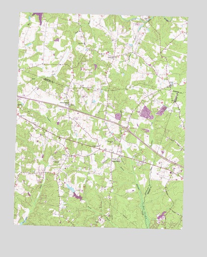
Hylas, VA USGS Topographic Map
Click on map above to begin viewing in our Map Viewer.

This topographic map contains these locations and features:
Feature Name Type Latitude Longitude GNIS ID View Map
Anderson CreekStreamN37.6751°W77.6728°1462464View Map
Anderson Creek QuarryMineN37.6898°W77.6755°2629375View Map
Auburn ChasePopulated PlaceN37.6404°W77.7283°1674239View Map
Bellview GardensPopulated PlaceN37.6682°W77.6597°1674241View Map
Berea ChurchChurchN37.7093°W77.6369°1463090View Map
BrittlandPopulated PlaceN37.7057°W77.7253°1674244View Map
Broad Branch DamDamN37.6451°W77.7064°1489885View Map
Broad Branch LakeReservoirN37.6474°W77.7080°1489886View Map
Broad RunPopulated PlaceN37.6446°W77.7083°1674245View Map
Broadview Shopping CenterLocaleN37.6704°W77.6817°1674246View Map
CascoPopulated PlaceN37.7490°W77.6542°1495356View Map
CentervillePopulated PlaceN37.6710°W77.6875°1495369View Map
Centerville School (historical)SchoolN37.6632°W77.7128°1674248View Map
Childress DamDamN37.7001°W77.6947°1489905View Map
Cochran DamDamN37.7435°W77.6580°1490051View Map
Coffman FieldAirportN37.6931°W77.6616°1498792View Map
Dawnington SabotPopulated PlaceN37.7054°W77.7147°1674257View Map
Deep Run Hunt ClubLocaleN37.6629°W77.7211°1491138View Map
District 4CivilN37.6804°W77.7364°1927242View Map
Dover LakeReservoirN37.6279°W77.7415°1502003View Map
Dover RunPopulated PlaceN37.6382°W77.7211°1674262View Map
Few Acres FarmLocaleN37.6296°W77.6839°1674266View Map
FordsPopulated PlaceN37.6863°W77.7144°1674268View Map
Gayton (historical)Populated PlaceN37.6371°W77.6342°1760171View Map
Gayton Elementary SchoolSchoolN37.6350°W77.6324°2465341View Map
Goldmine CreekStreamN37.7463°W77.6567°1467197View Map
Goochland ChurchChurchN37.6963°W77.7114°1467201View Map
Goochland County Volunteer Fire and Rescue Company 3 CentervilleBuildingN37.6707°W77.6831°2086247View Map
GoosepointPopulated PlaceN37.6465°W77.7017°1674277View Map
Hanover County Fire - EMS Company 9 - Rockville Volunteer Fire StationBuildingN37.7244°W77.6797°2075382View Map
Harding BranchStreamN37.6254°W77.6508°1760177View Map
Henrico County Firehouse 13BuildingN37.6363°W77.6337°2086241View Map
Hermitage Country ClubLocaleN37.6513°W77.7089°1674281View Map
Hermitage HamletPopulated PlaceN37.6451°W77.6803°1674282View Map
Hickory HavenPopulated PlaceN37.6651°W77.6753°1495680View Map
Homewood ParkPopulated PlaceN37.6651°W77.7147°1674285View Map
HylasPopulated PlaceN37.7099°W77.6364°1468443View Map
Interchange 173CrossingN37.6832°W77.6683°1674294View Map
Jerusalem ChurchChurchN37.6957°W77.7494°1468707View Map
Johnsons SpringsPopulated PlaceN37.6982°W77.7111°1495765View Map
Lapetite AcademySchoolN37.6366°W77.6321°2519558View Map
Little Tuckahoe CreekStreamN37.6401°W77.6542°1469676View Map
Missionary Learning CenterSchoolN37.7443°W77.6627°2464973View Map
Mount Olive ChurchChurchN37.6665°W77.7108°1470975View Map
Mount Olive TerracePopulated PlaceN37.6649°W77.7111°1674309View Map
Nelwood EstatesPopulated PlaceN37.7015°W77.7178°1674310View Map
Nuckols Farm Elementary SchoolSchoolN37.6558°W77.6391°2465009View Map
Oak Grove EstatesPopulated PlaceN37.6671°W77.6836°1674311View Map
PickelsPopulated PlaceN37.6976°W77.6786°1674318View Map
Readers BranchStreamN37.6574°W77.6617°1473032View Map
RockvillePopulated PlaceN37.7260°W77.6783°1473420View Map
Rockville Post OfficePost OfficeN37.7262°W77.6793°2767258View Map
Rockville SchoolSchoolN37.7329°W77.7005°1473421View Map
Sabot AirportAirportN37.6326°W77.7448°1498807View Map
Saint Matthews ChurchChurchN37.6751°W77.6778°1473850View Map
Samary ForestPopulated PlaceN37.6621°W77.6586°1674326View Map
Sycamore CreekPopulated PlaceN37.6785°W77.6992°1674333View Map
WGNZ-AM (Tuckahoe)TowerN37.6768°W77.6872°1502581View Map
WheatlandsPopulated PlaceN37.6932°W77.7219°1674345View Map
Windy RunPopulated PlaceN37.6940°W77.7289°1674348View Map
WingmeadPopulated PlaceN37.6760°W77.6747°1674349View Map
Woods AcresPopulated PlaceN37.6260°W77.6928°1674350View Map

Note: Coordinates in the location and feature list above are referenced to NAD83 datum.


Copyright (C) 2008-2024 Ryan Niemi / Sunset Dynamics ... All Rights Reserved