TopoQuest Logo
Do you find TopoQuest useful?
Help keep TopoQuest running and adding new maps/features by donating!
Bitcoin:  19c7KJd3qBynnjoSw5npx9KScwjBe4ifkT
Litecoin:  LXs6TkuXGGXo1vDsWCkWVdjQX94eUKd6ui
Home View Maps Find Maps Find Places Resources & Links


Hoytville, Ohio Topographic Map

USGS Map Title: Hoytville, OH
USGS Map MRC: 41083B7
DRG (GeoTIFF) Download: o41083b7.tif


Neighboring USGS Topographic Map Quads:


  McClure, OH  
41083C8
 

  Weston, OH  
41083C7
 

  Bowling Green South, OH  
41083C6
 

  Deshler, OH  
41083B8
 

  Hoytville, OH  
41083B7
 

  North Baltimore, OH  
41083B6
 

  Leipsic, OH  
41083A8
 

  McComb, OH  
41083A7
 

  Findlay, OH  
41083A6


Map MRC Location:

N42°
W84°
N42°
W83°
H8 H7 H6 H5 H4 H3 H2 H1
G8 G7 G6 G5 G4 G3 G2 G1
F8 F7 F6 F5 F4 F3 F2 F1
E8 E7 E6 E5 E4 E3 E2 E1
D8 D7 D6 D5 D4 D3 D2 D1
C8 C7 C6 C5 C4 C3 C2 C1
B8 B7 B6 B5 B4 B3 B2 B1
A8 A7 A6 A5 A4 A3 A2 A1
N41°
W84°
N41°
W83°

Hoytville, OH USGS 1:24K Topographic Map Preview:
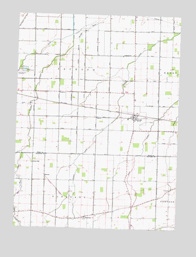
Hoytville, OH USGS Topographic Map
Click on map above to begin viewing in our Map Viewer.

This topographic map contains these locations and features:
Feature Name Type Latitude Longitude GNIS ID View Map
Bethel ChurchChurchN41.1898°W83.8135°1037949View Map
Brethren ChurchChurchN41.2042°W83.8424°1038284View Map
Brush CreekStreamN41.2464°W83.8172°1038402View Map
Butlers MillPopulated PlaceN41.1631°W83.8613°1062680View Map
Deshler Sewage DisposalLocaleN41.2173°W83.8694°1080080View Map
DeweyvillePopulated PlaceN41.1317°W83.8199°1064536View Map
Deweyville Post Office (historical)Post OfficeN41.1320°W83.8194°1990255View Map
HancockPopulated PlaceN41.1553°W83.8519°1064787View Map
HoytvillePopulated PlaceN41.1901°W83.7847°1064872View Map
Hoytville Fire DepartmentBuildingN41.1901°W83.7848°2549358View Map
Hoytville Post OfficePost OfficeN41.1900°W83.7844°1951782View Map
Jackson Middle SchoolSchoolN41.1895°W83.7888°1050463View Map
Jackson Township CemeteryCemeteryN41.1826°W83.8660°1731430View Map
North Ridgeville (historical)Populated PlaceN41.1342°W83.8616°1063604View Map
Reyskens DairyLocaleN41.2433°W83.7753°2547151View Map
Thomas CemeteryCemeteryN41.1483°W83.7555°1047026View Map
Township of JacksonCivilN41.2118°W83.8236°1087185View Map
Village of HoytvilleCivilN41.1900°W83.7844°2398551View Map
West CreekStreamN41.1692°W83.8702°1047716View Map
Yellow CreekStreamN41.2387°W83.8341°1048187View Map

Note: Coordinates in the location and feature list above are referenced to NAD83 datum.


Copyright (C) 2008-2024 Ryan Niemi / Sunset Dynamics ... All Rights Reserved