TopoQuest Logo
Do you find TopoQuest useful?
Help keep TopoQuest running and adding new maps/features by donating!
Bitcoin:  19c7KJd3qBynnjoSw5npx9KScwjBe4ifkT
Litecoin:  LXs6TkuXGGXo1vDsWCkWVdjQX94eUKd6ui
Home View Maps Find Maps Find Places Resources & Links


Bailey Island, Maine Topographic Map

USGS Map Title: Bailey Island, ME
USGS Map MRC: 43069F8
DRG (GeoTIFF) Download: o43069f8.tif


Neighboring USGS Topographic Map Quads:


  Freeport, ME  
43070G1
 

  Orrs Island, ME  
43069G8
 

  Phippsburg, ME  
43069G7
 

  South Harpswell, ME  
43070F1
 

  Bailey Island, ME  
43069F8
 

  Small Point, ME  
43069F7


Map MRC Location:

N44°
W70°
N44°
W69°
H8 H7 H6 H5 H4 H3 H2 H1
G8 G7 G6 G5 G4 G3 G2 G1
F8 F7 F6 F5 F4 F3 F2 F1
E8 E7 E6 E5 E4 E3 E2 E1
D8 D7 D6 D5 D4 D3 D2 D1
C8 C7 C6 C5 C4 C3 C2 C1
B8 B7 B6 B5 B4 B3 B2 B1
A8 A7 A6 A5 A4 A3 A2 A1
N43°
W70°
N43°
W69°

Bailey Island, ME USGS 1:24K Topographic Map Preview:
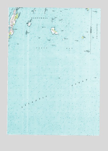
Bailey Island, ME USGS Topographic Map
Click on map above to begin viewing in our Map Viewer.

This topographic map contains these locations and features:
Feature Name Type Latitude Longitude GNIS ID View Map
Bailey IslandIslandN43.7376°W69.9937°561441View Map
Bailey IslandPopulated PlaceN43.7276°W69.9950°561442View Map
Bailey Island CemeteryCemeteryN43.7386°W69.9944°2736125View Map
Bailey Island Cobwork BridgeBridgeN43.7404°W69.9884°1912152View Map
Bailey Island Post OfficePost OfficeN43.7360°W69.9954°2768905View Map
Blacksnake LedgeBarN43.7384°W69.9403°562529View Map
Bold DickBarN43.7134°W69.9395°562708View Map
Cedar LedgesIslandN43.7476°W69.9495°563727View Map
Charity LedgeBarN43.7145°W69.9884°563854View Map
Chiver LedgeBarN43.7268°W69.8942°563963View Map
David CastleBarN43.7484°W69.9237°564786View Map
Dick ShoalBarN43.7465°W69.9298°565089View Map
East Brown CowIslandN43.7076°W69.8912°565585View Map
Holbrook LedgeBarN43.7401°W69.9373°568179View Map
Jamison LedgeBarN43.7462°W69.8800°568768View Map
Little Bull LedgeIslandN43.7273°W69.9275°569715View Map
Littlejohn RockBarN43.7481°W69.9725°581806View Map
Lumbo LedgeBarN43.6812°W69.9317°570582View Map
Mackerel Cove MarinaLocaleN43.7279°W69.9987°1912680View Map
Mark IslandIslandN43.7212°W69.8984°570778View Map
Mark Island LedgeBarN43.7179°W69.9050°570784View Map
Middle GroundBarN43.7409°W69.9787°581826View Map
Middle Ground RockBarN43.7315°W69.9542°571246View Map
Pond IslandIslandN43.7340°W69.9709°573598View Map
Pond Island LedgesBarN43.7254°W69.9748°573604View Map
Ragged IslandIslandN43.7268°W69.9378°573962View Map
Ram IslandIslandN43.7470°W69.9648°573986View Map
Round RockBarN43.7198°W69.9584°574530View Map
Saddleback LedgeBarN43.7187°W69.9462°574664View Map
Sisters GroundBarN43.7337°W69.9189°575501View Map
Sisters IslandIslandN43.7381°W69.9273°580001View Map
Temple LedgeBarN43.6820°W69.8825°576715View Map
Town of HarpswellCivilN43.7375°W69.9645°582511View Map
Water CoveBayN43.7443°W69.9892°577883View Map
White BullIslandN43.7193°W69.9239°578343View Map
Wills GutGutN43.7484°W69.9881°578534View Map
WYFP-FM (Harpswell)TowerN43.7376°W69.9938°582059View Map
Wyman LedgeBarN43.7215°W69.8856°578730View Map
Yellow RockBarN43.7468°W69.9375°578756View Map

Note: Coordinates in the location and feature list above are referenced to NAD83 datum.


Copyright (C) 2008-2024 Ryan Niemi / Sunset Dynamics ... All Rights Reserved