TopoQuest Logo
Do you find TopoQuest useful?
Help keep TopoQuest running and adding new maps/features by donating!
Bitcoin:  19c7KJd3qBynnjoSw5npx9KScwjBe4ifkT
Litecoin:  LXs6TkuXGGXo1vDsWCkWVdjQX94eUKd6ui
Home View Maps Find Maps Find Places Resources & Links


Horsethief Coulee West, Montana Topographic Map

USGS Map Title: Horsethief Coulee West, MT
USGS Map MRC: 47109A2
DRG (GeoTIFF) Download: o47109a2.tif


Neighboring USGS Topographic Map Quads:


  New Year, MT  
47109B3
 

  Judith Peak, MT  
47109B2
 

  Lewis Peak, MT  
47109B1
 

  Pike Creek, MT  
47109A3
 

  Horsethief Coulee West, MT  
47109A2
 

  Horsethief Coulee East, MT  
47109A1
 

  Heath, MT  
46109H3
 

  Loco Ridge, MT  
46109H2
 

  Forestgrove, MT  
46109H1


Map MRC Location:

N48°
W110°
N48°
W109°
H8 H7 H6 H5 H4 H3 H2 H1
G8 G7 G6 G5 G4 G3 G2 G1
F8 F7 F6 F5 F4 F3 F2 F1
E8 E7 E6 E5 E4 E3 E2 E1
D8 D7 D6 D5 D4 D3 D2 D1
C8 C7 C6 C5 C4 C3 C2 C1
B8 B7 B6 B5 B4 B3 B2 B1
A8 A7 A6 A5 A4 A3 A2 A1
N47°
W110°
N47°
W109°

Horsethief Coulee West, MT USGS 1:24K Topographic Map Preview:
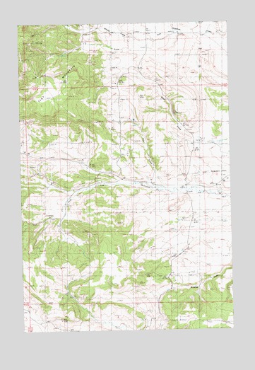
Horsethief Coulee West, MT USGS Topographic Map
Click on map above to begin viewing in our Map Viewer.

This topographic map contains these locations and features:
Feature Name Type Latitude Longitude GNIS ID View Map
15N19E12DA__01 WellWellN47.0741°W109.2482°820574View Map
15N20E03CCCB01 WellWellN47.0858°W109.1841°820651View Map
15N20E09ABDA01 WellWellN47.0803°W109.1910°820615View Map
15N20E09ADCB01 WellWellN47.0775°W109.1891°820596View Map
15N20E14CAAA01 WellWellN47.0608°W109.1521°820496View Map
Big Six MineMineN47.1105°W109.2418°798825View Map
Cheadle (historical)Populated PlaceN47.0611°W109.1524°1722807View Map
Cheadle Post Office (historical)Post OfficeN47.0611°W109.1524°1722808View Map
Cheadle School (historical)SchoolN47.0603°W109.1518°798827View Map
Flat MountainSummitN47.0897°W109.2357°798830View Map
Nelson (historical)Populated PlaceN47.1047°W109.2382°1722922View Map
Parr CreekStreamN47.0564°W109.1568°798836View Map
Skaggs (historical)Populated PlaceN47.0561°W109.2202°1722947View Map
Skaggs School (historical)SchoolN47.0564°W109.2191°798841View Map
Whiskey Gulch MineMineN47.1139°W109.2407°802907View Map
Whisky CreekStreamN47.1183°W109.1718°805775View Map
Whisky GulchValleyN47.1144°W109.1779°798843View Map
Whisky Gulch MineMineN47.1161°W109.2441°798844View Map

Note: Coordinates in the location and feature list above are referenced to NAD83 datum.


Copyright (C) 2008-2024 Ryan Niemi / Sunset Dynamics ... All Rights Reserved