TopoQuest Logo
Do you find TopoQuest useful?
Help keep TopoQuest running and adding new maps/features by donating!
Bitcoin:  19c7KJd3qBynnjoSw5npx9KScwjBe4ifkT
Litecoin:  LXs6TkuXGGXo1vDsWCkWVdjQX94eUKd6ui
Home View Maps Find Maps Find Places Resources & Links


Horse Heaven Creek, Oregon Topographic Map

USGS Map Title: Horse Heaven Creek, OR
USGS Map MRC: 44120F5
DRG (GeoTIFF) Download: o44120f5.tif


Neighboring USGS Topographic Map Quads:


  Donnybrook, OR  
44120G6
 

  Arrastra Butte, OR  
44120G5
 

  Muddy Ranch, OR  
44120G4
 

  Axehandle Butte, OR  
44120F6
 

  Horse Heaven Creek, OR  
44120F5
 

  Sandrock Mountain, OR  
44120F4
 

  Dutchman Creek, OR  
44120E6
 

  Opal Mountain, OR  
44120E5
 

  Stephenson Mountain, OR  
44120E4


Map MRC Location:

N45°
W121°
N45°
W120°
H8 H7 H6 H5 H4 H3 H2 H1
G8 G7 G6 G5 G4 G3 G2 G1
F8 F7 F6 F5 F4 F3 F2 F1
E8 E7 E6 E5 E4 E3 E2 E1
D8 D7 D6 D5 D4 D3 D2 D1
C8 C7 C6 C5 C4 C3 C2 C1
B8 B7 B6 B5 B4 B3 B2 B1
A8 A7 A6 A5 A4 A3 A2 A1
N44°
W121°
N44°
W120°

Horse Heaven Creek, OR USGS 1:24K Topographic Map Preview:
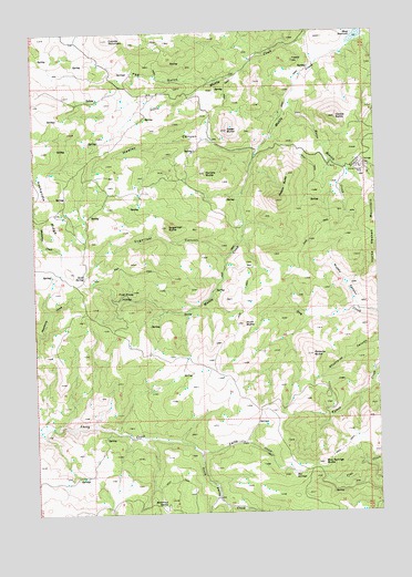
Horse Heaven Creek, OR USGS Topographic Map
Click on map above to begin viewing in our Map Viewer.

This topographic map contains these locations and features:
Feature Name Type Latitude Longitude GNIS ID View Map
Box SpringsSpringN44.6350°W120.5326°1118020View Map
Box Springs ButteSummitN44.6374°W120.5217°1118021View Map
Buttercup SpringSpringN44.6268°W120.5794°1118398View Map
Coyote MountainSummitN44.7482°W120.5978°1119474View Map
First Pines HollowBasinN44.6815°W120.5917°1120749View Map
Hawley CanyonValleyN44.7196°W120.5445°1121675View Map
Hawley CreekStreamN44.7199°W120.5428°1131997View Map
Hinkle ButteSummitN44.7274°W120.5156°1121844View Map
Horse Heaven CreekStreamN44.7318°W120.5328°1143764View Map
Horse Heaven MineMineN44.7146°W120.5081°1122002View Map
Horse Heaven Post Office (historical)Post OfficeN44.7157°W120.5072°1638259View Map
HorseheavenPopulated PlaceN44.7157°W120.5072°1158696View Map
Hunt ButteSummitN44.6740°W120.5503°1122137View Map
Ironside ButteSummitN44.7129°W120.5328°1158697View Map
Kaser ButteSummitN44.7243°W120.5550°1122638View Map
KiltsPopulated PlaceN44.7387°W120.5956°1158898View Map
Kilts Post Office (historical)Post OfficeN44.7387°W120.5956°1165481View Map
Maiers ButteRidgeN44.7093°W120.5334°1123698View Map
Mays ReservoirReservoirN44.7480°W120.5077°1123879View Map
Muddy CanyonValleyN44.6779°W120.5084°1124502View Map
Peg GulchValleyN44.7374°W120.5614°1125274View Map
Randle ButteSummitN44.7132°W120.5634°1125805View Map
Roberts ButteSummitN44.6657°W120.5253°1126106View Map
Sand SpringSpringN44.6866°W120.6075°1126581View Map
South Amity CreekStreamN44.6410°W120.5686°1149897View Map
Sugarloaf ButteSummitN44.6990°W120.5772°1127696View Map
Sugarloaf CanyonValleyN44.6912°W120.5567°1127697View Map

Note: Coordinates in the location and feature list above are referenced to NAD83 datum.


Copyright (C) 2008-2024 Ryan Niemi / Sunset Dynamics ... All Rights Reserved