TopoQuest Logo
Do you find TopoQuest useful?
Help keep TopoQuest running and adding new maps/features by donating!
Bitcoin:  19c7KJd3qBynnjoSw5npx9KScwjBe4ifkT
Litecoin:  LXs6TkuXGGXo1vDsWCkWVdjQX94eUKd6ui
Home View Maps Find Maps Find Places Resources & Links


Honoraville, Alabama Topographic Map

USGS Map Title: Honoraville, AL
USGS Map MRC: 31086G4
DRG (GeoTIFF) Download: o31086g4.tif


Neighboring USGS Topographic Map Quads:


  Fort Deposit, AL  
31086H5
 

  Danielsville, AL  
31086H4
 

  Lapine, AL  
31086H3
 

  Greenville East, AL  
31086G5
 

  Honoraville, AL  
31086G4
 

  Fullers Crossroads, AL  
31086G3
 

  Pigeon Creek, AL  
31086F5
 

  Moodys Crossroads, AL  
31086F4
 

  Luverne, AL  
31086F3


Map MRC Location:

N32°
W87°
N32°
W86°
H8 H7 H6 H5 H4 H3 H2 H1
G8 G7 G6 G5 G4 G3 G2 G1
F8 F7 F6 F5 F4 F3 F2 F1
E8 E7 E6 E5 E4 E3 E2 E1
D8 D7 D6 D5 D4 D3 D2 D1
C8 C7 C6 C5 C4 C3 C2 C1
B8 B7 B6 B5 B4 B3 B2 B1
A8 A7 A6 A5 A4 A3 A2 A1
N31°
W87°
N31°
W86°

Honoraville, AL USGS 1:24K Topographic Map Preview:
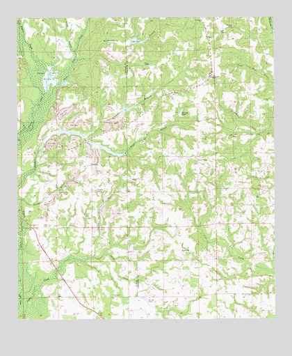
Honoraville, AL USGS Topographic Map
Click on map above to begin viewing in our Map Viewer.

This topographic map contains these locations and features:
Feature Name Type Latitude Longitude GNIS ID View Map
B C Massey DamDamN31.8352°W86.4216°129989View Map
Bethlehem ChurchChurchN31.7596°W86.4533°114123View Map
Bible ChurchChurchN31.7924°W86.4639°114205View Map
Black RockLocaleN31.7777°W86.4202°114433View Map
Black Rock CemeteryCemeteryN31.7788°W86.4205°154787View Map
Black Rock Primitive Baptist ChurchChurchN31.7779°W86.4208°133902View Map
Camp CreekStreamN31.8688°W86.3755°133906View Map
Center RidgePopulated PlaceN31.8160°W86.4125°115862View Map
Center Ridge School (historical)SchoolN31.8149°W86.4114°133908View Map
Chapel Hill ChurchChurchN31.7602°W86.3905°115956View Map
Chapel Hill School (historical)SchoolN31.7590°W86.3900°133909View Map
Chapel Hill Volunteer Fire DepartmentBuildingN31.7573°W86.3822°2691303View Map
Church of Christ (historical)ChurchN31.7843°W86.4466°134998View Map
County Line ChurchChurchN31.7779°W86.4469°116724View Map
Cumbies PondReservoirN31.8032°W86.4614°116962View Map
Damascus Baptist ChurchChurchN31.7885°W86.4922°117032View Map
Damascus CemeteryCemeteryN31.7882°W86.4922°135758View Map
Damascus Volunteer Fire DepartmentBuildingN31.7884°W86.4849°2691529View Map
El Bethel ChurchChurchN31.7765°W86.3819°117895View Map
Fayette BranchStreamN31.7757°W86.4636°118224View Map
Friendship ChurchChurchN31.7840°W86.4808°118672View Map
Gravel Hill ChurchChurchN31.8038°W86.3816°119264View Map
Graydon BranchStreamN31.8274°W86.4725°119300View Map
Holy Tabernacle ChurchChurchN31.8468°W86.4589°163363View Map
HonoravillePopulated PlaceN31.8507°W86.4061°155105View Map
Honoraville ChurchChurchN31.8493°W86.4077°133931View Map
Honoraville Junior High SchoolSchoolN31.8518°W86.4064°148948View Map
Honoraville Post OfficePost OfficeN31.8511°W86.4061°168364View Map
Honoraville Volunteer Fire DepartmentBuildingN31.8478°W86.4099°2691320View Map
Kellys Store (historical)LocaleN31.7649°W86.4072°133938View Map
L E Skipper PondReservoirN31.8168°W86.4116°129983View Map
L E Skipper Pond DamDamN31.8168°W86.4116°129984View Map
Lake JaneReservoirN31.8654°W86.4412°120819View Map
Little BranchStreamN31.8613°W86.4719°121714View Map
Masseys PondReservoirN31.8353°W86.4203°152245View Map
MidwayPopulated PlaceN31.8135°W86.4636°122702View Map
Midway ChurchChurchN31.8146°W86.4639°135029View Map
Mount Zion ChurchChurchN31.8402°W86.3775°123455View Map
Oak Grove ChurchChurchN31.8738°W86.4102°124079View Map
Pigeon Creek SwampSwampN31.7532°W86.4858°124716View Map
R Killough DamDamN31.8668°W86.4450°130002View Map
Rattlesnake BranchStreamN31.8574°W86.4719°125446View Map
Rock Hill ChurchChurchN31.8082°W86.4416°125766View Map
Rock Hill Church (historical)ChurchN31.8010°W86.4389°133966View Map
Ropers PondReservoirN31.8561°W86.4351°125929View Map
Russells PondReservoirN31.7579°W86.4375°126046View Map
Sims PondReservoirN31.8688°W86.4008°126891View Map
Skipper Mill BranchStreamN31.8260°W86.4680°153464View Map
Three Run CreekStreamN31.8393°W86.4880°127945View Map
Tuckers PondReservoirN31.8716°W86.3948°128117View Map
Whiddon FarmsLocaleN31.8156°W86.4700°2711266View Map

Note: Coordinates in the location and feature list above are referenced to NAD83 datum.


Copyright (C) 2008-2024 Ryan Niemi / Sunset Dynamics ... All Rights Reserved