TopoQuest Logo
Do you find TopoQuest useful?
Help keep TopoQuest running and adding new maps/features by donating!
Bitcoin:  19c7KJd3qBynnjoSw5npx9KScwjBe4ifkT
Litecoin:  LXs6TkuXGGXo1vDsWCkWVdjQX94eUKd6ui
Home View Maps Find Maps Find Places Resources & Links


Homochitto, Mississippi Topographic Map

USGS Map Title: Homochitto, MS
USGS Map MRC: 31090C8
DRG (GeoTIFF) Download: o31090c8.tif


Neighboring USGS Topographic Map Quads:


  Knoxville, MS  
31091D1
 

  Meadville, MS  
31090D8
 

  Bude, MS  
31090D7
 

  Crosby, MS  
31091C1
 

  Homochitto, MS  
31090C8
 

  Busy Corner, MS  
31090C7
 

  Gloster, MS  
31091B1
 

  Bewelcome, MS  
31090B8
 

  Liberty, MS  
31090B7


Map MRC Location:

N32°
W91°
N32°
W90°
H8 H7 H6 H5 H4 H3 H2 H1
G8 G7 G6 G5 G4 G3 G2 G1
F8 F7 F6 F5 F4 F3 F2 F1
E8 E7 E6 E5 E4 E3 E2 E1
D8 D7 D6 D5 D4 D3 D2 D1
C8 C7 C6 C5 C4 C3 C2 C1
B8 B7 B6 B5 B4 B3 B2 B1
A8 A7 A6 A5 A4 A3 A2 A1
N31°
W91°
N31°
W90°

Homochitto, MS USGS 1:24K Topographic Map Preview:
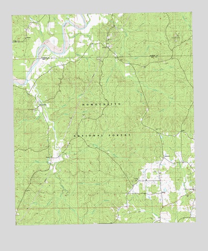
Homochitto, MS USGS Topographic Map
Click on map above to begin viewing in our Map Viewer.

This topographic map contains these locations and features:
Feature Name Type Latitude Longitude GNIS ID View Map
Birdman BranchStreamN31.2910°W90.9662°692621View Map
Bradley BranchStreamN31.3457°W90.9290°692684View Map
Brown BranchStreamN31.2657°W90.9707°692720View Map
Brushy CreekStreamN31.3360°W90.9873°692733View Map
Buckleys Ferry (historical)CrossingN31.3574°W90.9762°705197View Map
BunkleyPopulated PlaceN31.3624°W90.9909°692765View Map
Bunkley Baptist ChurchChurchN31.3593°W90.9970°707559View Map
Bunkley CemeteryCemeteryN31.3599°W90.9890°707560View Map
Bunkley ChurchChurchN31.3593°W90.9973°705493View Map
Caston CreekStreamN31.3682°W90.9498°692855View Map
Cedar Grove CemeteryCemeteryN31.3057°W90.9026°705495View Map
Cedar Grove CemeteryCemeteryN31.3052°W90.9012°705028View Map
Cedar Grove School (historical)SchoolN31.2905°W90.8973°705029View Map
Clark BranchStreamN31.3707°W90.9620°692915View Map
Dawson CemeteryCemeteryN31.2818°W90.8876°705034View Map
Deer CemeteryCemeteryN31.3157°W90.8876°705035View Map
EunicePopulated PlaceN31.2893°W90.9745°693186View Map
Faust CemeteryCemeteryN31.2560°W90.9551°705038View Map
Freeman CemeteryCemeteryN31.3077°W90.9112°705041View Map
Gresham BranchStreamN31.3613°W90.9618°693367View Map
HomochittoPopulated PlaceN31.3199°W90.9840°693516View Map
Homochitto State Wildlife Management AreaParkN31.3668°W90.8834°705049View Map
James Whittington CemeteryCemeteryN31.3196°W90.9282°705052View Map
John Huff CemeteryCemeteryN31.3424°W90.9684°705055View Map
John Knight BranchStreamN31.3349°W90.9115°693622View Map
Jonathan Day CemeteryCemeteryN31.2607°W90.8995°705057View Map
Long BranchStreamN31.2680°W90.9643°693811View Map
Marvin Huff CemeteryCemeteryN31.3474°W90.9534°705064View Map
Mary Springs CemeteryCemeteryN31.2677°W90.8754°685329View Map
Mary Springs ChurchChurchN31.2696°W90.8759°693884View Map
Merry Springs School (historical)SchoolN31.2696°W90.8765°705066View Map
Mill BranchStreamN31.3693°W90.9645°693970View Map
Mount OlivePopulated PlaceN31.3552°W90.9354°694076View Map
Mount Pleasant Baptist ChurchChurchN31.2888°W90.8965°694093View Map
Mount Pleasant CemeteryCemeteryN31.2885°W90.8962°705070View Map
Mount Vernon CemeteryCemeteryN31.3188°W90.9848°705071View Map
Mount Vernon ChurchChurchN31.3188°W90.9854°705494View Map
Mount Vernon Methodist ChurchChurchN31.3188°W90.9851°705072View Map
New Hope CemeteryCemeteryN31.2757°W90.9145°705073View Map
New Hope ChurchChurchN31.2757°W90.9143°694169View Map
O'Neal CemeteryCemeteryN31.3246°W90.9770°705076View Map
O'NeilPopulated PlaceN31.3038°W90.8845°694223View Map
O'Neil Volunteer Fire DepartmentBuildingN31.2675°W90.8987°2668041View Map
Oak Grove ChurchChurchN31.3593°W90.9343°705496View Map
Oak Grove ChurchChurchN31.3596°W90.9340°705335View Map
Old Mount Vernon CemeteryCemeteryN31.3224°W90.9912°705077View Map
OxfordPopulated PlaceN31.2680°W90.8982°694293View Map
Oxford School (historical)SchoolN31.2685°W90.9212°705079View Map
Parker BranchStreamN31.3552°W90.9243°694309View Map
Pine Hill CemeteryCemeteryN31.2968°W90.9773°705080View Map
Pine Hill School (historical)SchoolN31.2963°W90.9776°705081View Map
Red ProngStreamN31.2710°W90.9662°694532View Map
Rocky BranchStreamN31.3268°W90.9840°694594View Map
Rollison BranchStreamN31.3235°W90.8915°694605View Map
Sandy BranchStreamN31.3588°W90.9748°694703View Map
Scotts BranchStreamN31.3102°W90.9723°694732View Map
Smith CemeteryCemeteryN31.3471°W90.9268°694823View Map
Smyrna Church (historical)ChurchN31.3330°W90.8773°705088View Map
Steele CemeteryCemeteryN31.3427°W90.9104°694885View Map
Stephenson Lookout TowerTowerN31.2707°W90.9926°711479View Map
Strong BranchStreamN31.3243°W90.9823°694898View Map
Stubbs CemeteryCemeteryN31.3002°W90.9501°705091View Map
Sulphur Springs BranchStreamN31.3574°W90.9612°694905View Map
Supervisor District 3CivilN31.2727°W90.9798°711771View Map
Taylor CemeteryCemeteryN31.2674°W90.9773°705094View Map
Tom Way BranchStreamN31.3341°W90.9159°694992View Map
Walker BranchStreamN31.2541°W90.9559°695081View Map
Walker BranchStreamN31.2868°W90.9695°695082View Map
West Bude Oil FieldOilfieldN31.3632°W90.8879°695127View Map
Whittington CemeteryCemeteryN31.2743°W90.9245°705104View Map

Note: Coordinates in the location and feature list above are referenced to NAD83 datum.


Copyright (C) 2008-2024 Ryan Niemi / Sunset Dynamics ... All Rights Reserved