TopoQuest Logo
Do you find TopoQuest useful?
Help keep TopoQuest running and adding new maps/features by donating!
Bitcoin:  19c7KJd3qBynnjoSw5npx9KScwjBe4ifkT
Litecoin:  LXs6TkuXGGXo1vDsWCkWVdjQX94eUKd6ui
Home View Maps Find Maps Find Places Resources & Links


Holy Ghost Spring, New Mexico Topographic Map

USGS Map Title: Holy Ghost Spring, NM
USGS Map MRC: 35106F8
DRG (GeoTIFF) Download: o35106f8.tif


Neighboring USGS Topographic Map Quads:


  Headcut Reservoir, NM  
35107G1
 

  La Ventana, NM  
35106G8
 

  San Miguel Mountain, NM  
35106G7
 

  San Luis, NM  
35107F1
 

  Holy Ghost Spring, NM  
35106F8
 

  Gilman, NM  
35106F7
 

  Cabezon Peak, NM  
35107E1
 

  Ojito Spring, NM  
35106E8
 

  San Ysidro, NM  
35106E7


Map MRC Location:

N36°
W107°
N36°
W106°
H8 H7 H6 H5 H4 H3 H2 H1
G8 G7 G6 G5 G4 G3 G2 G1
F8 F7 F6 F5 F4 F3 F2 F1
E8 E7 E6 E5 E4 E3 E2 E1
D8 D7 D6 D5 D4 D3 D2 D1
C8 C7 C6 C5 C4 C3 C2 C1
B8 B7 B6 B5 B4 B3 B2 B1
A8 A7 A6 A5 A4 A3 A2 A1
N35°
W107°
N35°
W106°

Holy Ghost Spring, NM USGS 1:24K Topographic Map Preview:
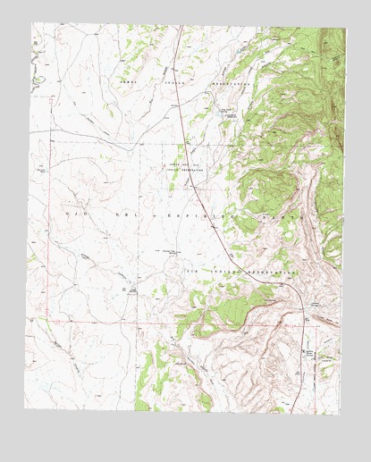
Holy Ghost Spring, NM USGS Topographic Map
Click on map above to begin viewing in our Map Viewer.

This topographic map contains these locations and features:
Feature Name Type Latitude Longitude GNIS ID View Map
Arroyo CachulieStreamN35.6525°W106.9439°897622View Map
Arroyo LopezStreamN35.6875°W106.9464°903395View Map
Arroyo SemillaStreamN35.7022°W106.9328°903424View Map
Burcar ProspectMineN35.7242°W106.8878°916306View Map
Cachana ArroyoStreamN35.6575°W106.8892°904291View Map
Cachana SpringSpringN35.6606°W106.8875°887059View Map
CCC Camp Number 8NLocaleN35.7045°W106.9370°933941View Map
Chamisa Vega Spring FallsFallsN35.6762°W106.9412°887422View Map
Collins MineMineN35.6764°W106.8934°916267View Map
Cuchilla Blanca HillRidgeN35.6545°W106.8795°888130View Map
Goodner Section 24 and 25 MineMineN35.6825°W106.8937°915497View Map
Goodner Section Eleven ProspectMineN35.7211°W106.9045°917738View Map
Holy Ghost CampgroundLocaleN35.7209°W106.9217°890087View Map
Holy Ghost SpringSpringN35.7224°W106.9248°915839View Map
Kaseman Number One MineMineN35.6361°W106.8781°917730View Map
Los Pinos ArroyoStreamN35.6422°W106.8892°908225View Map
RWP 1 Water WellWellN35.7434°W106.9942°922725View Map
RWP 4 Water WellWellN35.7386°W106.9942°922724View Map
RWP 4 Water WellWellN35.7386°W106.9159°922726View Map
San Luis TankReservoirN35.7023°W106.9926°894462View Map
Semilla CanyonValleyN35.7409°W106.8845°910936View Map
Soda SpringSpringN35.6639°W106.9566°894985View Map
Warm SpringsSpringN35.6453°W106.8889°897512View Map
Warm Springs MineMineN35.6764°W106.8934°915626View Map
Warm Springs Water WellWellN35.6456°W106.8889°921888View Map

Note: Coordinates in the location and feature list above are referenced to NAD83 datum.


Copyright (C) 2008-2024 Ryan Niemi / Sunset Dynamics ... All Rights Reserved