TopoQuest Logo
Do you find TopoQuest useful?
Help keep TopoQuest running and adding new maps/features by donating!
Bitcoin:  19c7KJd3qBynnjoSw5npx9KScwjBe4ifkT
Litecoin:  LXs6TkuXGGXo1vDsWCkWVdjQX94eUKd6ui
Home View Maps Find Maps Find Places Resources & Links


Hobart, New York Topographic Map

USGS Map Title: Hobart, NY
USGS Map MRC: 42074C6
DRG (GeoTIFF) Download: o42074c6.tif


Neighboring USGS Topographic Map Quads:


  Davenport, NY  
42074D7
 

  Harpersfield, NY  
42074D6
 

  Stamford, NY  
42074D5
 

  Bloomville, NY  
42074C7
 

  Hobart, NY  
42074C6
 

  Roxbury, NY  
42074C5
 

  Andes, NY  
42074B7
 

  Margaretville, NY  
42074B6
 

  Fleischmanns, NY  
42074B5


Map MRC Location:

N43°
W75°
N43°
W74°
H8 H7 H6 H5 H4 H3 H2 H1
G8 G7 G6 G5 G4 G3 G2 G1
F8 F7 F6 F5 F4 F3 F2 F1
E8 E7 E6 E5 E4 E3 E2 E1
D8 D7 D6 D5 D4 D3 D2 D1
C8 C7 C6 C5 C4 C3 C2 C1
B8 B7 B6 B5 B4 B3 B2 B1
A8 A7 A6 A5 A4 A3 A2 A1
N42°
W75°
N42°
W74°

Hobart, NY USGS 1:24K Topographic Map Preview:
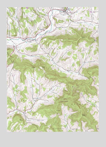
Hobart, NY USGS Topographic Map
Click on map above to begin viewing in our Map Viewer.

This topographic map contains these locations and features:
Feature Name Type Latitude Longitude GNIS ID View Map
Allen Residential CenterBuildingN42.3448°W74.7207°2618304View Map
Betty BrookStreamN42.3434°W74.7338°943812View Map
BovinaPopulated PlaceN42.2695°W74.7268°972250View Map
Bovina MountainSummitN42.3209°W74.7454°969908View Map
Burnt HillSummitN42.2590°W74.6854°945244View Map
Carmans NotchGapN42.3140°W74.7113°945856View Map
Cowan MountainSummitN42.3451°W74.6499°947596View Map
Crescent HollowValleyN42.2684°W74.7274°947739View Map
Foote HollowValleyN42.3590°W74.6349°950368View Map
Good Shepherd ChapelChurchN42.3060°W74.6467°2616091View Map
Griffin HillSummitN42.3612°W74.6785°951819View Map
Hand-In-Hand FarmLocaleN42.3164°W74.6742°2554115View Map
HobartPopulated PlaceN42.3715°W74.6704°952909View Map
Hobart Fire DepartmentBuildingN42.3725°W74.6669°2718231View Map
Hobart Post OfficePost OfficeN42.3727°W74.6682°2617966View Map
Hobart United Methodist ChurchChurchN42.3690°W74.6682°2616465View Map
Lake BrookStreamN42.3720°W74.6874°954898View Map
Locust Hill CemeteryCemeteryN42.3684°W74.6707°955800View Map
Lyon MountainSummitN42.3423°W74.6707°956194View Map
McMurdy BrookStreamN42.3659°W74.6913°956837View Map
McMurdy HillSummitN42.3651°W74.7260°956838View Map
Mill MountainSummitN42.2629°W74.7340°957252View Map
Mount WarrenSummitN42.3148°W74.7046°968822View Map
Mountain BrookStreamN42.2679°W74.7282°957935View Map
Narrow NotchGapN42.3412°W74.6310°958268View Map
Old ClumpSummitN42.3109°W74.6352°959266View Map
Plattekill MountainSummitN42.2668°W74.6482°960695View Map
Relay CemeteryCemeteryN42.3195°W74.6444°2548275View Map
Roses Brook CemeteryCemeteryN42.3114°W74.6672°962901View Map
Round TopSummitN42.2715°W74.6832°963022View Map
School Number 3 (historical)SchoolN42.2697°W74.7278°2106768View Map
School Number 4 (historical)SchoolN42.2837°W74.7090°975315View Map
Schuman FarmsLocaleN42.2786°W74.7111°2554141View Map
South KortrightPopulated PlaceN42.3423°W74.7171°965796View Map
South Kortright Central SchoolSchoolN42.3517°W74.6990°965797View Map
South Kortright Volunteer Fire DepartmentBuildingN42.3421°W74.7187°2735065View Map
Stone Tavern FarmLocaleN42.2817°W74.6289°2554140View Map
Thompson Hollow SchoolSchoolN42.2523°W74.6613°967409View Map
Top Of The Hill NurseriesLocaleN42.3572°W74.6658°2554133View Map
Town BrookStreamN42.3717°W74.6779°970719View Map
Town of StamfordCivilN42.3494°W74.6582°979518View Map
Township ValleyValleyN42.3690°W74.6777°967728View Map
Valley View CemeteryCemeteryN42.3350°W74.7376°968370View Map
Village of HobartCivilN42.3715°W74.6690°2390899View Map

Note: Coordinates in the location and feature list above are referenced to NAD83 datum.


Copyright (C) 2008-2024 Ryan Niemi / Sunset Dynamics ... All Rights Reserved