TopoQuest Logo
Do you find TopoQuest useful?
Help keep TopoQuest running and adding new maps/features by donating!
Bitcoin:  19c7KJd3qBynnjoSw5npx9KScwjBe4ifkT
Litecoin:  LXs6TkuXGGXo1vDsWCkWVdjQX94eUKd6ui
Home View Maps Find Maps Find Places Resources & Links


Hiteman, Iowa Topographic Map

USGS Map Title: Hiteman, IA
USGS Map MRC: 41092A8
DRG (GeoTIFF) Download: o41092a8.tif


Neighboring USGS Topographic Map Quads:


  Attica, IA  
41093B1
 

  Lovilia, IA  
41092B8
 

  Buxton, IA  
41092B7
 

  Weller, IA  
41093A1
 

  Hiteman, IA  
41092A8
 

  Albia, IA  
41092A7
 

  Melrose, IA  
40093H1
 

  Iconium, IA  
40092H8
 

  Moravia, IA  
40092H7


Map MRC Location:

N42°
W93°
N42°
W92°
H8 H7 H6 H5 H4 H3 H2 H1
G8 G7 G6 G5 G4 G3 G2 G1
F8 F7 F6 F5 F4 F3 F2 F1
E8 E7 E6 E5 E4 E3 E2 E1
D8 D7 D6 D5 D4 D3 D2 D1
C8 C7 C6 C5 C4 C3 C2 C1
B8 B7 B6 B5 B4 B3 B2 B1
A8 A7 A6 A5 A4 A3 A2 A1
N41°
W93°
N41°
W92°

Hiteman, IA USGS 1:24K Topographic Map Preview:
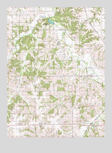
Hiteman, IA USGS Topographic Map
Click on map above to begin viewing in our Map Viewer.

This topographic map contains these locations and features:
Feature Name Type Latitude Longitude GNIS ID View Map
Abegglen CemeteryCemeteryN41.0961°W92.9121°1823342View Map
Babb CemeteryCemeteryN41.0166°W92.9021°1823336View Map
Bee BranchStreamN41.0722°W92.9066°454476View Map
Bell CemeteryCemeteryN41.0878°W92.9896°1823341View Map
Carmack County ParkParkN41.1194°W92.9335°1823343View Map
Coalton Post Office (historical)Post OfficeN41.1092°W92.9930°466554View Map
Craig SchoolSchoolN41.0583°W92.9491°455693View Map
Flattery SchoolSchoolN41.0339°W92.8994°456632View Map
GeorgetownPopulated PlaceN41.0128°W92.9552°456877View Map
Georgetown (historical)LocaleN41.0206°W92.9169°465477View Map
Georgetown CemeteryCemeteryN41.0222°W92.9752°1970438View Map
Georgetown Post Office (historical)Post OfficeN41.0139°W92.9558°1970346View Map
Georgetown Rest AreaLocaleN41.0117°W92.9585°463911View Map
HalpinLocaleN41.0247°W92.8763°1823335View Map
HitemanPopulated PlaceN41.0589°W92.8921°457523View Map
Hiteman (historical)LocaleN41.0589°W92.8921°1970344View Map
Hiteman CemeteryCemeteryN41.0585°W92.9069°1823339View Map
Hiteman Mine Number 10MineN41.0683°W92.9274°465841View Map
Hiteman Post Office (historical)Post OfficeN41.0589°W92.8921°1970343View Map
La Hart State Public Hunting AreaParkN41.0917°W92.9502°463294View Map
Maple Number 2LocaleN41.1222°W92.9746°465875View Map
Miller SchoolSchoolN41.0867°W92.8916°459111View Map
Morris SchoolSchoolN41.0047°W92.8860°459244View Map
Mountain View SchoolSchoolN41.0917°W92.9463°459365View Map
Rex 4 MineMineN41.1122°W92.8908°460594View Map
Rex Number 4LocaleN41.1122°W92.8966°465891View Map
RexfieldPopulated PlaceN41.0817°W92.9524°464715View Map
Rexfield (historical)LocaleN41.0817°W92.9585°1970342View Map
Rexfield Post Office (historical)Post OfficeN41.0817°W92.9585°1970341View Map
Rowley CemeteryCemeteryN41.0667°W92.8930°1823340View Map
Ryan SchoolSchoolN41.0372°W92.9610°460874View Map
Saint Patricks CemeteryCemeteryN41.0104°W92.9554°1823337View Map
Saint Patricks ChurchChurchN41.0136°W92.9555°1823338View Map
Smoky Hollow MineMineN41.0433°W92.8996°461713View Map
TowerLocaleN41.0228°W92.8777°462283View Map
Township of GuilfordCivilN41.0303°W92.9264°467988View Map
Township of UnionCivilN41.1174°W92.9269°468834View Map
Wanlock Post Office (historical)Post OfficeN41.1244°W92.9835°1970328View Map
WardPopulated PlaceN41.0295°W92.8866°464792View Map
Ward Post Office (historical)Post OfficeN41.0295°W92.8866°1970345View Map
Whippoorwill CreekStreamN41.0992°W92.9666°465584View Map
Whites CreekStreamN41.1153°W92.9419°465617View Map

Note: Coordinates in the location and feature list above are referenced to NAD83 datum.


Copyright (C) 2008-2024 Ryan Niemi / Sunset Dynamics ... All Rights Reserved