TopoQuest Logo
Do you find TopoQuest useful?
Help keep TopoQuest running and adding new maps/features by donating!
Bitcoin:  19c7KJd3qBynnjoSw5npx9KScwjBe4ifkT
Litecoin:  LXs6TkuXGGXo1vDsWCkWVdjQX94eUKd6ui
Home View Maps Find Maps Find Places Resources & Links


Hiouchi, California Topographic Map

USGS Map Title: Hiouchi, CA
USGS Map MRC: 41124G1
DRG (GeoTIFF) Download: o41124g1.tif


Neighboring USGS Topographic Map Quads:


  Smith River, CA  
41124H2
 

  High Divide, CA  
41124H1
 

  High Plateau Mountain, CA  
41123H8
 

  Crescent City, CA  
41124G2
 

  Hiouchi, CA  
41124G1
 

  Gasquet, CA  
41123G8
 

  Sister Rocks, CA  
41124F2
 

  Childs Hill, CA  
41124F1
 

  Canthook Mountain, CA  
41123F8


Map MRC Location:

N42°
W125°
N42°
W124°
H8 H7 H6 H5 H4 H3 H2 H1
G8 G7 G6 G5 G4 G3 G2 G1
F8 F7 F6 F5 F4 F3 F2 F1
E8 E7 E6 E5 E4 E3 E2 E1
D8 D7 D6 D5 D4 D3 D2 D1
C8 C7 C6 C5 C4 C3 C2 C1
B8 B7 B6 B5 B4 B3 B2 B1
A8 A7 A6 A5 A4 A3 A2 A1
N41°
W125°
N41°
W124°

Hiouchi, CA USGS 1:24K Topographic Map Preview:
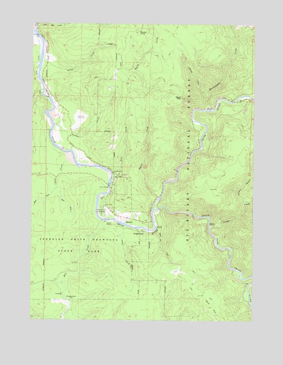
Hiouchi, CA USGS Topographic Map
Click on map above to begin viewing in our Map Viewer.

This topographic map contains these locations and features:
Feature Name Type Latitude Longitude GNIS ID View Map
Allens GulchValleyN41.7994°W124.0059°256189View Map
Bald HillSummitN41.7565°W124.0260°266406View Map
Cedar CreekStreamN41.7907°W124.0762°258117View Map
Clarks CreekStreamN41.8171°W124.1062°258411View Map
Coldwater CreekStreamN41.8451°W124.0279°258579View Map
Craigs CreekStreamN41.7896°W124.0251°258864View Map
Daughters of the American Revolution GroveWoodsN41.7859°W124.0879°1657319View Map
Del Norte Golf CourseLocaleN41.8343°W124.0987°1654228View Map
Douglas ParkPopulated PlaceN41.7873°W124.0629°1658433View Map
East Fork Clarks CreekStreamN41.8057°W124.1123°259724View Map
Ferrel GroveWoodsN41.7679°W124.1098°1657321View Map
Hardscrabble CreekStreamN41.8390°W124.0259°261091View Map
HiouchiPopulated PlaceN41.7926°W124.0720°261367View Map
Hiouchi BridgeBridgeN41.8062°W124.0817°261368View Map
Hiouchi Census Designated PlaceCensusN41.7937°W124.0661°2611435View Map
Hiouchi Information CenterLocaleN41.7979°W124.0870°277108View Map
Hiouchi School (historical)SchoolN41.7951°W124.0848°1682414View Map
Jedediah Smith CampgroundLocaleN41.7959°W124.0859°261914View Map
Jedediah Smith Redwoods State ParkParkN41.7815°W124.1020°261915View Map
Krause Grove NorthWoodsN41.7887°W124.0856°1657331View Map
Lind MineMineN41.8059°W124.0220°262490View Map
Little Mill CreekStreamN41.8732°W124.1240°262672View Map
Mill CreekStreamN41.7918°W124.0842°263616View Map
Myrtle CreekStreamN41.8012°W124.0542°263997View Map
Nickerson RanchLocaleN41.7596°W124.1056°264088View Map
Peacock CreekStreamN41.8323°W124.1131°264587View Map
Peacocks Ferry (historical)CrossingN41.8326°W124.1142°1682423View Map
Redwood Heritage State WildernessReserveN41.7862°W124.1168°2741315View Map
Rock CreekStreamN41.8093°W124.0806°265479View Map
Round KnobSummitN41.8714°W124.0662°265597View Map
Sheep Pen CreekStreamN41.7884°W124.0554°266075View Map
Signal PeakSummitN41.8440°W124.0420°266169View Map
South Fork Smith RiverStreamN41.7954°W124.0570°267506View Map
Stout GroveWoodsN41.7904°W124.0829°267796View Map
Sultan CreekStreamN41.8593°W124.1204°267910View Map
Wellman GroveWoodsN41.8012°W124.0817°1657353View Map
West Fork Clarks CreekStreamN41.8057°W124.1120°268892View Map

Note: Coordinates in the location and feature list above are referenced to NAD83 datum.


Copyright (C) 2008-2024 Ryan Niemi / Sunset Dynamics ... All Rights Reserved