TopoQuest Logo
Do you find TopoQuest useful?
Help keep TopoQuest running and adding new maps/features by donating!
Bitcoin:  19c7KJd3qBynnjoSw5npx9KScwjBe4ifkT
Litecoin:  LXs6TkuXGGXo1vDsWCkWVdjQX94eUKd6ui
Home View Maps Find Maps Find Places Resources & Links


Bachelor Valley, California Topographic Map

USGS Map Title: Bachelor Valley, CA
USGS Map MRC: 37120H7
DRG (GeoTIFF) Download: o37120h7.tif


Neighboring USGS Topographic Map Quads:


  Valley Springs SW, CA  
38120A8
 

  Jenny Lind, CA  
38120A7
 

  Salt Spring Valley, CA  
38120A6
 

  Farmington, CA  
37120H8
 

  Bachelor Valley, CA  
37120H7
 

  Copperopolis, CA  
37120H6
 

  Escalon, CA  
37120G8
 

  Oakdale, CA  
37120G7
 

  Knights Ferry, CA  
37120G6


Map MRC Location:

N38°
W121°
N38°
W120°
H8 H7 H6 H5 H4 H3 H2 H1
G8 G7 G6 G5 G4 G3 G2 G1
F8 F7 F6 F5 F4 F3 F2 F1
E8 E7 E6 E5 E4 E3 E2 E1
D8 D7 D6 D5 D4 D3 D2 D1
C8 C7 C6 C5 C4 C3 C2 C1
B8 B7 B6 B5 B4 B3 B2 B1
A8 A7 A6 A5 A4 A3 A2 A1
N37°
W121°
N37°
W120°

Bachelor Valley, CA USGS 1:24K Topographic Map Preview:
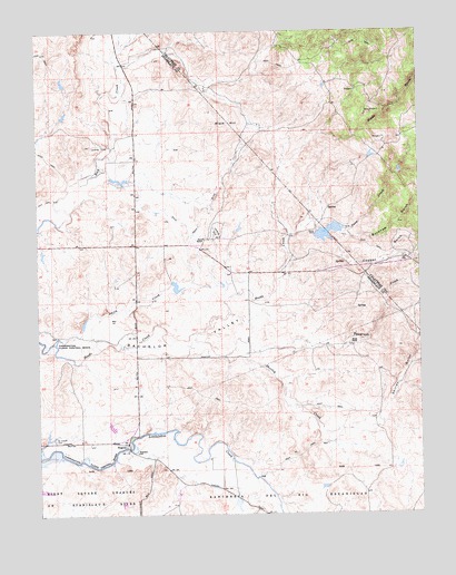
Bachelor Valley, CA USGS Topographic Map
Click on map above to begin viewing in our Map Viewer.

This topographic map contains these locations and features:
Feature Name Type Latitude Longitude GNIS ID View Map
Bachelor ValleyFlatN37.9194°W120.8277°218497View Map
Bachelor Valley School (historical)SchoolN37.9152°W120.8074°1816874View Map
Black HillSummitN37.9741°W120.8116°219368View Map
Black Hill School (historical)SchoolN37.9880°W120.8080°1804792View Map
Buckham GulchValleyN37.9477°W120.7763°220047View Map
Bund RanchLocaleN37.9185°W120.7741°220156View Map
Copper GulchValleyN37.9452°W120.7780°221538View Map
EugenePopulated PlaceN37.8930°W120.8469°252674View Map
Orvis 560 DamDamN37.9483°W120.7844°1663951View Map
Orvis DamDamN37.9485°W120.7833°230128View Map
Quail Hill MineMineN37.9658°W120.7597°1804809View Map
Rock Creek DitchCanalN37.9530°W120.8238°231726View Map
Rosedale SchoolSchoolN37.8908°W120.8444°231895View Map
Saint Joseph Catholic CemeteryCemeteryN37.8942°W120.8710°232182View Map
Shirley CreekStreamN37.9216°W120.8252°234692View Map
Shirley GulchValleyN37.9033°W120.7619°234693View Map
Smith CreekStreamN37.9194°W120.8702°233314View Map
Snow CreekStreamN37.9471°W120.7927°234768View Map
Snow RanchLocaleN37.9463°W120.8210°234779View Map
Telegraph CreekStreamN37.9158°W120.8149°236082View Map

Note: Coordinates in the location and feature list above are referenced to NAD83 datum.


Copyright (C) 2008-2024 Ryan Niemi / Sunset Dynamics ... All Rights Reserved