TopoQuest Logo
Do you find TopoQuest useful?
Help keep TopoQuest running and adding new maps/features by donating!
Bitcoin:  19c7KJd3qBynnjoSw5npx9KScwjBe4ifkT
Litecoin:  LXs6TkuXGGXo1vDsWCkWVdjQX94eUKd6ui
Home View Maps Find Maps Find Places Resources & Links


Hillsboro, Kentucky Topographic Map

USGS Map Title: Hillsboro, KY
USGS Map MRC: 38083C6
DRG (GeoTIFF) Download: o38083c6.tif


Neighboring USGS Topographic Map Quads:


  Elizaville, KY  
38083D7
 

  Flemingsburg, KY  
38083D6
 

  Burtonville, KY  
38083D5
 

  Sherburne, KY  
38083C7
 

  Hillsboro, KY  
38083C6
 

  Plummers Landing, KY  
38083C5
 

  Owingsville, KY  
38083B7
 

  Colfax, KY  
38083B6
 

  Farmers, KY  
38083B5


Map MRC Location:

N39°
W84°
N39°
W83°
H8 H7 H6 H5 H4 H3 H2 H1
G8 G7 G6 G5 G4 G3 G2 G1
F8 F7 F6 F5 F4 F3 F2 F1
E8 E7 E6 E5 E4 E3 E2 E1
D8 D7 D6 D5 D4 D3 D2 D1
C8 C7 C6 C5 C4 C3 C2 C1
B8 B7 B6 B5 B4 B3 B2 B1
A8 A7 A6 A5 A4 A3 A2 A1
N38°
W84°
N38°
W83°

Hillsboro, KY USGS 1:24K Topographic Map Preview:
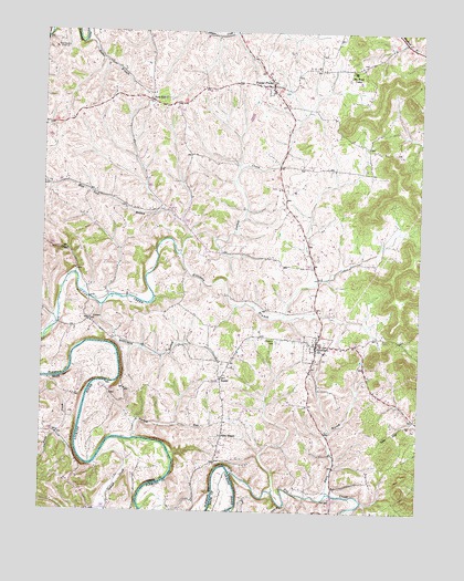
Hillsboro, KY USGS Topographic Map
Click on map above to begin viewing in our Map Viewer.

This topographic map contains these locations and features:
Feature Name Type Latitude Longitude GNIS ID View Map
Bald HillPopulated PlaceN38.3570°W83.7146°507441View Map
Bald Hill ChurchChurchN38.3576°W83.7154°2355159View Map
Big Davis TrestleBridgeN38.3557°W83.6701°2355170View Map
Blue Bell School (historical)SchoolN38.3734°W83.7340°2355174View Map
Butler BranchStreamN38.3715°W83.7377°488503View Map
Buttermilk BranchStreamN38.3031°W83.7302°488522View Map
Chalybeate SpringSpringN38.3001°W83.6253°2355177View Map
Davis BranchStreamN38.2548°W83.6546°490640View Map
Days MillLocaleN38.2681°W83.7361°2355189View Map
Eden ChapelChurchN38.2695°W83.6894°491555View Map
Eden Chapel School (historical)SchoolN38.2699°W83.6897°2355194View Map
Fleming CountyCivilN38.3701°W83.6966°516881View Map
Forge CreekStreamN38.2842°W83.7485°492334View Map
Fox CemeteryCemeteryN38.2531°W83.6538°492405View Map
Fox CreekStreamN38.2601°W83.6866°512230View Map
Graham Trestle BridgeBridgeN38.3107°W83.6585°2355225View Map
Grange City Covered Bridge Historical MarkerParkN38.2550°W83.6533°2744374View Map
Grange City Fox Creek BridgeBridgeN38.2549°W83.6530°2355226View Map
Grassland (historical)Populated PlaceN38.3134°W83.6768°2085099View Map
HillsboroPopulated PlaceN38.2934°W83.6588°494271View Map
Hillsboro BranchStreamN38.3167°W83.7046°494272View Map
Hillsboro CemeteryCemeteryN38.2942°W83.6721°494273View Map
Hillsboro Methodist ChurchChurchN38.2984°W83.6963°2355230View Map
Hillsboro Post OfficePost OfficeN38.2937°W83.6588°2355231View Map
Hillsboro Volunteer Fire DepartmentBuildingN38.2924°W83.6589°2636912View Map
Indian CreekStreamN38.2629°W83.7310°512906View Map
LocustPopulated PlaceN38.2998°W83.7344°508484View Map
Locust GraveyardCemeteryN38.2971°W83.7390°2355243View Map
Locust Graveyard HillSummitN38.2979°W83.7305°2355244View Map
Locust Methodist ChurchChurchN38.2994°W83.7347°2355245View Map
Mount Hope CampLocaleN38.3645°W83.6469°498753View Map
Mud Sock BranchStreamN38.3212°W83.7021°499020View Map
New Hope Presbyterian Church (historical)ChurchN38.2984°W83.6963°2355260View Map
Pleasant Grove Mills Post Office (historical)Post OfficeN38.2826°W83.7303°2355273View Map
Poplar PlainsPopulated PlaceN38.3609°W83.6744°501127View Map
Poplar Plains Post Office (historical)Post OfficeN38.3557°W83.6701°2355278View Map
Samuels Trestle BridgeBridgeN38.3747°W83.6868°2355286View Map
South Lick BranchStreamN38.2984°W83.7446°503959View Map
SunsetPopulated PlaceN38.2845°W83.6905°509165View Map
Sunset Post Office (historical)Post OfficeN38.2844°W83.6903°2355300View Map
Sunset School (historical)SchoolN38.2889°W83.6909°2355301View Map
Turkey RunStreamN38.2687°W83.7188°505629View Map

Note: Coordinates in the location and feature list above are referenced to NAD83 datum.


Copyright (C) 2008-2024 Ryan Niemi / Sunset Dynamics ... All Rights Reserved