TopoQuest Logo
Do you find TopoQuest useful?
Help keep TopoQuest running and adding new maps/features by donating!
Bitcoin:  19c7KJd3qBynnjoSw5npx9KScwjBe4ifkT
Litecoin:  LXs6TkuXGGXo1vDsWCkWVdjQX94eUKd6ui
Home View Maps Find Maps Find Places Resources & Links


Hill City, South Dakota Topographic Map

USGS Map Title: Hill City, SD
USGS Map MRC: 43103H5
DRG (GeoTIFF) Download: o43103h5.tif


Neighboring USGS Topographic Map Quads:


  Rochford, SD  
44103A6
 

  Silver City, SD  
44103A5
 

  Pactola Dam, SD  
44103A4
 

  Medicine Mountain, SD  
43103H6
 

  Hill City, SD  
43103H5
 

  Mount Rushmore, SD  
43103H4
 

  Berne, SD  
43103G6
 

  Custer, SD  
43103G5
 

  Iron Mountain, SD  
43103G4


Map MRC Location:

N44°
W104°
N44°
W103°
H8 H7 H6 H5 H4 H3 H2 H1
G8 G7 G6 G5 G4 G3 G2 G1
F8 F7 F6 F5 F4 F3 F2 F1
E8 E7 E6 E5 E4 E3 E2 E1
D8 D7 D6 D5 D4 D3 D2 D1
C8 C7 C6 C5 C4 C3 C2 C1
B8 B7 B6 B5 B4 B3 B2 B1
A8 A7 A6 A5 A4 A3 A2 A1
N43°
W104°
N43°
W103°

Hill City, SD USGS 1:24K Topographic Map Preview:
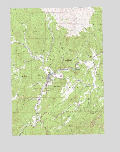
Hill City, SD USGS Topographic Map
Click on map above to begin viewing in our Map Viewer.

This topographic map contains these locations and features:
Feature Name Type Latitude Longitude GNIS ID View Map
Addie Lode MineMineN43.9267°W103.5202°1264820View Map
Allen GulchValleyN43.9304°W103.5770°1261184View Map
Annie Number 1 Lode MineMineN43.9283°W103.5852°1264799View Map
Antler-Burlington MineMineN43.9597°W103.5810°1264841View Map
Battle CreekStreamN43.9403°W103.6166°1261220View Map
Battleax CreekStreamN43.9405°W103.6163°1262982View Map
Bishop MountainSummitN43.9220°W103.5641°1261275View Map
Black Crystal MineMineN43.9750°W103.5088°1264842View Map
Black Hills Country Club (historical)LocaleN43.9080°W103.5407°1264130View Map
Black Metal MineMineN43.9475°W103.5588°1264839View Map
Black Miner GulchValleyN43.9415°W103.5732°1261288View Map
Blackbird MineMineN43.9042°W103.5144°1264825View Map
Bluebird Claim MineMineN43.9194°W103.6188°1264828View Map
Buckeye and Lena MineMineN43.9753°W103.5880°1264846View Map
Burnt ForkStreamN43.9611°W103.6038°1261375View Map
Campaign HillSummitN43.9272°W103.6060°1262957View Map
Campaign MineMineN43.9333°W103.5941°1264809View Map
Carnbray MineMineN43.9511°W103.5316°1264832View Map
Cassiterite MineMineN43.9375°W103.5824°1264806View Map
Century MineMineN43.9230°W103.5760°1264807View Map
Champion MineMineN43.9269°W103.5019°1264822View Map
China GulchValleyN43.9401°W103.5529°1261442View Map
City of Hill CityCivilN43.9337°W103.5694°1267423View Map
Coats Dike MineMineN43.9247°W103.5994°1264811View Map
Cowboy GulchValleyN43.9244°W103.5811°1261502View Map
Cowboy MineMineN43.9264°W103.5982°1264810View Map
Crain MineMineN43.9930°W103.5977°1264845View Map
Custer Group MineMineN43.9333°W103.5546°1264812View Map
Dewey MineMineN43.8828°W103.5419°1264836View Map
Dolcode MineMineN43.9289°W103.5202°1261566View Map
Dyke MineMineN43.9278°W103.5549°1264813View Map
East China GulchValleyN43.9519°W103.5554°1261610View Map
El Dorado MineMineN43.9361°W103.5171°1264827View Map
Eldorado MineMineN43.9364°W103.5171°1261626View Map
Elkhorn MineMineN43.9150°W103.5041°1264823View Map
Elkhorn MountainSummitN43.8863°W103.5163°1261636View Map
Empire MineMineN43.9444°W103.5010°1263122View Map
Empire MineMineN43.9444°W103.5002°1261643View Map
Excelsior MineMineN43.8919°W103.5421°1264831View Map
February MineMineN43.9186°W103.5282°1264817View Map
Five PointsPopulated PlaceN43.9714°W103.5505°1261673View Map
Flag MountainSummitN43.9323°W103.6078°1261675View Map
Ford MountainSummitN43.9251°W103.5558°1261687View Map
Gertie MineMineN43.9233°W103.5824°1264801View Map
Gold Hill MineMineN43.9853°W103.6074°1264844View Map
Gold Mountain MineMineN43.9853°W103.6082°1261723View Map
Gold Mountain SubdivisionPopulated PlaceN43.9564°W103.5966°1265093View Map
Golden Summit MineMineN43.9167°W103.5338°1264815View Map
Good Luck MineMineN43.9267°W103.5144°1264819View Map
Greenback MineMineN43.9597°W103.5846°1264840View Map
Grizzly Bear MineMineN43.8789°W103.5616°1261755View Map
Hay DrawValleyN43.9146°W103.5194°1261792View Map
Hidden Treasure MineMineN43.9442°W103.5296°1261809View Map
High Lode MineMineN43.9125°W103.5380°1264816View Map
Hill CityPopulated PlaceN43.9325°W103.5752°1267029View Map
Hill City Ambulance ServiceBuildingN43.9345°W103.5694°2659013View Map
Hill City CemeteryCemeteryN43.9365°W103.5787°2779303View Map
Hill City City HallBuildingN43.9359°W103.5804°2725063View Map
Hill City Community LibraryBuildingN43.9287°W103.5756°2723587View Map
Hill City Elementary SchoolSchoolN43.9306°W103.5753°2728796View Map
Hill City High SchoolSchoolN43.9287°W103.5756°2728797View Map
Hill City Middle SchoolSchoolN43.9297°W103.5752°2728798View Map
Hill City Post OfficePost OfficeN43.9345°W103.5745°2710037View Map
Hill City Sewage LagoonLocaleN43.9325°W103.5560°1265749View Map
Hill City Volunteer Fire DepartmentBuildingN43.9345°W103.5692°2580737View Map
Humbolt MountainSummitN43.9472°W103.5495°1261854View Map
Ida MineMineN43.9272°W103.5191°1264821View Map
Irwins Ranch (historical)LocaleN43.9403°W103.6177°1264183View Map
J R Extension MineMineN43.9514°W103.5246°1264833View Map
J R MineMineN43.9542°W103.5282°1261876View Map
Jolly MineMineN43.9203°W103.5380°1264814View Map
KennedyvillePopulated PlaceN43.9230°W103.5241°1269137View Map
Lena GulchValleyN43.9524°W103.5817°1261945View Map
Lowden MountainSummitN43.9760°W103.6162°1262001View Map
Major LakeReservoirN43.9363°W103.5694°1262017View Map
Marshall GulchValleyN43.9480°W103.5811°1262023View Map
Martha Washington MineMineN43.9078°W103.5041°1264824View Map
McKinnon and Millers Claim MineMineN43.8839°W103.5407°1264835View Map
Mitchell LakeReservoirN43.9392°W103.5403°1262938View Map
Mitchell Lake DamDamN43.9383°W103.5371°1262865View Map
Mohawk MineMineN43.9314°W103.5810°1264804View Map
Monkey Lode MineMineN43.8803°W103.5538°1264837View Map
Nelson CreekStreamN43.8872°W103.5499°1262117View Map
Newton ForkStreamN43.9344°W103.5680°1262123View Map
Newton Lake Picnic GroundsLocaleN43.9614°W103.6110°1262983View Map
Newton ParkFlatN43.9647°W103.6107°1262124View Map
OK Lode MineMineN43.9853°W103.6010°1264843View Map
Olympia MineMineN43.9064°W103.6010°1264829View Map
Palmer CreekStreamN43.9517°W103.5085°1262177View Map
Patterson CreekStreamN43.9500°W103.5896°1262186View Map
Penalua GulchValleyN43.9473°W103.5310°1262192View Map
Pettit and Pfanders Claim MineMineN43.9042°W103.5482°1264826View Map
Rabbit GulchValleyN43.9049°W103.5354°1262253View Map
Red Dog GulchValleyN43.9575°W103.6004°1262272View Map
Reder Ranger StationLocaleN43.9380°W103.5619°1262285View Map
Reinbold Claim MineMineN43.8814°W103.5788°1264838View Map
RenoPopulated PlaceN43.9147°W103.6174°1262290View Map
Reno GulchValleyN43.9104°W103.5921°1262291View Map
Ruby GulchValleyN43.9508°W103.5142°1262339View Map
Smith MountainSummitN43.9555°W103.6163°1262436View Map
South Dakota State Railroad MuseumBuildingN43.9317°W103.5738°2729337View Map
South Fork Whaley GulchValleyN43.9651°W103.5228°1262468View Map
Storm HillSummitN43.9353°W103.5378°1262516View Map
Summit MineMineN43.9175°W103.5338°1262531View Map
Summit PeakSummitN43.9091°W103.5441°1262532View Map
Sunday GulchValleyN43.8898°W103.5886°1262537View Map
Sunnyside MineMineN43.9567°W103.5935°1262539View Map
Teddy Bear (historical)LocaleN43.9514°W103.5060°1264576View Map
The PulpitRidgeN43.8933°W103.5396°1265031View Map
Three Forks (historical)LocaleN43.9514°W103.5060°1264129View Map
Three Forks CampgroundLocaleN43.9530°W103.5135°1263121View Map
Tim Plate MineMineN43.8922°W103.6135°1264830View Map
Tin Boom MineMineN43.9353°W103.5857°1264805View Map
Tin Center MineMineN43.9292°W103.5741°1264803View Map
Tin Chance MineMineN43.9278°W103.5816°1264800View Map
Union HillSummitN43.9760°W103.5933°1262624View Map
Vida May MineMineN43.9319°W103.5255°1264818View Map
Whaley GulchValleyN43.9560°W103.5137°1262685View Map
White Swan MineMineN43.9317°W103.5710°1264802View Map
White Whale MineMineN43.9267°W103.5630°1264808View Map
Whites Ranch (historical)LocaleN43.9583°W103.6013°1264184View Map
Willow CreekStreamN43.8975°W103.5369°1262727View Map
Willow Creek Horse CampgroundLocaleN43.9030°W103.5355°1262984View Map
Willow Creek TrailTrailN43.8925°W103.5355°1262985View Map
Wolfram LodeMineN43.9269°W103.5838°1264795View Map
Woodchuck MineMineN43.9947°W103.5960°1262743View Map
Zimmer RidgeRidgeN43.8980°W103.6232°1262758View Map

Note: Coordinates in the location and feature list above are referenced to NAD83 datum.


Copyright (C) 2008-2024 Ryan Niemi / Sunset Dynamics ... All Rights Reserved