TopoQuest Logo
Do you find TopoQuest useful?
Help keep TopoQuest running and adding new maps/features by donating!
Bitcoin:  19c7KJd3qBynnjoSw5npx9KScwjBe4ifkT
Litecoin:  LXs6TkuXGGXo1vDsWCkWVdjQX94eUKd6ui
Home View Maps Find Maps Find Places Resources & Links


Adna, Washington Topographic Map

USGS Map Title: Adna, WA
USGS Map MRC: 46123F1
DRG (GeoTIFF) Download: o46123f1.tif


Neighboring USGS Topographic Map Quads:


  Oakville, WA  
46123G2
 

  Rochester, WA  
46123G1
 

  Violet Prairie, WA  
46122G8
 

  Rainbow Falls, WA  
46123F2
 

  Adna, WA  
46123F1
 

  Centralia, WA  
46122F8
 

  Boistfort, WA  
46123E2
 

  Curtis, WA  
46123E1
 

  Napavine, WA  
46122E8


Map MRC Location:

N47°
W124°
N47°
W123°
H8 H7 H6 H5 H4 H3 H2 H1
G8 G7 G6 G5 G4 G3 G2 G1
F8 F7 F6 F5 F4 F3 F2 F1
E8 E7 E6 E5 E4 E3 E2 E1
D8 D7 D6 D5 D4 D3 D2 D1
C8 C7 C6 C5 C4 C3 C2 C1
B8 B7 B6 B5 B4 B3 B2 B1
A8 A7 A6 A5 A4 A3 A2 A1
N46°
W124°
N46°
W123°

Adna, WA USGS 1:24K Topographic Map Preview:
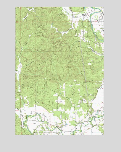
Adna, WA USGS Topographic Map
Click on map above to begin viewing in our Map Viewer.

This topographic map contains these locations and features:
Feature Name Type Latitude Longitude GNIS ID View Map
AdnaPopulated PlaceN46.6290°W123.0612°1502945View Map
Adna Elementary SchoolSchoolN46.6384°W123.0594°1515095View Map
Adna Middle - High SchoolSchoolN46.6303°W123.0568°1515096View Map
Adna Post OfficePost OfficeN46.6279°W123.0598°2781598View Map
BunkerPopulated PlaceN46.6443°W123.1165°1510847View Map
Bunker CreekStreamN46.6434°W123.1065°1503644View Map
Byron CreekStreamN46.7104°W123.1101°1503692View Map
Carson CreekStreamN46.6984°W123.1193°1503826View Map
Centralia High SchoolSchoolN46.7265°W123.0022°1515085View Map
ClaquatoPopulated PlaceN46.6434°W123.0174°1510879View Map
Claquato CemeteryCemeteryN46.6467°W123.0179°1503989View Map
Cook HillSummitN46.7182°W123.0476°1504114View Map
Deep CreekStreamN46.6479°W123.1157°1504388View Map
Eagle CreekStreamN46.7412°W123.0435°1504609View Map
Eagle Creek DamDamN46.7332°W123.0746°1532873View Map
FayettePopulated PlaceN46.6476°W123.1179°1514891View Map
Fords Prairie Census Designated PlaceCensusN46.7462°W123.0028°2408227View Map
Gabel CreekStreamN46.6876°W123.1196°1505067View Map
GalvinPopulated PlaceN46.7423°W123.0271°1505074View Map
Galvin Post OfficePost OfficeN46.7418°W123.0263°2781634View Map
Lewis County Adventist SchoolSchoolN46.6615°W123.0144°1515092View Map
Lewis County Fire District 12 Riverside Fire Authority Station 5BuildingN46.7153°W123.0247°2643306View Map
Lewis County Fire District 6 Adna Station 62BuildingN46.6339°W123.0598°2643300View Map
Lincoln CreekStreamN46.7484°W123.0282°1506159View Map
Lincoln Creek ValleyValleyN46.7368°W123.0229°1511600View Map
LittellPopulated PlaceN46.6368°W123.0354°1506183View Map
Mill CreekStreamN46.6415°W123.0176°1506686View Map
MillburnPopulated PlaceN46.6304°W123.0974°1511155View Map
Rudolph CreekStreamN46.6926°W123.1157°1507957View Map
Scammon CreekStreamN46.7170°W123.0046°1508139View Map
South Branch Scammon CreekStreamN46.7029°W123.0049°1508506View Map
Stearns CreekStreamN46.6382°W123.0193°1508712View Map
Tapp CreekStreamN46.6823°W123.1193°1508914View Map
Van Ornum CreekStreamN46.6457°W123.0943°1513230View Map
Wisner CreekStreamN46.6598°W123.0487°1509601View Map

Note: Coordinates in the location and feature list above are referenced to NAD83 datum.


Copyright (C) 2008-2024 Ryan Niemi / Sunset Dynamics ... All Rights Reserved