TopoQuest Logo
Do you find TopoQuest useful?
Help keep TopoQuest running and adding new maps/features by donating!
Bitcoin:  19c7KJd3qBynnjoSw5npx9KScwjBe4ifkT
Litecoin:  LXs6TkuXGGXo1vDsWCkWVdjQX94eUKd6ui
Home View Maps Find Maps Find Places Resources & Links


Henderson, Georgia Topographic Map

USGS Map Title: Henderson, GA
USGS Map MRC: 32083C7
DRG (GeoTIFF) Download: o32083c7.tif


Neighboring USGS Topographic Map Quads:


  Marshallville, GA  
32083D8
 

  Perry West, GA  
32083D7
 

  Perry East, GA  
32083D6
 

  Marshallville SW, GA  
32083C8
 

  Henderson, GA  
32083C7
 

  Unadilla, GA  
32083C6
 

  Byromville, GA  
32083B8
 

  Pinehurst, GA  
32083B7
 

  Pineview NW, GA  
32083B6


Map MRC Location:

N33°
W84°
N33°
W83°
H8 H7 H6 H5 H4 H3 H2 H1
G8 G7 G6 G5 G4 G3 G2 G1
F8 F7 F6 F5 F4 F3 F2 F1
E8 E7 E6 E5 E4 E3 E2 E1
D8 D7 D6 D5 D4 D3 D2 D1
C8 C7 C6 C5 C4 C3 C2 C1
B8 B7 B6 B5 B4 B3 B2 B1
A8 A7 A6 A5 A4 A3 A2 A1
N32°
W84°
N32°
W83°

Henderson, GA USGS 1:24K Topographic Map Preview:
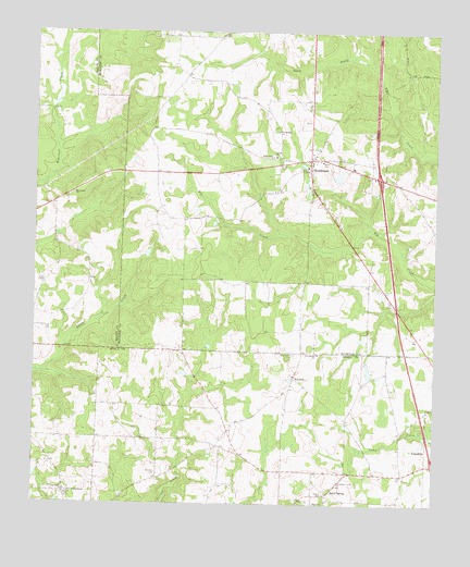
Henderson, GA USGS Topographic Map
Click on map above to begin viewing in our Map Viewer.

This topographic map contains these locations and features:
Feature Name Type Latitude Longitude GNIS ID View Map
Big Poplar ChurchChurchN32.2529°W83.8649°354723View Map
County Line Church (historical)ChurchN32.2904°W83.8457°335198View Map
EmerichPopulated PlaceN32.2835°W83.7938°331659View Map
Exit 41CrossingN32.3368°W83.7677°1671663View Map
Friendship ChurchChurchN32.3490°W83.7993°314409View Map
HendersonPopulated PlaceN32.3413°W83.7893°331949View Map
Henderson CemeteryCemeteryN32.3393°W83.7905°1671686View Map
Holly Grove ChurchChurchN32.3421°W83.8010°315557View Map
Kersey DamDamN32.3352°W83.7799°336213View Map
Kersey LakeReservoirN32.3352°W83.7799°336214View Map
Kersey LakeReservoirN32.3666°W83.8193°341242View Map
Kersey Lake DamDamN32.3668°W83.8166°341241View Map
Macedonia ChurchChurchN32.3318°W83.8630°317542View Map
McInnis School (historical)SchoolN32.3093°W83.7910°1671714View Map
New Bethel CemeteryCemeteryN32.2896°W83.7938°319264View Map
New Bethel ChurchChurchN32.2899°W83.7866°319277View Map
New Poplar Spring ChurchChurchN32.2527°W83.8641°319496View Map
Oakland CemeteryCemeteryN32.2582°W83.8363°319860View Map
Oakland Church (historical)ChurchN32.2577°W83.8363°335244View Map
Shiloh CemeteryCemeteryN32.3404°W83.7985°322852View Map
Shiloh ChurchChurchN32.3421°W83.8002°322870View Map
Snow Hill AirstripAirportN32.2599°W83.7881°2646200View Map
Snow Methodist ChurchChurchN32.2529°W83.7841°323195View Map
Snow SpringPopulated PlaceN32.2543°W83.7816°333083View Map
Snow Springs CemeteryCemeteryN32.2535°W83.7841°335266View Map
Thompson DamDamN32.2585°W83.8732°341225View Map

Note: Coordinates in the location and feature list above are referenced to NAD83 datum.


Copyright (C) 2008-2024 Ryan Niemi / Sunset Dynamics ... All Rights Reserved