TopoQuest Logo
Do you find TopoQuest useful?
Help keep TopoQuest running and adding new maps/features by donating!
Bitcoin:  19c7KJd3qBynnjoSw5npx9KScwjBe4ifkT
Litecoin:  LXs6TkuXGGXo1vDsWCkWVdjQX94eUKd6ui
Home View Maps Find Maps Find Places Resources & Links


Helper, Utah Topographic Map

USGS Map Title: Helper, UT
USGS Map MRC: 39110F7
DRG (GeoTIFF) Download: o39110f7.tif


Neighboring USGS Topographic Map Quads:


  Kyune, UT  
39110G8
 

  Matts Summit, UT  
39110G7
 

  Minnie Maud Creek West, UT  
39110G6
 

  Standardville, UT  
39110F8
 

  Helper, UT  
39110F7
 

  Deadman Canyon, UT  
39110F6
 

  Pinnacle Peak, UT  
39110E8
 

  Price, UT  
39110E7
 

  Wellington, UT  
39110E6


Map MRC Location:

N40°
W111°
N40°
W110°
H8 H7 H6 H5 H4 H3 H2 H1
G8 G7 G6 G5 G4 G3 G2 G1
F8 F7 F6 F5 F4 F3 F2 F1
E8 E7 E6 E5 E4 E3 E2 E1
D8 D7 D6 D5 D4 D3 D2 D1
C8 C7 C6 C5 C4 C3 C2 C1
B8 B7 B6 B5 B4 B3 B2 B1
A8 A7 A6 A5 A4 A3 A2 A1
N39°
W111°
N39°
W110°

Helper, UT USGS 1:24K Topographic Map Preview:
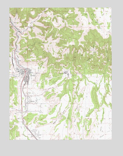
Helper, UT USGS Topographic Map
Click on map above to begin viewing in our Map Viewer.

This topographic map contains these locations and features:
Feature Name Type Latitude Longitude GNIS ID View Map
Aberdeen MineMineN39.7050°W110.7885°1425037View Map
Alrad CanyonValleyN39.6664°W110.7624°1425093View Map
Barn CanyonValleyN39.7369°W110.8713°1438398View Map
Carbonville CemeteryCemeteryN39.6333°W110.8443°1437248View Map
Carbonville Census Designated PlaceCensusN39.6272°W110.8338°2584758View Map
Carbonville School (historical)SchoolN39.6319°W110.8452°1435253View Map
Castle Gate (historical)Populated PlaceN39.7277°W110.8674°1426382View Map
Castle Gate CemeteryCemeteryN39.7325°W110.8510°1426383View Map
Castle Gate Mine Number 1MineN39.7311°W110.8710°1454405View Map
Castle Gate Mine Number 2MineN39.7314°W110.8518°1454406View Map
Castle Gate Mine Number 4MineN39.7325°W110.8524°1454407View Map
Castle Gate Precinct (historical)CivilN39.7167°W110.8667°2678905View Map
Central Cemetery / Slovenian CemeteryCemeteryN39.6516°W110.8610°1425206View Map
City of HelperCivilN39.6897°W110.8596°2410737View Map
Consumers WashValleyN39.6525°W110.8593°1426832View Map
Cordingly CanyonValleyN39.6730°W110.7674°1426867View Map
Dry CanyonValleyN39.7494°W110.8282°1427513View Map
Ewell Post Office (historical)Post OfficeN39.6652°W110.8538°1455265View Map
Garley CanyonValleyN39.6391°W110.8654°1428151View Map
Gentile WashValleyN39.7114°W110.8682°1428169View Map
Glen CanalCanalN39.6672°W110.8446°1428199View Map
Gorley CemeteryCemeteryN39.6401°W110.8617°2769394View Map
Hardscrabble CanyonValleyN39.7014°W110.8727°1428528View Map
Haycock CemeteryCemeteryN39.6518°W110.8393°1428598View Map
HeinerPopulated PlaceN39.7080°W110.8663°1437586View Map
HelperPopulated PlaceN39.6841°W110.8546°1428654View Map
Helper CanyonValleyN39.6880°W110.8490°1428655View Map
Helper Fire DepartmentBuildingN39.6853°W110.8544°2627162View Map
Helper Police DepartmentBuildingN39.6853°W110.8543°2730361View Map
Helper Post OfficePost OfficeN39.6866°W110.8543°2769060View Map
KenilworthPopulated PlaceN39.6883°W110.8057°1429319View Map
Kenilworth Census Designated PlaceCensusN39.6803°W110.8145°2584769View Map
Kenilworth WashValleyN39.6880°W110.8490°1429320View Map
Ketchum MineMineN39.7319°W110.8635°1429336View Map
KOAL-AM (Price)TowerN39.6291°W110.8479°1455736View Map
MartinPopulated PlaceN39.7019°W110.8682°1430126View Map
Maxwell (historical)LocaleN39.6272°W110.8452°1435926View Map
Milburn MineMineN39.7097°W110.7732°1430315View Map
Mountain View CemeteryCemeteryN39.6875°W110.8446°1430538View Map
New Life Ministries ChurchChurchN39.6880°W110.8549°1436749View Map
Panther CanyonValleyN39.7094°W110.8660°1431085View Map
Panther Carbon Post Office (historical)Post OfficeN39.7077°W110.8668°1455446View Map
Price CanyonValleyN39.7086°W110.8685°1444639View Map
Saint Anthony Catholic ChurchChurchN39.6866°W110.8582°1436761View Map
Saint Anthony SchoolSchoolN39.6925°W110.8652°1432111View Map
Sally Mauro Elementary SchoolSchoolN39.6896°W110.8647°1432128View Map
Spring CanyonValleyN39.6872°W110.8621°1432831View Map
Spring GlenPopulated PlaceN39.6594°W110.8535°1432849View Map
Spring Glen CemeteryCemeteryN39.6688°W110.8560°1436410View Map
Spring Glen Census Designated PlaceCensusN39.6561°W110.8461°2584777View Map
The Church of Jesus Christ of Latter Day SaintsChurchN39.6894°W110.8496°1436939View Map
The Church of Jesus Christ of Latter Day SaintsChurchN39.6589°W110.8529°1437076View Map
Warehouse CanyonValleyN39.6261°W110.8368°1433948View Map
Willow CreekStreamN39.7277°W110.8657°1447410View Map

Note: Coordinates in the location and feature list above are referenced to NAD83 datum.


Copyright (C) 2008-2024 Ryan Niemi / Sunset Dynamics ... All Rights Reserved