TopoQuest Logo
Do you find TopoQuest useful?
Help keep TopoQuest running and adding new maps/features by donating!
Bitcoin:  19c7KJd3qBynnjoSw5npx9KScwjBe4ifkT
Litecoin:  LXs6TkuXGGXo1vDsWCkWVdjQX94eUKd6ui
Home View Maps Find Maps Find Places Resources & Links


Helmville, Montana Topographic Map

USGS Map Title: Helmville, MT
USGS Map MRC: 46112G8
DRG (GeoTIFF) Download: o46112g8.tif


Neighboring USGS Topographic Map Quads:


  Browns Lake, MT  
46113H1
 

  Marcum Mountain, MT  
46112H8
 

  Moose Creek, MT  
46112H7
 

  Chimney Lakes, MT  
46113G1
 

  Helmville, MT  
46112G8
 

  Nevada Lake, MT  
46112G7
 

  Limestone Ridge, MT  
46113F1
 

  Bailey Mountain, MT  
46112F8
 

  Windy Rock, MT  
46112F7


Map MRC Location:

N47°
W113°
N47°
W112°
H8 H7 H6 H5 H4 H3 H2 H1
G8 G7 G6 G5 G4 G3 G2 G1
F8 F7 F6 F5 F4 F3 F2 F1
E8 E7 E6 E5 E4 E3 E2 E1
D8 D7 D6 D5 D4 D3 D2 D1
C8 C7 C6 C5 C4 C3 C2 C1
B8 B7 B6 B5 B4 B3 B2 B1
A8 A7 A6 A5 A4 A3 A2 A1
N46°
W113°
N46°
W112°

Helmville, MT USGS 1:24K Topographic Map Preview:
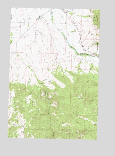
Helmville, MT USGS Topographic Map
Click on map above to begin viewing in our Map Viewer.

This topographic map contains these locations and features:
Feature Name Type Latitude Longitude GNIS ID View Map
12N10W05BDDD01 WellWellN46.8252°W112.8837°818626View Map
12N10W05CAAB01 WellWellN46.8235°W112.8839°818592View Map
13N10W32CADC01 WellWellN46.8355°W112.8928°818685View Map
13N11W22AABA01 WellWellN46.8747°W112.9687°819003View Map
13N11W23CCBB01 WellWellN46.8638°W112.9639°818918View Map
13N11W24AABB01 WellWellN46.8747°W112.9267°819002View Map
Canarway GulchValleyN46.8419°W112.9017°780884View Map
Chimney CreekStreamN46.8452°W112.9145°781226View Map
Douglas Creek CanalCanalN46.8383°W112.9353°782512View Map
Dry Cottonwood CreekStreamN46.7574°W112.9381°782552View Map
Dry GulchValleyN46.8572°W112.9698°782620View Map
Hall CreekStreamN46.8319°W112.9042°784480View Map
HelmvillePopulated PlaceN46.8666°W112.9612°784755View Map
Helmville CemeteryCemeteryN46.8555°W112.9662°1803317View Map
Helmville Community FellowshipChurchN46.8624°W112.9656°1803290View Map
Helmville Elementary SchoolSchoolN46.8658°W112.9598°1803316View Map
Helmville Fire DepartmentBuildingN46.8659°W112.9615°2546615View Map
Helmville Library (historical)BuildingN46.8666°W112.9612°1803319View Map
Helmville Post OfficePost OfficeN46.8639°W112.9644°1803390View Map
Hoodoo MountainSummitN46.7891°W112.9012°784988View Map
Methodist Church (historical)ChurchN46.8666°W112.9612°1803291View Map
Pole CreekStreamN46.8035°W112.9562°789055View Map
Powell CountyCivilN46.8564°W112.9362°1720021View Map
Puzzle GulchValleyN46.8480°W112.8931°789238View Map
Roselle MineMineN46.8669°W112.8853°789779View Map
Saint Thomas CemeteryCemeteryN46.8663°W112.9564°1803318View Map
Saint Thomas the Apostle ChurchChurchN46.8674°W112.9587°1803295View Map
Snowflake MineMineN46.8708°W112.8773°805067View Map
South Fork Cottonwood CreekStreamN46.8160°W112.9714°790932View Map
Treasure State MineMineN46.8138°W112.9206°802850View Map
Wet Cottonwood CreekStreamN46.7574°W112.9381°793144View Map
Wilson CreekStreamN46.8677°W112.9284°793388View Map

Note: Coordinates in the location and feature list above are referenced to NAD83 datum.


Copyright (C) 2008-2024 Ryan Niemi / Sunset Dynamics ... All Rights Reserved