TopoQuest Logo
Do you find TopoQuest useful?
Help keep TopoQuest running and adding new maps/features by donating!
Bitcoin:  19c7KJd3qBynnjoSw5npx9KScwjBe4ifkT
Litecoin:  LXs6TkuXGGXo1vDsWCkWVdjQX94eUKd6ui
Home View Maps Find Maps Find Places Resources & Links


Helenville, Wisconsin Topographic Map

USGS Map Title: Helenville, WI
USGS Map MRC: 43088A6
DRG (GeoTIFF) Download: o43088a6.tif


Neighboring USGS Topographic Map Quads:


  Richwood, WI  
43088B7
 

  Watertown, WI  
43088B6
 

  Ixonia, WI  
43088B5
 

  Jefferson, WI  
43088A7
 

  Helenville, WI  
43088A6
 

  Oconomowoc West, WI  
43088A5
 

  Fort Atkinson, WI  
42088H7
 

  Rome, WI  
42088H6
 

  Palmyra, WI  
42088H5


Map MRC Location:

N44°
W89°
N44°
W88°
H8 H7 H6 H5 H4 H3 H2 H1
G8 G7 G6 G5 G4 G3 G2 G1
F8 F7 F6 F5 F4 F3 F2 F1
E8 E7 E6 E5 E4 E3 E2 E1
D8 D7 D6 D5 D4 D3 D2 D1
C8 C7 C6 C5 C4 C3 C2 C1
B8 B7 B6 B5 B4 B3 B2 B1
A8 A7 A6 A5 A4 A3 A2 A1
N43°
W89°
N43°
W88°

Helenville, WI USGS 1:24K Topographic Map Preview:
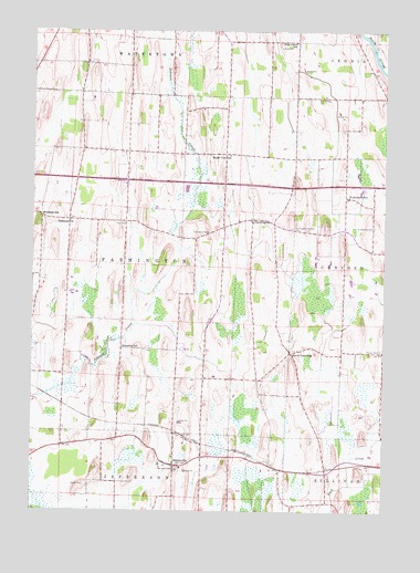
Helenville, WI USGS Topographic Map
Click on map above to begin viewing in our Map Viewer.

This topographic map contains these locations and features:
Feature Name Type Latitude Longitude GNIS ID View Map
Baker Town SchoolSchoolN43.0408°W88.6579°1561112View Map
Bakertown Baptist CemeteryCemeteryN43.0423°W88.6558°2781313View Map
Deer Track Park LandfillLocaleN43.0911°W88.7444°2635476View Map
Evergreen CemeteryCemeteryN43.0112°W88.6979°2781323View Map
FarmingtonPopulated PlaceN43.0761°W88.6720°1564867View Map
Farmington CemeteryCemeteryN43.0728°W88.6878°1564868View Map
Farmington Concord CemeteryCemeteryN43.0736°W88.6572°1564871View Map
HelenvillePopulated PlaceN43.0119°W88.6995°1566277View Map
Helenville Census Designated PlaceCensusN43.0168°W88.7000°2393045View Map
Helenville Volunteer Fire DepartmentBuildingN43.0135°W88.6998°2697769View Map
High Lawn SchoolSchoolN43.1222°W88.6570°1566382View Map
Immanuel ChurchChurchN43.0756°W88.7368°1566866View Map
Immanuel Lutheran CemeteryCemeteryN43.0767°W88.7367°2781334View Map
J-3 Cub FieldAirportN43.0796°W88.6646°1581053View Map
Maple Mound FarmLocaleN43.0467°W88.6703°2706322View Map
Maple View SchoolSchoolN43.0928°W88.6801°1569005View Map
Palm Mushroom CellarsLocaleN43.0186°W88.7339°2706325View Map
Pioneer CemeteryCemeteryN43.0420°W88.6267°1571539View Map
Probst FarmLocaleN43.0225°W88.6878°2706326View Map
Saint Peters Lutheran SchoolSchoolN43.0113°W88.6969°2716674View Map
Saint Stephens CemeteryCemeteryN43.0741°W88.6291°1573575View Map
Saint Stephens Lutheran ChurchChurchN43.0819°W88.6387°1840444View Map
Saint Stephens SchoolSchoolN43.0819°W88.6382°1573580View Map
Sunshine SchoolSchoolN43.0425°W88.7176°1575123View Map
Town of FarmingtonCivilN43.0643°W88.7162°1583190View Map
Woodside SchoolSchoolN43.0767°W88.7473°1577029View Map

Note: Coordinates in the location and feature list above are referenced to NAD83 datum.


Copyright (C) 2008-2024 Ryan Niemi / Sunset Dynamics ... All Rights Reserved