TopoQuest Logo
Do you find TopoQuest useful?
Help keep TopoQuest running and adding new maps/features by donating!
Bitcoin:  19c7KJd3qBynnjoSw5npx9KScwjBe4ifkT
Litecoin:  LXs6TkuXGGXo1vDsWCkWVdjQX94eUKd6ui
Home View Maps Find Maps Find Places Resources & Links


Hedstrom Lake, Montana Topographic Map

USGS Map Title: Hedstrom Lake, MT
USGS Map MRC: 47106B1
DRG (GeoTIFF) Download: o47106b1.tif


Neighboring USGS Topographic Map Quads:


  Flowing Well, MT  
47106C2
 

  Cemetery Coulee, MT  
47106C1
 

  Beauty Creek, MT  
47105C8
 

  Hedstrom Lake NW, MT  
47106B2
 

  Hedstrom Lake, MT  
47106B1
 

  Berry School, MT  
47105B8
 

  Tree Coulee School, MT  
47106A2
 

  Hedstrom Lake SE, MT  
47106A1
 

  Heitz School, MT  
47105A8


Map MRC Location:

N48°
W107°
N48°
W106°
H8 H7 H6 H5 H4 H3 H2 H1
G8 G7 G6 G5 G4 G3 G2 G1
F8 F7 F6 F5 F4 F3 F2 F1
E8 E7 E6 E5 E4 E3 E2 E1
D8 D7 D6 D5 D4 D3 D2 D1
C8 C7 C6 C5 C4 C3 C2 C1
B8 B7 B6 B5 B4 B3 B2 B1
A8 A7 A6 A5 A4 A3 A2 A1
N47°
W107°
N47°
W106°

Hedstrom Lake, MT USGS 1:24K Topographic Map Preview:
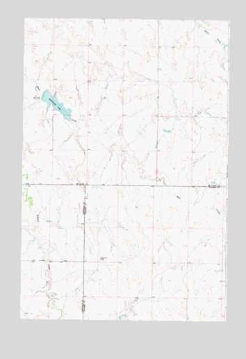
Hedstrom Lake, MT USGS Topographic Map
Click on map above to begin viewing in our Map Viewer.

This topographic map contains these locations and features:
Feature Name Type Latitude Longitude GNIS ID View Map
16N44E02BABA01 WellWellN47.1803°W106.1214°821275View Map
16N44E02BABA02 WellWellN47.1808°W106.1217°821280View Map
16N44E02BABB01 WellWellN47.1783°W106.1217°821257View Map
16N44E11DDCA01 WellWellN47.1508°W106.1114°821044View Map
16N44E14DAAC01 WellWellN47.1408°W106.1092°820978View Map
16N45E03BCAD01 WellWellN47.1756°W106.0192°821243View Map
16N45E03BCDB01 WellWellN47.1753°W106.0206°821242View Map
16N45E05AAAC01 WellWellN47.1794°W106.0472°821268View Map
16N45E05AABC01 WellWellN47.1789°W106.0484°821262View Map
16N45E06BABD01 WellWellN47.1800°W106.0797°821271View Map
16N45E18BACA01 WellWellN47.1461°W106.0795°821014View Map
17N44E13CCBD01 WellWellN47.2267°W106.0620°821562View Map
17N44E16DABC01 WellWellN47.2303°W106.1106°821582View Map
17N44E23ADBB01 WellWellN47.2203°W106.0678°821516View Map
17N44E24AAAA01 WellWellN47.2100°W106.0431°821460View Map
17N44E24DAAA01 WellWellN47.2167°W106.0431°821493View Map
17N44E27ABBC01 WellWellN47.2086°W106.0947°821446View Map
17N44E34DDBA01 WellWellN47.1842°W106.0886°821293View Map
17N44E35AABA01 WellWellN47.1950°W106.0672°821364View Map
17N44E36ACDD01 WellWellN47.1892°W106.0486°821317View Map
17N45E20CCC_01 WellWellN47.2111°W106.0067°821467View Map
Biebers CemeteryCemeteryN47.2386°W106.0356°1716217View Map
Biebers CemeteryCemeteryN47.2258°W106.0222°1716219View Map
Crowley Post Office (historical)Post OfficeN47.1564°W106.0659°1721411View Map
Hedstorm Reservoir DamDamN47.2167°W106.1106°796108View Map
Hedstrom LakeReservoirN47.2142°W106.1052°772307View Map
Hedstrom Post Office (historical)Post OfficeN47.1481°W106.1139°1715986View Map
Hedstrom School (historical)SchoolN47.1631°W106.0034°1715705View Map
Lutheran Church (historical)ChurchN47.2258°W106.0222°1716218View Map
Naasz School (historical)SchoolN47.1344°W106.0678°1715718View Map
Schlenker DamDamN47.1267°W106.0639°795738View Map
Seventh Day Adventist Church (historical)ChurchN47.2386°W106.0356°1716216View Map

Note: Coordinates in the location and feature list above are referenced to NAD83 datum.


Copyright (C) 2008-2024 Ryan Niemi / Sunset Dynamics ... All Rights Reserved