TopoQuest Logo
Do you find TopoQuest useful?
Help keep TopoQuest running and adding new maps/features by donating!
Bitcoin:  19c7KJd3qBynnjoSw5npx9KScwjBe4ifkT
Litecoin:  LXs6TkuXGGXo1vDsWCkWVdjQX94eUKd6ui
Home View Maps Find Maps Find Places Resources & Links


Heavener, Oklahoma Topographic Map

USGS Map Title: Heavener, OK
USGS Map MRC: 34094H5
DRG (GeoTIFF) Download: o34094h5.tif


Neighboring USGS Topographic Map Quads:


  Poteau West, OK  
35094A6
 

  Poteau East, OK  
35094A5
 

  Hartford, AR  
35094A4
 

  Wister, OK  
34094H6
 

  Heavener, OK  
34094H5
 

  Bates, AR  
34094H4
 

  Hodgen, OK  
34094G6
 

  Hontubby, OK  
34094G5
 

  Loving, OK  
34094G4


Map MRC Location:

N35°
W95°
N35°
W94°
H8 H7 H6 H5 H4 H3 H2 H1
G8 G7 G6 G5 G4 G3 G2 G1
F8 F7 F6 F5 F4 F3 F2 F1
E8 E7 E6 E5 E4 E3 E2 E1
D8 D7 D6 D5 D4 D3 D2 D1
C8 C7 C6 C5 C4 C3 C2 C1
B8 B7 B6 B5 B4 B3 B2 B1
A8 A7 A6 A5 A4 A3 A2 A1
N34°
W95°
N34°
W94°

Heavener, OK USGS 1:24K Topographic Map Preview:
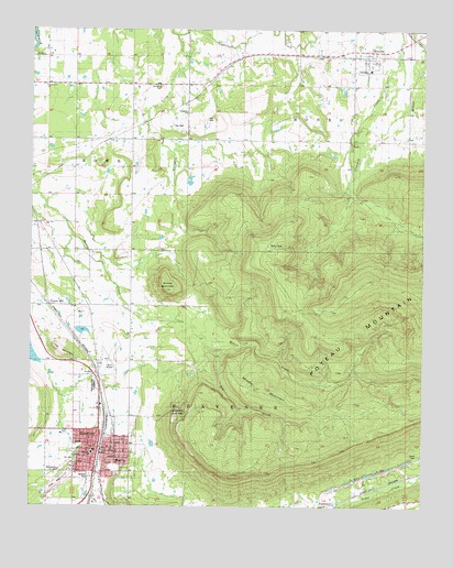
Heavener, OK USGS Topographic Map
Click on map above to begin viewing in our Map Viewer.

This topographic map contains these locations and features:
Feature Name Type Latitude Longitude GNIS ID View Map
Assembly of God ChurchChurchN34.8854°W94.6047°1798309View Map
Burns CemeteryCemeteryN34.8887°W94.5017°1777512View Map
Church of ChristChurchN34.8895°W94.5991°1798310View Map
City of HeavenerCivilN34.8919°W94.6075°2410730View Map
Community ChurchChurchN34.9857°W94.6205°1777518View Map
Dry CreekStreamN34.9237°W94.5777°1092219View Map
Emergency Medical Services of Le Flore County Station 8 HeavenerBuildingN34.8954°W94.6059°2695949View Map
First Baptist ChurchChurchN34.8898°W94.6049°1798311View Map
First United Methodist ChurchChurchN34.8907°W94.6022°1798312View Map
Forest HillPopulated PlaceN34.9276°W94.6197°1092937View Map
ForresterLocaleN34.8762°W94.5308°1777513View Map
Free Will Baptist ChurchChurchN34.8879°W94.5977°1798313View Map
HeavenerPopulated PlaceN34.8893°W94.6008°1093640View Map
Heavener Church of NazareneChurchN34.8907°W94.5999°1798314View Map
Heavener Elementary SchoolSchoolN34.8857°W94.5987°1790677View Map
Heavener Fire Department Eastside StationBuildingN34.8893°W94.6020°2656912View Map
Heavener Fire Department West Side StationBuildingN34.8954°W94.6056°2657356View Map
Heavener High SchoolSchoolN34.8869°W94.5971°1790362View Map
Heavener Memorial ParkCemeteryN34.9065°W94.6045°1093641View Map
Heavener Police DepartmentBuildingN34.8899°W94.6016°2757592View Map
Hill CemeteryCemeteryN34.8875°W94.6106°1093769View Map
Horsepen CreekStreamN34.9987°W94.5780°1093948View Map
KPRV-FM (Heavener)TowerN34.8984°W94.5752°1102259View Map
Lost MountainSummitN34.9162°W94.6163°1095010View Map
Middle MountainSummitN34.9062°W94.5527°1095362View Map
MonroePopulated PlaceN34.9926°W94.5169°1095479View Map
Monroe CemeteryCemeteryN34.9895°W94.5204°2711795View Map
Monroe Census Designated PlaceCensusN34.9937°W94.5155°2629931View Map
Monroe Elementary SchoolSchoolN34.9896°W94.5175°1794223View Map
Monroe Volunteer Fire DepartmentBuildingN34.9923°W94.5164°2657367View Map
Municipal Airport (historical)AirportN34.9137°W94.6002°1777517View Map
Oakdale CemeteryCemeteryN34.8834°W94.6056°1777516View Map
Poteau MountainRangeN34.9195°W94.5224°1777514View Map
Round MountainSummitN34.9318°W94.5819°1097494View Map
Runestone State ParkParkN34.9001°W94.5780°1777515View Map
Springhill CemeteryCemeteryN34.9851°W94.5834°1098457View Map
Springhill ChurchChurchN34.9784°W94.5752°1098458View Map
Township of HeavenerCivilN34.9029°W94.5613°1824681View Map
Township of MonroeCivilN34.9779°W94.5224°1824679View Map
Trinity Baptist ChurchChurchN34.8923°W94.5966°1798315View Map
Westside SchoolSchoolN34.8890°W94.6052°1099638View Map
Wilson CreekStreamN34.9962°W94.5005°1101741View Map

Note: Coordinates in the location and feature list above are referenced to NAD83 datum.


Copyright (C) 2008-2024 Ryan Niemi / Sunset Dynamics ... All Rights Reserved