TopoQuest Logo
Do you find TopoQuest useful?
Help keep TopoQuest running and adding new maps/features by donating!
Bitcoin:  19c7KJd3qBynnjoSw5npx9KScwjBe4ifkT
Litecoin:  LXs6TkuXGGXo1vDsWCkWVdjQX94eUKd6ui
Home View Maps Find Maps Find Places Resources & Links


Hayfork Summit, California Topographic Map

USGS Map Title: Hayfork Summit, CA
USGS Map MRC: 40123E1
DRG (GeoTIFF) Download: o40123e1.tif


Neighboring USGS Topographic Map Quads:


  Hayfork Bally, CA  
40123F2
 

  Junction City, CA  
40123F1
 

  Weaverville, CA  
40122F8
 

  Hayfork, CA  
40123E2
 

  Hayfork Summit, CA  
40123E1
 

  Hoosimbim Mountain, CA  
40122E8


  Dubakella Mountain, CA  
40123D1
 

  Chancheulla Peak, CA  
40122D7


Map MRC Location:

N41°
W124°
N41°
W123°
H8 H7 H6 H5 H4 H3 H2 H1
G8 G7 G6 G5 G4 G3 G2 G1
F8 F7 F6 F5 F4 F3 F2 F1
E8 E7 E6 E5 E4 E3 E2 E1
D8 D7 D6 D5 D4 D3 D2 D1
C8 C7 C6 C5 C4 C3 C2 C1
B8 B7 B6 B5 B4 B3 B2 B1
A8 A7 A6 A5 A4 A3 A2 A1
N40°
W124°
N40°
W123°

Hayfork Summit, CA USGS 1:24K Topographic Map Preview:
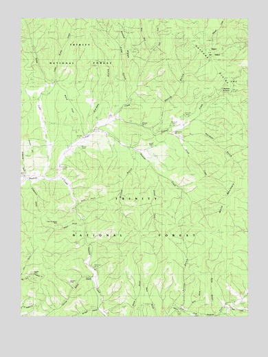
Hayfork Summit, CA USGS Topographic Map
Click on map above to begin viewing in our Map Viewer.

This topographic map contains these locations and features:
Feature Name Type Latitude Longitude GNIS ID View Map
Alder GulchValleyN40.5910°W123.0675°266374View Map
Barker CreekStreamN40.5588°W123.1153°256518View Map
Billy GulchValleyN40.5046°W123.0334°257061View Map
Bridge GulchValleyN40.5038°W123.0842°257454View Map
Carr CreekStreamN40.5599°W123.1064°257996View Map
Carrier GulchValleyN40.5165°W123.0886°258001View Map
Cope and Johnson MineMineN40.5385°W123.1070°258695View Map
Deep GulchValleyN40.5488°W123.0953°259186View Map
Devils GulchValleyN40.5793°W123.0539°259315View Map
Duncan CreekStreamN40.5785°W123.0842°259607View Map
Duncan HillSummitN40.5732°W123.1247°1658444View Map
East Fork Carr CreekStreamN40.6099°W123.0550°259720View Map
East Fork Hayfork CreekStreamN40.5001°W123.0772°222886View Map
Fulton GulchValleyN40.5043°W123.0378°260448View Map
Garden GulchValleyN40.5796°W123.0889°260473View Map
Gardner GulchValleyN40.5751°W123.0364°260481View Map
Grapevine GulchValleyN40.5599°W123.1247°260779View Map
Hayfork SummitGapN40.5960°W123.0122°1658726View Map
Limestone GulchValleyN40.5551°W123.1214°262480View Map
Little Barker CreekStreamN40.5921°W123.1167°262520View Map
Mueller MineMineN40.5179°W123.1220°263948View Map
Negro GulchValleyN40.5379°W123.0928°264033View Map
North Fork East Fork Hayfork CreekStreamN40.5093°W123.0011°264192View Map
Potato CreekStreamN40.5029°W123.0436°264992View Map
Rock FlatFlatN40.5888°W123.0995°1665413View Map
Ross GulchValleyN40.5018°W123.0197°265584View Map
Scorpion MineMineN40.5143°W123.1009°265933View Map
Shake RidgeRidgeN40.6129°W123.0678°276667View Map
Shock CreekStreamN40.5768°W123.0447°266128View Map
Sims CreekStreamN40.5038°W123.0136°266358View Map
South Fork Duncan CreekStreamN40.5607°W123.0528°267453View Map
Staffords CrossingCrossingN40.5165°W123.0878°276666View Map
Summit CreekStreamN40.5832°W123.0745°267918View Map
Wells MountainSummitN40.5579°W123.0053°268851View Map
West Fork Carr CreekStreamN40.6104°W123.0553°268888View Map
Willow GulchValleyN40.5701°W123.0675°269173View Map

Note: Coordinates in the location and feature list above are referenced to NAD83 datum.


Copyright (C) 2008-2024 Ryan Niemi / Sunset Dynamics ... All Rights Reserved