TopoQuest Logo
Do you find TopoQuest useful?
Help keep TopoQuest running and adding new maps/features by donating!
Bitcoin:  19c7KJd3qBynnjoSw5npx9KScwjBe4ifkT
Litecoin:  LXs6TkuXGGXo1vDsWCkWVdjQX94eUKd6ui
Home View Maps Find Maps Find Places Resources & Links


Hawley Lake East, Arizona Topographic Map

USGS Map Title: Hawley Lake East, AZ
USGS Map MRC: 33109H6
DRG (GeoTIFF) Download: o33109h6.tif


Neighboring USGS Topographic Map Quads:


  McNary, AZ  
34109A7
 

  Horseshoe Cienega, AZ  
34109A6
 

  Greens Peak, AZ  
34109A5
 

  Hawley Lake West, AZ  
33109H7
 

  Hawley Lake East, AZ  
33109H6
 

  Mount Baldy, AZ  
33109H5
 

  Corn Creek Plateau, AZ  
33109G7
 

  Marshall Butte, AZ  
33109G6
 

  Bonito Rock, AZ  
33109G5


Map MRC Location:

N34°
W110°
N34°
W109°
H8 H7 H6 H5 H4 H3 H2 H1
G8 G7 G6 G5 G4 G3 G2 G1
F8 F7 F6 F5 F4 F3 F2 F1
E8 E7 E6 E5 E4 E3 E2 E1
D8 D7 D6 D5 D4 D3 D2 D1
C8 C7 C6 C5 C4 C3 C2 C1
B8 B7 B6 B5 B4 B3 B2 B1
A8 A7 A6 A5 A4 A3 A2 A1
N33°
W110°
N33°
W109°

Hawley Lake East, AZ USGS 1:24K Topographic Map Preview:
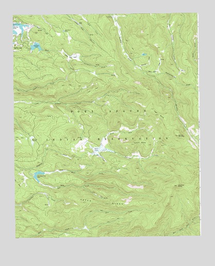
Hawley Lake East, AZ USGS Topographic Map
Click on map above to begin viewing in our Map Viewer.

This topographic map contains these locations and features:
Feature Name Type Latitude Longitude GNIS ID View Map
Apache ButteSummitN33.9264°W109.6595°723View Map
Aspen RidgeRidgeN33.8937°W109.6862°866View Map
Bear CienegaSwampN33.9673°W109.6362°1121View Map
Beaver DamSwampN33.9238°W109.6923°1164View Map
Christmas Tree LakeReservoirN33.9065°W109.7336°2900View Map
Diamond ButteSummitN33.9031°W109.6406°3925View Map
Diamond Creek Campsite Number FiveParkN33.9245°W109.7270°21601View Map
Diamond Creek Campsite Number FourParkN33.9334°W109.7101°21602View Map
Earl CreekStreamN33.9875°W109.7443°4259View Map
Earl Park DamDamN33.9850°W109.7357°21613View Map
Earl Park LakeReservoirN33.9822°W109.7345°4260View Map
Earl Park TankReservoirN33.9907°W109.7154°4261View Map
Hawley LakePopulated PlaceN33.9839°W109.7470°5637View Map
Maverick CienegaSwampN33.9293°W109.7380°7783View Map
Moon CreekStreamN33.9106°W109.7390°8254View Map
North Fork Diamond CreekStreamN33.9234°W109.6943°8724View Map
Porcupine CreekStreamN33.9764°W109.7120°9650View Map
Sand TankReservoirN33.9944°W109.7056°10895View Map
Snow Stake CreekStreamN33.9670°W109.6626°11501View Map
Snowshoe CreekStreamN33.9698°W109.6659°11507View Map
Spruce MountainSummitN33.9314°W109.6395°11716View Map
Star CreekStreamN33.9217°W109.6976°11787View Map
Sun CreekStreamN33.9137°W109.7407°11954View Map
Tiger ButteSummitN33.9431°W109.6529°12453View Map
Upper Earl ParkFlatN33.9753°W109.7118°13083View Map
Wohlenberg DrawValleyN33.9945°W109.6807°36350View Map

Note: Coordinates in the location and feature list above are referenced to NAD83 datum.


Copyright (C) 2008-2024 Ryan Niemi / Sunset Dynamics ... All Rights Reserved