TopoQuest Logo
Do you find TopoQuest useful?
Help keep TopoQuest running and adding new maps/features by donating!
Bitcoin:  19c7KJd3qBynnjoSw5npx9KScwjBe4ifkT
Litecoin:  LXs6TkuXGGXo1vDsWCkWVdjQX94eUKd6ui
Home View Maps Find Maps Find Places Resources & Links


Hartland, Texas Topographic Map

USGS Map Title: Hartland, TX
USGS Map MRC: 26098G2
DRG (GeoTIFF) Download: o26098g2.tif


Neighboring USGS Topographic Map Quads:


  Tacubaya, TX  
26098H3
 

  Encino, TX  
26098H2
 

  San Tomas Camp, TX  
26098H1
 

  Santa Elena SE, TX  
26098G3
 

  Hartland, TX  
26098G2
 

  Callo Padrones, TX  
26098G1
 

  La Reforma, TX  
26098F3
 

  Linn NW, TX  
26098F2
 

  Linn NE, TX  
26098F1


Map MRC Location:

N27°
W99°
N27°
W98°
H8 H7 H6 H5 H4 H3 H2 H1
G8 G7 G6 G5 G4 G3 G2 G1
F8 F7 F6 F5 F4 F3 F2 F1
E8 E7 E6 E5 E4 E3 E2 E1
D8 D7 D6 D5 D4 D3 D2 D1
C8 C7 C6 C5 C4 C3 C2 C1
B8 B7 B6 B5 B4 B3 B2 B1
A8 A7 A6 A5 A4 A3 A2 A1
N26°
W99°
N26°
W98°

Hartland, TX USGS 1:24K Topographic Map Preview:
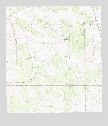
Hartland, TX USGS Topographic Map
Click on map above to begin viewing in our Map Viewer.

This topographic map contains these locations and features:
Feature Name Type Latitude Longitude GNIS ID View Map
Bacera WindmillLocaleN26.8139°W98.2197°1329900View Map
Buena Suerte WindmillLocaleN26.8567°W98.1375°1331532View Map
Coyote RanchLocaleN26.8362°W98.1708°1333599View Map
Cuero de Venada WindmillLocaleN26.7906°W98.1550°1333783View Map
El Coyote Ranch AirportAirportN26.8524°W98.2174°1386615View Map
Encalmado WindmillLocaleN26.7667°W98.2072°1335450View Map
Encinal WindmillLocaleN26.8631°W98.1597°1335454View Map
Fant PastureFlatN26.8498°W98.1575°1335701View Map
Fant WindmillLocaleN26.8514°W98.1664°1335702View Map
HartlandPopulated PlaceN26.8248°W98.1475°1378422View Map
La Blanca WindmillLocaleN26.8328°W98.1372°1339281View Map
La Merienda WindmillLocaleN26.7870°W98.1419°1339352View Map
Llano WindmillLocaleN26.8159°W98.1706°1340279View Map
Los Aceiteros WindmillLocaleN26.8470°W98.1511°1340560View Map
Machos WindmillLocaleN26.8056°W98.1947°1340810View Map
Marrana PastureFlatN26.8459°W98.1372°1340972View Map
Medanito WindmillLocaleN26.7637°W98.2258°1341310View Map
Mesquite WindmillLocaleN26.7509°W98.1617°1341421View Map
Old Coyote WindmillLocaleN26.8314°W98.2014°1343138View Map
Palomas PastureFlatN26.8076°W98.1670°1343497View Map
Palomas WindmillLocaleN26.8214°W98.1553°1343500View Map
Patitos PastureFlatN26.8537°W98.2011°1343655View Map
Pens WindmillLocaleN26.8398°W98.1770°1343832View Map
Plato WindmillLocaleN26.8595°W98.1800°1344172View Map
Prieto WindmillLocaleN26.8503°W98.1989°1344564View Map
Quaco WindmillLocaleN26.7826°W98.2239°1344646View Map
Sulphur WindmillLocaleN26.8603°W98.2142°1348058View Map
Tasajal LakeLakeN26.7814°W98.1659°1348263View Map
Tordillas WindmillLocaleN26.7823°W98.1775°1348646View Map
Tres Lagunas PastureFlatN26.7637°W98.1897°1348752View Map
Tuerto WindmillLocaleN26.7573°W98.1914°1348828View Map
Vargas CreekStreamN26.7814°W98.1686°1349198View Map
Vargas PastureFlatN26.8092°W98.2122°1349199View Map
Vargas WindmillLocaleN26.7973°W98.2095°1349200View Map
Venada WindmillLocaleN26.8314°W98.2250°1349225View Map

Note: Coordinates in the location and feature list above are referenced to NAD83 datum.


Copyright (C) 2008-2024 Ryan Niemi / Sunset Dynamics ... All Rights Reserved