TopoQuest Logo
Do you find TopoQuest useful?
Help keep TopoQuest running and adding new maps/features by donating!
Bitcoin:  19c7KJd3qBynnjoSw5npx9KScwjBe4ifkT
Litecoin:  LXs6TkuXGGXo1vDsWCkWVdjQX94eUKd6ui
Home View Maps Find Maps Find Places Resources & Links


Harrison, Ohio Topographic Map

USGS Map Title: Harrison, OH
USGS Map MRC: 39084C7
DRG (GeoTIFF) Download: o39084c7.tif


Neighboring USGS Topographic Map Quads:


  Whitcomb, IN  
39084D8
 

  Reily, OH  
39084D7
 

  Millville, OH  
39084D6
 

  Cedar Grove, IN  
39084C8
 

  Harrison, OH  
39084C7
 

  Shandon, OH  
39084C6
 

  Guilford, IN  
39084B8
 

  Hooven, OH  
39084B7
 

  Addyston, OH  
39084B6


Map MRC Location:

N40°
W85°
N40°
W84°
H8 H7 H6 H5 H4 H3 H2 H1
G8 G7 G6 G5 G4 G3 G2 G1
F8 F7 F6 F5 F4 F3 F2 F1
E8 E7 E6 E5 E4 E3 E2 E1
D8 D7 D6 D5 D4 D3 D2 D1
C8 C7 C6 C5 C4 C3 C2 C1
B8 B7 B6 B5 B4 B3 B2 B1
A8 A7 A6 A5 A4 A3 A2 A1
N39°
W85°
N39°
W84°

Harrison, OH USGS 1:24K Topographic Map Preview:
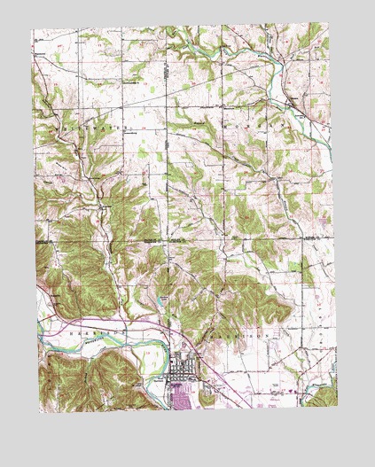
Harrison, OH USGS Topographic Map
Click on map above to begin viewing in our Map Viewer.

This topographic map contains these locations and features:
Feature Name Type Latitude Longitude GNIS ID View Map
AlertPopulated PlaceN39.3251°W84.7752°1064307View Map
Alert Post Office (historical)Post OfficeN39.3237°W84.7736°1083268View Map
Alert Post Office (historical)Post OfficeN39.3251°W84.7750°1965257View Map
Arnold School (historical)SchoolN39.2623°W84.7833°1059670View Map
Baptist CemeteryCemeteryN39.2689°W84.7652°1064061View Map
Biddinger School (historical)SchoolN39.2909°W84.7963°1059671View Map
BraysvillePopulated PlaceN39.2881°W84.8697°431459View Map
Braysville CemeteryCemeteryN39.2852°W84.8692°431460View Map
Buck RunStreamN39.3612°W84.7697°1065942View Map
Camp RunStreamN39.3353°W84.7522°1038747View Map
Camp Saint JosephParkN39.2587°W84.8316°432065View Map
Cincinnati West AirportAirportN39.2551°W84.7766°1075026View Map
City of HarrisonCivilN39.2571°W84.7883°2394305View Map
Cooper RunStreamN39.2701°W84.8197°432950View Map
Crane RunStreamN39.2706°W84.8686°433090View Map
Cranes RunStreamN39.3178°W84.8483°433091View Map
Crossroads Plaza Shopping CenterLocaleN39.2592°W84.8041°1059760View Map
DrewersburgPopulated PlaceN39.3403°W84.8372°433687View Map
Drewersburg ChurchChurchN39.3567°W84.8369°433688View Map
Drewersburg Volunteer Fire Department Station 1BuildingN39.3391°W84.8376°2626459View Map
Edgewood School (historical)SchoolN39.2903°W84.7636°1059669View Map
Fairview CemeteryCemeteryN39.3055°W84.7928°1040325View Map
Fairview Church (historical)ChurchN39.3053°W84.7925°1069310View Map
First Baptist ChurchChurchN39.2611°W84.8147°2089798View Map
First Christian ChurchChurchN39.2633°W84.8169°2089799View Map
First Presbyterian ChurchChurchN39.2611°W84.8161°2089800View Map
Franklin County Emergency Medical Services Station 1BuildingN39.3391°W84.8375°2719399View Map
Glen Haven CemeteryCemeteryN39.2675°W84.8119°1040897View Map
Governor Bebb PreserveParkN39.3667°W84.8008°1806431View Map
HarrisonPopulated PlaceN39.2620°W84.8200°1041362View Map
Harrison City Police DepartmentBuildingN39.2622°W84.8167°2732429View Map
Harrison Elementary SchoolSchoolN39.2603°W84.8116°1059673View Map
Harrison Fire Department Station 56BuildingN39.2617°W84.8183°2550498View Map
Harrison Fire Department Station 57BuildingN39.2551°W84.7875°2549212View Map
Harrison HillSummitN39.2534°W84.8469°435790View Map
Harrison Hills CemeteryCemeteryN39.2509°W84.8363°435793View Map
Harrison Middle SchoolSchoolN39.2551°W84.7677°1059667View Map
Harrison Park CemeteryCemeteryN39.2634°W84.8136°1960285View Map
Harrison Post OfficePost OfficeN39.2626°W84.8194°1989735View Map
Harrison Seventh Day Adventist ChurchChurchN39.2606°W84.8175°2089801View Map
Interchange 1CrossingN39.2603°W84.7988°1059672View Map
Johnson ForkStreamN39.2723°W84.8377°449791View Map
Kiata CreekStreamN39.3637°W84.7741°1042249View Map
Kolb CreekStreamN39.2698°W84.8205°437430View Map
Lee CreekStreamN39.2567°W84.7616°437734View Map
Liebrook HillSummitN39.3489°W84.7819°1048914View Map
Logan CreekStreamN39.2748°W84.8738°438228View Map
MacedoniaPopulated PlaceN39.3487°W84.7958°1062869View Map
Macedonia CemeteryCemeteryN39.3489°W84.7963°1806441View Map
Macedonia Christian ChurchChurchN39.3487°W84.7958°1063727View Map
Morgan Elementary SchoolSchoolN39.3445°W84.7611°1052652View Map
OkeanaPopulated PlaceN39.3478°W84.7675°1065195View Map
Okeana Post OfficePost OfficeN39.3473°W84.7680°1965249View Map
Othneil Looker ParkParkN39.2562°W84.8094°1064063View Map
Otwell CemeteryCemeteryN39.3235°W84.8275°440761View Map
Pinhook CreekStreamN39.2714°W84.8394°441171View Map
RockdalePopulated PlaceN39.3170°W84.8469°442216View Map
Saint John The Baptist ChurchChurchN39.2628°W84.8142°2089802View Map
Saint John the Baptist SchoolSchoolN39.2626°W84.8138°1064064View Map
Saint Johns Catholic CemeteryCemeteryN39.2687°W84.8130°1960289View Map
Sater RunStreamN39.3681°W84.8075°443038View Map
School Number 4 (historical)SchoolN39.3487°W84.7927°1069311View Map
School Number 9 (historical)SchoolN39.3192°W84.7958°1052614View Map
SharptownPopulated PlaceN39.3670°W84.8736°443314View Map
Snow CemeteryCemeteryN39.3269°W84.8629°443735View Map
Snow HillSummitN39.3306°W84.8636°443739View Map
Souders LakeReservoirN39.2857°W84.8237°443775View Map
Sours RunStreamN39.3734°W84.8125°449801View Map
Tall Oaks Shopping CenterLocaleN39.2562°W84.8013°1064062View Map
Town of West HarrisonCivilN39.2553°W84.8222°2397732View Map
Township of HarrisonCivilN39.2619°W84.7920°1086214View Map
Township of HarrisonCivilN39.2663°W84.8478°453383View Map
Township of MorganCivilN39.3481°W84.7609°1085816View Map
Township of WhitewaterCivilN39.3492°W84.8736°454057View Map
West HarrisonPopulated PlaceN39.2609°W84.8208°445771View Map
William Henry Harrison High SchoolSchoolN39.2553°W84.7699°1059668View Map
Woodlawn CemeteryCemeteryN39.2667°W84.8097°1048085View Map

Note: Coordinates in the location and feature list above are referenced to NAD83 datum.


Copyright (C) 2008-2024 Ryan Niemi / Sunset Dynamics ... All Rights Reserved