TopoQuest Logo
Do you find TopoQuest useful?
Help keep TopoQuest running and adding new maps/features by donating!
Bitcoin:  19c7KJd3qBynnjoSw5npx9KScwjBe4ifkT
Litecoin:  LXs6TkuXGGXo1vDsWCkWVdjQX94eUKd6ui
Home View Maps Find Maps Find Places Resources & Links


Harmony, Wisconsin Topographic Map

USGS Map Title: Harmony, WI
USGS Map MRC: 45087A7
DRG (GeoTIFF) Download: o45087a7.tif


Neighboring USGS Topographic Map Quads:


  Loomis, WI  
45087B8
 

  Porterfield, WI  
45087B7
 

  Chappee Rapids, MI  
45087B6
 

  Porterfield SW, WI  
45087A8
 

  Harmony, WI  
45087A7
 

  Marinette West, WI  
45087A6
 

  Oconto West, WI  
44087H8
 

  Oconto East, WI  
44087H7
 

  Peshtigo Harbor, WI  
44087H6


Map MRC Location:

N46°
W88°
N46°
W87°
H8 H7 H6 H5 H4 H3 H2 H1
G8 G7 G6 G5 G4 G3 G2 G1
F8 F7 F6 F5 F4 F3 F2 F1
E8 E7 E6 E5 E4 E3 E2 E1
D8 D7 D6 D5 D4 D3 D2 D1
C8 C7 C6 C5 C4 C3 C2 C1
B8 B7 B6 B5 B4 B3 B2 B1
A8 A7 A6 A5 A4 A3 A2 A1
N45°
W88°
N45°
W87°

Harmony, WI USGS 1:24K Topographic Map Preview:
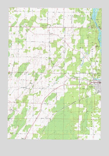
Harmony, WI USGS Topographic Map
Click on map above to begin viewing in our Map Viewer.

This topographic map contains these locations and features:
Feature Name Type Latitude Longitude GNIS ID View Map
Bagley Flowage 1061ReservoirN45.1245°W87.7578°1792990View Map
Bundy CreekStreamN45.0619°W87.7993°1578893View Map
Cedar School (historical)SchoolN45.0342°W87.7793°1876836View Map
Feifarek School (historical)SchoolN45.0136°W87.8412°1564899View Map
Grover - Porterfield Fire DepartmentBuildingN45.0990°W87.8204°2696814View Map
Hale Road School (historical)SchoolN45.0053°W87.7595°1876852View Map
HarmonyPopulated PlaceN45.0992°W87.8198°1566072View Map
Harmony CemeteryCemeteryN45.0964°W87.8045°1566073View Map
Homestead School (historical)SchoolN45.1205°W87.8543°1876853View Map
Job Place School (historical)SchoolN45.0475°W87.8201°1567185View Map
Marinette County Farm (historical)LocaleN45.0989°W87.7996°1845585View Map
May CornerPopulated PlaceN45.0492°W87.8507°1569142View Map
Peshtigo City Fire Department Station 1BuildingN45.0540°W87.7519°2696694View Map
Peshtigo City HallBuildingN45.0542°W87.7520°1845614View Map
Peshtigo Elementary Learning CenterSchoolN45.0590°W87.7522°1845615View Map
Peshtigo Fire CemeteryCemeteryN45.0565°W87.7548°2781243View Map
Peshtigo Fire MuseumBuildingN45.0558°W87.7534°1845616View Map
Peshtigo Lookout TowerTowerN45.0886°W87.7562°1581311View Map
Peshtigo Middle - High SchoolSchoolN45.0568°W87.7529°1845617View Map
Peshtigo Police DepartmentBuildingN45.0542°W87.7519°2759369View Map
Peshtigo United Methodist ChurchChurchN45.0542°W87.7557°1845620View Map
Plumb School (historical)SchoolN45.1228°W87.8012°1876865View Map
Potato Rapids DamDamN45.1144°W87.7604°1571833View Map
Potato Rapids WP 133 DamDamN45.1150°W87.7618°1792989View Map
Red School (historical)SchoolN45.0778°W87.8209°1572158View Map
Roosevelt School (historical)SchoolN45.0744°W87.7665°1876869View Map
Saint John Evangelical Lutheran SchoolSchoolN45.0281°W87.8696°1845630View Map
Saint Johns ChurchChurchN45.0272°W87.8701°1573110View Map
Saint Marys Catholic ChurchChurchN45.0533°W87.7590°1845633View Map
Saint Thomas Aquinas Academy Elementary CampusSchoolN45.0533°W87.7587°2713259View Map
Sandberg School (historical)SchoolN45.1205°W87.7715°1876871View Map
Town of GroverCivilN45.0582°W87.8625°1583327View Map
Urbaniak Field (historical)AirportN45.1191°W87.7815°1582062View Map
WHYB-FM (Peshtigo)TowerN45.1219°W87.8521°1582441View Map
Zion Lutheran ChurchChurchN45.0525°W87.7537°1845662View Map

Note: Coordinates in the location and feature list above are referenced to NAD83 datum.


Copyright (C) 2008-2024 Ryan Niemi / Sunset Dynamics ... All Rights Reserved