TopoQuest Logo
Do you find TopoQuest useful?
Help keep TopoQuest running and adding new maps/features by donating!
Bitcoin:  19c7KJd3qBynnjoSw5npx9KScwjBe4ifkT
Litecoin:  LXs6TkuXGGXo1vDsWCkWVdjQX94eUKd6ui
Home View Maps Find Maps Find Places Resources & Links


Avant, Arkansas Topographic Map

USGS Map Title: Avant, AR
USGS Map MRC: 34093F3
DRG (GeoTIFF) Download: o34093f3.tif


Neighboring USGS Topographic Map Quads:


  Onyx, AR  
34093G4
 

  Steve, AR  
34093G3
 

  Nimrod SW, AR  
34093G2
 

  Fannie, AR  
34093F4
 

  Avant, AR  
34093F3
 

  Hamilton, AR  
34093F2
 

  McGraw Mountain, AR  
34093E4
 

  Crystal Springs, AR  
34093E3
 

  Mountain Pine, AR  
34093E2


Map MRC Location:

N35°
W94°
N35°
W93°
H8 H7 H6 H5 H4 H3 H2 H1
G8 G7 G6 G5 G4 G3 G2 G1
F8 F7 F6 F5 F4 F3 F2 F1
E8 E7 E6 E5 E4 E3 E2 E1
D8 D7 D6 D5 D4 D3 D2 D1
C8 C7 C6 C5 C4 C3 C2 C1
B8 B7 B6 B5 B4 B3 B2 B1
A8 A7 A6 A5 A4 A3 A2 A1
N34°
W94°
N34°
W93°

Avant, AR USGS 1:24K Topographic Map Preview:
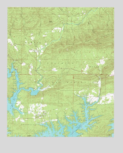
Avant, AR USGS Topographic Map
Click on map above to begin viewing in our Map Viewer.

This topographic map contains these locations and features:
Feature Name Type Latitude Longitude GNIS ID View Map
AvantPopulated PlaceN34.6459°W93.3399°70479View Map
Avant CemeteryCemeteryN34.6384°W93.3402°83590View Map
Big BranchStreamN34.7065°W93.3371°70654View Map
Buckville Volunteer Fire Station 1BuildingN34.6452°W93.3406°2116199View Map
Buckville Volunteer Fire Station 2BuildingN34.6972°W93.3543°2116200View Map
Caldwell CemeteryCemeteryN34.7370°W93.2921°83595View Map
Cedar Fourche LandingLocaleN34.6576°W93.2794°71085View Map
Cedar Fourche Public Use AreaParkN34.6576°W93.2791°64294View Map
Daley CemeteryCemeteryN34.6718°W93.3418°83597View Map
Daley CreekStreamN34.6695°W93.3382°71328View Map
Gladstone (historical)Populated PlaceN34.7459°W93.3044°64312View Map
Gobblers KnobSummitN34.6254°W93.3516°71774View Map
Hogpen HollowValleyN34.7415°W93.2838°72039View Map
Irons ForkStreamN34.6701°W93.3627°81872View Map
Irons Fork LandingLocaleN34.6901°W93.3644°72151View Map
Irons Fork Public Use AreaParkN34.6879°W93.3724°77352View Map
Little CreekStreamN34.7345°W93.2988°72385View Map
McElrath CreekStreamN34.7118°W93.3405°72591View Map
Mount TaborPopulated PlaceN34.7076°W93.3380°72771View Map
Mount Tabor CemeteryCemeteryN34.7118°W93.3321°83607View Map
Muse CreekStreamN34.6915°W93.3696°72824View Map
Pilot KnobSummitN34.7154°W93.2699°73075View Map
Round MountainSummitN34.7362°W93.3269°73406View Map
Township of Baxter (historical)CivilN34.6862°W93.3085°66590View Map
Township of Bucksville (historical)CivilN34.6376°W93.3641°64293View Map
Township of Davis (historical)CivilN34.6876°W93.2516°64302View Map

Note: Coordinates in the location and feature list above are referenced to NAD83 datum.


Copyright (C) 2008-2024 Ryan Niemi / Sunset Dynamics ... All Rights Reserved