TopoQuest Logo
Do you find TopoQuest useful?
Help keep TopoQuest running and adding new maps/features by donating!
Bitcoin:  19c7KJd3qBynnjoSw5npx9KScwjBe4ifkT
Litecoin:  LXs6TkuXGGXo1vDsWCkWVdjQX94eUKd6ui
Home View Maps Find Maps Find Places Resources & Links


Harco, Illinois Topographic Map

USGS Map Title: Harco, IL
USGS Map MRC: 37088G6
DRG (GeoTIFF) Download: o37088g6.tif


Neighboring USGS Topographic Map Quads:


  Thompsonville, IL  
37088H7
 

  Akin, IL  
37088H6
 

  Walpole, IL  
37088H5
 

  Pittsburg, IL  
37088G7
 

  Harco, IL  
37088G6
 

  Galatia, IL  
37088G5
 

  Crab Orchard, IL  
37088F7
 

  Carrier Mills, IL  
37088F6
 

  Harrisburg, IL  
37088F5


Map MRC Location:

N38°
W89°
N38°
W88°
H8 H7 H6 H5 H4 H3 H2 H1
G8 G7 G6 G5 G4 G3 G2 G1
F8 F7 F6 F5 F4 F3 F2 F1
E8 E7 E6 E5 E4 E3 E2 E1
D8 D7 D6 D5 D4 D3 D2 D1
C8 C7 C6 C5 C4 C3 C2 C1
B8 B7 B6 B5 B4 B3 B2 B1
A8 A7 A6 A5 A4 A3 A2 A1
N37°
W89°
N37°
W88°

Harco, IL USGS 1:24K Topographic Map Preview:
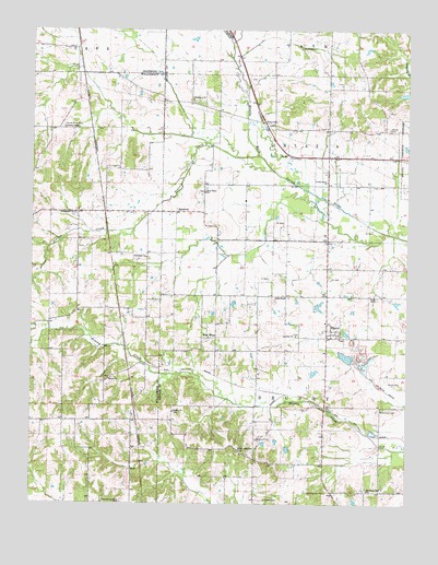
Harco, IL USGS Topographic Map
Click on map above to begin viewing in our Map Viewer.

This topographic map contains these locations and features:
Feature Name Type Latitude Longitude GNIS ID View Map
Abney Family CemeteryCemeteryN37.8042°W88.6351°403324View Map
Abney Family Number 2 CemeteryCemeteryN37.7820°W88.6275°403323View Map
Allens ChapelChurchN37.8489°W88.7392°403435View Map
BanklickPopulated PlaceN37.8273°W88.7023°422430View Map
Bankston Fork ChurchChurchN37.7537°W88.6376°403872View Map
Bethel ChurchChurchN37.7831°W88.7245°404285View Map
Brooks CemeteryCemeteryN37.8489°W88.6312°404915View Map
Brushy ChurchChurchN37.7945°W88.6620°405050View Map
Dillingham ChurchChurchN37.8267°W88.7359°407217View Map
Ebenezer CemeteryCemeteryN37.7514°W88.6723°407727View Map
Ebenezer ChurchChurchN37.8567°W88.6967°407735View Map
Ebenezer Church (historical)ChurchN37.7514°W88.6734°1820962View Map
Ebenezer School (historical)SchoolN37.8556°W88.6978°1820963View Map
Halltown CreekStreamN37.8714°W88.6842°409675View Map
HarcoPopulated PlaceN37.7959°W88.6501°409766View Map
HartfordPopulated PlaceN37.8048°W88.6656°422788View Map
Liberty ChurchChurchN37.7742°W88.7028°411994View Map
Locust Grove (historical)Populated PlaceN37.8703°W88.7353°1810961View Map
Locust Grove CemeteryCemeteryN37.8495°W88.7395°412483View Map
Martin Swine FarmLocaleN37.7875°W88.6728°2705329View Map
New HopePopulated PlaceN37.7939°W88.6889°423018View Map
New Hope ChurchChurchN37.8323°W88.6926°414418View Map
New Hope School (historical)SchoolN37.8320°W88.6923°1820992View Map
North American ChurchChurchN37.7642°W88.6803°414557View Map
Old Ebenezer CemeteryCemeteryN37.7534°W88.6514°415016View Map
Old Ruff CemeteryCemeteryN37.8703°W88.6612°415050View Map
Prairie CreekStreamN37.8417°W88.6748°416117View Map
RileyvillePopulated PlaceN37.8506°W88.6728°423121View Map
Spring Grove Church (historical)ChurchN37.7506°W88.7167°1736168View Map
Summers ChurchChurchN37.8150°W88.7120°419346View Map
Township of BrushyCivilN37.7767°W88.6554°428724View Map
Township of GalatiaCivilN37.8407°W88.6502°422231View Map
Union Grove ChurchChurchN37.8353°W88.6520°420077View Map
Ward School (historical)SchoolN37.8195°W88.6656°1821022View Map
WBVN-FM (Carrier Mills)TowerN37.7737°W88.7389°428467View Map
Winkleman CemeteryCemeteryN37.7750°W88.6334°421330View Map

Note: Coordinates in the location and feature list above are referenced to NAD83 datum.


Copyright (C) 2008-2024 Ryan Niemi / Sunset Dynamics ... All Rights Reserved