TopoQuest Logo
Do you find TopoQuest useful?
Help keep TopoQuest running and adding new maps/features by donating!
Bitcoin:  19c7KJd3qBynnjoSw5npx9KScwjBe4ifkT
Litecoin:  LXs6TkuXGGXo1vDsWCkWVdjQX94eUKd6ui
Home View Maps Find Maps Find Places Resources & Links


Hanson Flat, Montana Topographic Map

USGS Map Title: Hanson Flat, MT
USGS Map MRC: 47108E3
DRG (GeoTIFF) Download: o47108e3.tif


Neighboring USGS Topographic Map Quads:


  Sagebrush Reservoir, MT  
47108F4
 

  Blizzard Reservoir, MT  
47108F3
 

  Lake Reservoir, MT  
47108F2
 

  Kepple Bottoms, MT  
47108E4
 

  Hanson Flat, MT  
47108E3
 

  Dry Coulee, MT  
47108E2
 

  Pipes Coulee, MT  
47108D4
 

  Dovetail Butte, MT  
47108D3
 

  Weingart Place NW, MT  
47108D2


Map MRC Location:

N48°
W109°
N48°
W108°
H8 H7 H6 H5 H4 H3 H2 H1
G8 G7 G6 G5 G4 G3 G2 G1
F8 F7 F6 F5 F4 F3 F2 F1
E8 E7 E6 E5 E4 E3 E2 E1
D8 D7 D6 D5 D4 D3 D2 D1
C8 C7 C6 C5 C4 C3 C2 C1
B8 B7 B6 B5 B4 B3 B2 B1
A8 A7 A6 A5 A4 A3 A2 A1
N47°
W109°
N47°
W108°

Hanson Flat, MT USGS 1:24K Topographic Map Preview:
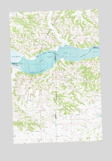
Hanson Flat, MT USGS Topographic Map
Click on map above to begin viewing in our Map Viewer.

This topographic map contains these locations and features:
Feature Name Type Latitude Longitude GNIS ID View Map
21N26E01DD__01 WellWellN47.6064°W108.3143°824020View Map
21N26E14ACDD01 WellWellN47.5822°W108.3410°823883View Map
21N27E04AD__01 WellWellN47.6125°W108.2521°824055View Map
21N27E07CD__01 WellWellN47.5908°W108.3057°823936View Map
Athearn School (historical)SchoolN47.5606°W108.2918°1721734View Map
Carroll (historical)Populated PlaceN47.5736°W108.3735°1722810View Map
Carroll CouleeValleyN47.5697°W108.3679°769616View Map
Carroll Post Office (historical)Post OfficeN47.5736°W108.3735°1722812View Map
Fisher CouleeValleyN47.5786°W108.3001°771395View Map
Fort Carroll (historical)MilitaryN47.5736°W108.3728°1722811View Map
Hanson FlatFlatN47.5389°W108.3474°772133View Map
HEADMAN DamDamN47.5233°W108.2523°797770View Map
Horse Camp TrailTrailN47.5064°W108.3046°772529View Map
Hutton BottomsBendN47.5711°W108.3665°772651View Map
Sevenmile CreekStreamN47.5928°W108.2973°776365View Map
Skyline TrailTrailN47.5364°W108.3612°776627View Map
Turkey Joe Boat RampLocaleN47.5742°W108.3687°777804View Map

Note: Coordinates in the location and feature list above are referenced to NAD83 datum.


Copyright (C) 2008-2024 Ryan Niemi / Sunset Dynamics ... All Rights Reserved