TopoQuest Logo
Do you find TopoQuest useful?
Help keep TopoQuest running and adding new maps/features by donating!
Bitcoin:  19c7KJd3qBynnjoSw5npx9KScwjBe4ifkT
Litecoin:  LXs6TkuXGGXo1vDsWCkWVdjQX94eUKd6ui
Home View Maps Find Maps Find Places Resources & Links


Hanna City, Illinois Topographic Map

USGS Map Title: Hanna City, IL
USGS Map MRC: 40089F7
DRG (GeoTIFF) Download: o40089f7.tif


Neighboring USGS Topographic Map Quads:


  Elmwood, IL  
40089G8
 

  Oak Hill, IL  
40089G7
 

  Dunlap, IL  
40089G6
 

  Farmington East, IL  
40089F8
 

  Hanna City, IL  
40089F7
 

  Peoria West, IL  
40089F6
 

  Banner, IL  
40089E8
 

  Glasford, IL  
40089E7
 

  Pekin, IL  
40089E6


Map MRC Location:

N41°
W90°
N41°
W89°
H8 H7 H6 H5 H4 H3 H2 H1
G8 G7 G6 G5 G4 G3 G2 G1
F8 F7 F6 F5 F4 F3 F2 F1
E8 E7 E6 E5 E4 E3 E2 E1
D8 D7 D6 D5 D4 D3 D2 D1
C8 C7 C6 C5 C4 C3 C2 C1
B8 B7 B6 B5 B4 B3 B2 B1
A8 A7 A6 A5 A4 A3 A2 A1
N40°
W90°
N40°
W89°

Hanna City, IL USGS 1:24K Topographic Map Preview:
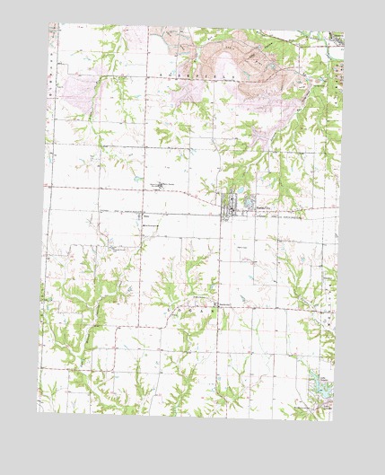
Hanna City, IL USGS Topographic Map
Click on map above to begin viewing in our Map Viewer.

This topographic map contains these locations and features:
Feature Name Type Latitude Longitude GNIS ID View Map
Cherry Fork School (historical)SchoolN40.6961°W89.8137°1720266View Map
Christ OrchardLocaleN40.7419°W89.8744°2556423View Map
Coal HollowValleyN40.7465°W89.7785°406302View Map
Cottonwood CemeteryCemeteryN40.7326°W89.7958°1959210View Map
Cottonwood ChurchChurchN40.7334°W89.7957°406630View Map
Cottonwood School (historical)SchoolN40.7334°W89.7948°1720268View Map
Crow HollowValleyN40.7224°W89.7694°1720270View Map
East Farmington SchoolSchoolN40.6859°W89.8321°407633View Map
EdenPopulated PlaceN40.6889°W89.8329°407765View Map
Hanna CityPopulated PlaceN40.6917°W89.7951°409747View Map
Hanna City Air Force Station (historical)MilitaryN40.6992°W89.8261°2087682View Map
Hanna City Boys SchoolSchoolN40.6989°W89.8254°409748View Map
Hanna City Elementary SchoolSchoolN40.6953°W89.7957°2041081View Map
Hanna City Post OfficePost OfficeN40.6916°W89.7955°2041082View Map
Harker's Corner CemeteryCemeteryN40.6289°W89.7593°409781View Map
Heaton HollowValleyN40.7124°W89.7812°1720282View Map
Johnson RunStreamN40.7411°W89.7548°411171View Map
Lake CamelotReservoirN40.6353°W89.7558°405425View Map
Lake Camelot Census Designated PlaceCensusN40.6342°W89.7510°2629864View Map
Lake Camelot DamDamN40.6325°W89.7526°1691297View Map
Lake LancelotLakeN40.6306°W89.7534°411793View Map
Lakeland LakeReservoirN40.6949°W89.7885°1691302View Map
Lakeland Lake DamDamN40.6967°W89.7868°1691301View Map
Leisure Oak Lake Number 2ReservoirN40.6798°W89.7735°1692419View Map
Leisure Oak Lake Number 2 DamDamN40.6800°W89.7768°1692418View Map
Logan - Trivoli Fire Protection District Hanna City StationBuildingN40.6916°W89.7949°2041083View Map
Morris School (historical)SchoolN40.7231°W89.8332°1720299View Map
Patton School (historical)SchoolN40.6970°W89.8509°1720306View Map
Peoria City - County LandfillLocaleN40.7422°W89.7989°2680849View Map
Pinkerton School (historical)SchoolN40.6914°W89.7762°1720311View Map
Pleasant Grove CemeteryCemeteryN40.6782°W89.8464°415782View Map
Pleasant Grove School (historical)SchoolN40.6781°W89.8451°1720312View Map
Salem School (historical)SchoolN40.6464°W89.8248°1720316View Map
SmithvillePopulated PlaceN40.6603°W89.7998°418655View Map
Smithville CemeteryCemeteryN40.6634°W89.8044°418656View Map
Texas Station CemeteryCemeteryN40.7305°W89.8708°1959231View Map
Township of LoganCivilN40.6675°W89.8147°429274View Map
Union School (historical)SchoolN40.6395°W89.8743°1720329View Map
United Methodist ChurchChurchN40.6911°W89.7879°2041084View Map
Village of Hanna CityCivilN40.6933°W89.8081°2398240View Map
Warsaw RunStreamN40.7484°W89.7668°420543View Map

Note: Coordinates in the location and feature list above are referenced to NAD83 datum.


Copyright (C) 2008-2024 Ryan Niemi / Sunset Dynamics ... All Rights Reserved