TopoQuest Logo
Do you find TopoQuest useful?
Help keep TopoQuest running and adding new maps/features by donating!
Bitcoin:  19c7KJd3qBynnjoSw5npx9KScwjBe4ifkT
Litecoin:  LXs6TkuXGGXo1vDsWCkWVdjQX94eUKd6ui
Home View Maps Find Maps Find Places Resources & Links


Hahnaman, Illinois Topographic Map

USGS Map Title: Hahnaman, IL
USGS Map MRC: 41089F6
DRG (GeoTIFF) Download: o41089f6.tif


Neighboring USGS Topographic Map Quads:


  Como, IL  
41089G7
 

  Sterling, IL  
41089G6
 

  Dixon West, IL  
41089G5
 

  Tampico, IL  
41089F7
 

  Hahnaman, IL  
41089F6
 

  Harmon, IL  
41089F5
 

  Yorktown, IL  
41089E7
 

  New Bedford, IL  
41089E6
 

  Walnut, IL  
41089E5


Map MRC Location:

N42°
W90°
N42°
W89°
H8 H7 H6 H5 H4 H3 H2 H1
G8 G7 G6 G5 G4 G3 G2 G1
F8 F7 F6 F5 F4 F3 F2 F1
E8 E7 E6 E5 E4 E3 E2 E1
D8 D7 D6 D5 D4 D3 D2 D1
C8 C7 C6 C5 C4 C3 C2 C1
B8 B7 B6 B5 B4 B3 B2 B1
A8 A7 A6 A5 A4 A3 A2 A1
N41°
W90°
N41°
W89°

Hahnaman, IL USGS 1:24K Topographic Map Preview:
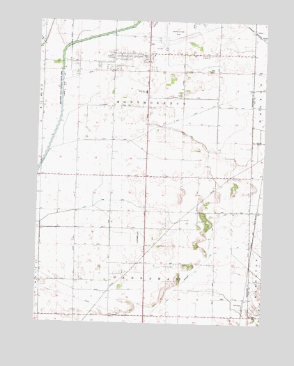
Hahnaman, IL USGS Topographic Map
Click on map above to begin viewing in our Map Viewer.

This topographic map contains these locations and features:
Feature Name Type Latitude Longitude GNIS ID View Map
Advance School (historical)SchoolN41.6648°W89.6909°403363View Map
Allpress School (historical)SchoolN41.7142°W89.7087°403450View Map
Bane School (historical)SchoolN41.6856°W89.6876°403869View Map
Branch F DitchCanalN41.6381°W89.7104°404796View Map
Cady Aerial RLA AirportAirportN41.6600°W89.6934°1718911View Map
Champion School (historical)SchoolN41.6586°W89.7282°405943View Map
East Hume School (historical)SchoolN41.7331°W89.7473°407657View Map
Elmendorf School (historical)SchoolN41.6861°W89.7387°407945View Map
Excelsior School (historical)SchoolN41.7361°W89.6898°408140View Map
Foley Sand Prairie Nature PreserveParkN41.6439°W89.6295°2013869View Map
Golder CemeteryCemeteryN41.7352°W89.6901°1718909View Map
Goose LakeLakeN41.6875°W89.6440°409175View Map
HahnamanPopulated PlaceN41.6317°W89.6351°422772View Map
Island School (historical)SchoolN41.6275°W89.6512°410973View Map
McWhorter School (historical)SchoolN41.6931°W89.6323°413337View Map
Montmorency SchoolSchoolN41.7209°W89.6909°1718910View Map
Shrock FeedlotLocaleN41.6254°W89.7310°2729058View Map
South Fork DitchCanalN41.6759°W89.7120°418760View Map
StoresLocaleN41.7436°W89.6282°419194View Map
Sturtz School (historical)SchoolN41.7361°W89.6359°419247View Map
Swan Lake School (historical)SchoolN41.7145°W89.6695°419462View Map
Township of HahnamanCivilN41.6280°W89.6897°429094View Map
Township of MontmorencyCivilN41.7146°W89.6899°429391View Map
Whiteside County Airport-Jos H Bittorf FieldAirportN41.7414°W89.6831°427841View Map
Winnebago DitchCanalN41.6536°W89.6529°421338View Map

Note: Coordinates in the location and feature list above are referenced to NAD83 datum.


Copyright (C) 2008-2024 Ryan Niemi / Sunset Dynamics ... All Rights Reserved