TopoQuest Logo
Do you find TopoQuest useful?
Help keep TopoQuest running and adding new maps/features by donating!
Bitcoin:  19c7KJd3qBynnjoSw5npx9KScwjBe4ifkT
Litecoin:  LXs6TkuXGGXo1vDsWCkWVdjQX94eUKd6ui
Home View Maps Find Maps Find Places Resources & Links


Augusta, Indiana Topographic Map

USGS Map Title: Augusta, IN
USGS Map MRC: 38087C2
DRG (GeoTIFF) Download: o38087c2.tif


Neighboring USGS Topographic Map Quads:


  Petersburg, IN  
38087D3
 

  Winslow, IN  
38087D2
 

  Otwell, IN  
38087D1
 

  Oakland City, IN  
38087C3
 

  Augusta, IN  
38087C2
 

  Velpen, IN  
38087C1
 

  Lynnville, IN  
38087B3
 

  Folsomville, IN  
38087B2
 

  Holland, IN  
38087B1


Map MRC Location:

N39°
W88°
N39°
W87°
H8 H7 H6 H5 H4 H3 H2 H1
G8 G7 G6 G5 G4 G3 G2 G1
F8 F7 F6 F5 F4 F3 F2 F1
E8 E7 E6 E5 E4 E3 E2 E1
D8 D7 D6 D5 D4 D3 D2 D1
C8 C7 C6 C5 C4 C3 C2 C1
B8 B7 B6 B5 B4 B3 B2 B1
A8 A7 A6 A5 A4 A3 A2 A1
N38°
W88°
N38°
W87°

Augusta, IN USGS 1:24K Topographic Map Preview:
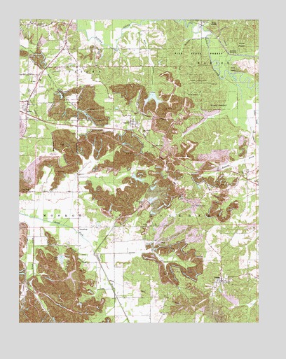
Augusta, IN USGS Topographic Map
Click on map above to begin viewing in our Map Viewer.

This topographic map contains these locations and features:
Feature Name Type Latitude Longitude GNIS ID View Map
ArthurPopulated PlaceN38.3406°W87.2458°430283View Map
Ashby ChurchChurchN38.3414°W87.2197°430304View Map
AugustaPopulated PlaceN38.3314°W87.1908°430341View Map
Augusta LakeReservoirN38.3438°W87.1806°447860View Map
Augusta Lake DamDamN38.3450°W87.1804°447859View Map
AyrshirePopulated PlaceN38.3720°W87.2408°430370View Map
Barre CemeteryCemeteryN38.2817°W87.1733°430523View Map
Bethel ChurchChurchN38.2895°W87.1833°430915View Map
Blackfoot LandfillLocaleN38.3239°W87.2044°2708762View Map
Blackfoot MineMineN38.2984°W87.1853°431149View Map
Clifford CreekStreamN38.2787°W87.1942°447934View Map
Corn CemeteryCemeteryN38.3481°W87.1503°432974View Map
Cup Creek ChurchChurchN38.3112°W87.1328°433253View Map
Enos Lake DamDamN38.2784°W87.2283°447861View Map
Eros LakeReservoirN38.2762°W87.2278°434232View Map
Fritz CornerPopulated PlaceN38.2976°W87.1589°434875View Map
Grey LakeReservoirN38.3214°W87.2458°435488View Map
Grey Lake DamDamN38.3214°W87.2458°447866View Map
HartwellPopulated PlaceN38.3226°W87.1797°435841View Map
Hartwell JunctionPopulated PlaceN38.3606°W87.1408°435842View Map
Hartwell Lookout TowerTowerN38.3492°W87.1575°435843View Map
Hog BranchStreamN38.3695°W87.1600°436284View Map
Hoskins PitsBasinN38.2598°W87.2361°436503View Map
Houchin DitchCanalN38.2781°W87.1892°436509View Map
Lockhart Township Fire DepartmentBuildingN38.2673°W87.1420°2626338View Map
Mill CreekStreamN38.3717°W87.1928°439147View Map
Mount Zion ChurchChurchN38.3067°W87.1253°439749View Map
New Liberty ChurchChurchN38.3031°W87.2450°440076View Map
Odd Fellow CemeteryCemeteryN38.3289°W87.1864°440501View Map
Oxley LakeReservoirN38.2902°W87.1293°448670View Map
Oxley Lake DamDamN38.2917°W87.1267°448897View Map
Pike State ForestForestN38.3603°W87.1575°441128View Map
Rough CreekStreamN38.2923°W87.2422°442344View Map
Saint Peters ChurchChurchN38.2673°W87.1419°442809View Map
ScottsburgPopulated PlaceN38.2887°W87.2192°443162View Map
South Patoka RiverStreamN38.2787°W87.2106°449053View Map
South Patoka Township Volunteer Fire DepartmentBuildingN38.3365°W87.2490°2626467View Map
StendalPopulated PlaceN38.2667°W87.1444°444123View Map
SurvantPopulated PlaceN38.3739°W87.1553°444438View Map
Township of LockhartCivilN38.2834°W87.1367°453577View Map

Note: Coordinates in the location and feature list above are referenced to NAD83 datum.


Copyright (C) 2008-2024 Ryan Niemi / Sunset Dynamics ... All Rights Reserved