TopoQuest Logo
Do you find TopoQuest useful?
Help keep TopoQuest running and adding new maps/features by donating!
Bitcoin:  19c7KJd3qBynnjoSw5npx9KScwjBe4ifkT
Litecoin:  LXs6TkuXGGXo1vDsWCkWVdjQX94eUKd6ui
Home View Maps Find Maps Find Places Resources & Links


Greenhorn, Oregon Topographic Map

USGS Map Title: Greenhorn, OR
USGS Map MRC: 44118F4
DRG (GeoTIFF) Download: o44118f4.tif


Neighboring USGS Topographic Map Quads:


  Olive Lake, OR  
44118G5
 

  Granite, OR  
44118G4
 

  Mount Ireland, OR  
44118G3
 

  Vinegar Hill, OR  
44118F5
 

  Greenhorn, OR  
44118F4
 

  Whitney, OR  
44118F3
 

  Bates, OR  
44118E5
 

  Austin, OR  
44118E4
 

  Pogue Point, OR  
44118E3


Map MRC Location:

N45°
W119°
N45°
W118°
H8 H7 H6 H5 H4 H3 H2 H1
G8 G7 G6 G5 G4 G3 G2 G1
F8 F7 F6 F5 F4 F3 F2 F1
E8 E7 E6 E5 E4 E3 E2 E1
D8 D7 D6 D5 D4 D3 D2 D1
C8 C7 C6 C5 C4 C3 C2 C1
B8 B7 B6 B5 B4 B3 B2 B1
A8 A7 A6 A5 A4 A3 A2 A1
N44°
W119°
N44°
W118°

Greenhorn, OR USGS 1:24K Topographic Map Preview:
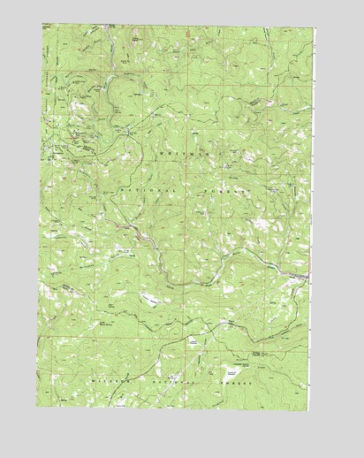
Greenhorn, OR USGS Topographic Map
Click on map above to begin viewing in our Map Viewer.

This topographic map contains these locations and features:
Feature Name Type Latitude Longitude GNIS ID View Map
Aurora MineMineN44.7090°W118.4911°1137343View Map
Bear GulchValleyN44.7127°W118.4508°1137714View Map
Bear SpringSpringN44.6582°W118.4679°1137749View Map
Belcher MineMineN44.7285°W118.4919°1137893View Map
Bennett CreekStreamN44.6746°W118.3994°1137925View Map
Big Elk MineMineN44.7379°W118.4597°1138021View Map
Bonanza MineMineN44.7096°W118.4094°1138406View Map
California GulchValleyN44.6735°W118.4655°1139159View Map
China CreekStreamN44.6682°W118.3780°1139669View Map
City of GreenhornCivilN44.7087°W118.4967°2410658View Map
Corral CampLocaleN44.6757°W118.4613°1140136View Map
Crawford MeadowFlatN44.6372°W118.4288°1140414View Map
Crawford Meadow SpringSpringN44.6389°W118.4027°1140415View Map
Cub CreekStreamN44.6796°W118.4488°1140523View Map
Dawson MineMineN44.6854°W118.4905°1140673View Map
Diamond Jack MineMineN44.6960°W118.3933°1140998View Map
Diffin Post Office (historical)Post OfficeN44.7138°W118.4847°1164317View Map
Don Juan MineMineN44.7049°W118.4794°1141168View Map
Eureka MineMineN44.7096°W118.4874°1141916View Map
Eureka MineMineN44.7288°W118.4724°1141917View Map
GeiserLocaleN44.7043°W118.4141°1142602View Map
Geiser CreekStreamN44.6704°W118.3899°1142603View Map
Geiser Post Office (historical)Post OfficeN44.7043°W118.4141°1165301View Map
Golden Boy MineMineN44.6979°W118.3858°1142831View Map
Golden Eagle MineMineN44.6946°W118.4708°1142834View Map
Golden Gate MineMineN44.7307°W118.4855°1142835View Map
GreenhornPopulated PlaceN44.7079°W118.4913°1143062View Map
Greenhorn CemeteryCemeteryN44.7067°W118.4946°1116557View Map
Greenhorn CreekStreamN44.6838°W118.4616°1143063View Map
Greenhorn Post Office (historical)Post OfficeN44.7079°W118.4913°1165346View Map
Howard MeadowFlatN44.6607°W118.4480°1143850View Map
Humboldt MineMineN44.7165°W118.4880°1143902View Map
Irish GulchValleyN44.7188°W118.4686°1144105View Map
IXL MineMineN44.7168°W118.4916°1143975View Map
Liston Lake MineMineN44.6682°W118.4938°1145061View Map
Lobelia MeadowFlatN44.6470°W118.4288°1145309View Map
McNamee GulchValleyN44.6813°W118.4547°1146028View Map
McWillis GulchValleyN44.7338°W118.4669°1146037View Map
Morning Glory MineMineN44.6927°W118.4736°1146463View Map
Myrtle SpringSpringN44.6525°W118.4717°1145267View Map
Nevada GulchValleyN44.7449°W118.4691°1146797View Map
Olive ButteSummitN44.7452°W118.4552°1147210View Map
Ophir MineMineN44.7113°W118.4852°1147253View Map
Orofino GulchValleyN44.7493°W118.4708°1147274View Map
Orofino MineMineN44.7477°W118.4749°1158409View Map
Owl MineMineN44.7160°W118.4791°1147315View Map
Parkersville (historical)Populated PlaceN44.6893°W118.4224°1153834View Map
Parkersville Post Office (historical)Post OfficeN44.6893°W118.4224°1165765View Map
Parkerville MineMineN44.6888°W118.4236°1147463View Map
Phoenix MineMineN44.7049°W118.4852°1147643View Map
Pie MeadowFlatN44.6350°W118.4368°1147657View Map
Pix Post Office (historical)Post OfficeN44.7085°W118.4927°1164603View Map
Placer DitchCanalN44.7188°W118.4755°1147787View Map
PYX MineMineN44.7268°W118.4469°1158411View Map
Quartz GulchValleyN44.7318°W118.4694°1148090View Map
Rabbit MineMineN44.7118°W118.4774°1148124View Map
Red Bird MineMineN44.7140°W118.4763°1148271View Map
RobinsonvillePopulated PlaceN44.7138°W118.4847°1148559View Map
Robinsonville Post Office (historical)Post OfficeN44.7138°W118.4847°1165867View Map
Ross GulchValleyN44.7160°W118.4669°1148738View Map
Royal White MineMineN44.7260°W118.4816°1148819View Map
San Lou FlatFlatN44.7149°W118.4591°1149020View Map
Simpson CreekStreamN44.7371°W118.3761°1149530View Map
Slab CreekStreamN44.6860°W118.4691°1149654View Map
Snow CreekStreamN44.6840°W118.4569°1149813View Map
Taylor FlatFlatN44.6263°W118.4613°1150919View Map
Three Cent GulchValleyN44.7285°W118.4705°1151151View Map
Tipton (historical)LocaleN44.6532°W118.4130°1151279View Map
Tipton Post Office (historical)Post OfficeN44.6532°W118.4130°1166051View Map
Tone SpringSpringN44.7216°W118.4665°1151330View Map
White Pine (historical)LocaleN44.6479°W118.4486°1153835View Map
White Pine Post Office (historical)Post OfficeN44.6479°W118.4486°1166168View Map
Winterville CreekStreamN44.6879°W118.3858°1152552View Map

Note: Coordinates in the location and feature list above are referenced to NAD83 datum.


Copyright (C) 2008-2024 Ryan Niemi / Sunset Dynamics ... All Rights Reserved