TopoQuest Logo
Do you find TopoQuest useful?
Help keep TopoQuest running and adding new maps/features by donating!
Bitcoin:  19c7KJd3qBynnjoSw5npx9KScwjBe4ifkT
Litecoin:  LXs6TkuXGGXo1vDsWCkWVdjQX94eUKd6ui
Home View Maps Find Maps Find Places Resources & Links


Greek Store, California Topographic Map

USGS Map Title: Greek Store, CA
USGS Map MRC: 39120A5
DRG (GeoTIFF) Download: o39120a5.tif


Neighboring USGS Topographic Map Quads:


  Westville, CA  
39120B6
 

  Duncan Peak, CA  
39120B5
 

  Royal Gorge, CA  
39120B4
 

  Michigan Bluff, CA  
39120A6
 

  Greek Store, CA  
39120A5
 

  Bunker Hill, CA  
39120A4
 

  Tunnel Hill, CA  
38120H6
 

  Devil Peak, CA  
38120H5
 

  Robbs Peak, CA  
38120H4


Map MRC Location:

N40°
W121°
N40°
W120°
H8 H7 H6 H5 H4 H3 H2 H1
G8 G7 G6 G5 G4 G3 G2 G1
F8 F7 F6 F5 F4 F3 F2 F1
E8 E7 E6 E5 E4 E3 E2 E1
D8 D7 D6 D5 D4 D3 D2 D1
C8 C7 C6 C5 C4 C3 C2 C1
B8 B7 B6 B5 B4 B3 B2 B1
A8 A7 A6 A5 A4 A3 A2 A1
N39°
W121°
N39°
W120°

Greek Store, CA USGS 1:24K Topographic Map Preview:
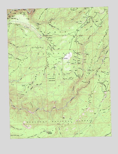
Greek Store, CA USGS Topographic Map
Click on map above to begin viewing in our Map Viewer.

This topographic map contains these locations and features:
Feature Name Type Latitude Longitude GNIS ID View Map
Abrams RavineValleyN39.0716°W120.5405°256103View Map
Beaman Ledge MineMineN39.0988°W120.5830°256609View Map
Bear SpringSpringN39.0671°W120.5702°256702View Map
Bear Trap CreekStreamN39.1110°W120.5794°256709View Map
Big BarBarN39.0749°W120.5330°256875View Map
Big CraterCliffN39.0121°W120.6085°256908View Map
Big Tree Grove CampgroundLocaleN39.0585°W120.5752°1662401View Map
Big Tree Grove Picnic AreaLocaleN39.0585°W120.5741°274856View Map
Big Tree Nature TrailTrailN39.0566°W120.5763°274858View Map
Bloody RavineValleyN39.1024°W120.5180°257213View Map
Blue Eyes CanyonValleyN39.0882°W120.5341°257241View Map
Brushy SpringSpringN39.0062°W120.5828°1701146View Map
Brushy Spring Guard StationLocaleN39.0055°W120.5796°257551View Map
Butcher FlatFlatN39.0635°W120.5419°257747View Map
China BarBarN39.0718°W120.5344°258296View Map
Chipmunk CreekStreamN39.0624°W120.5166°258332View Map
Deep CanyonValleyN39.1121°W120.5474°259177View Map
Deep Canyon MineMineN39.1066°W120.5883°259179View Map
Deller SpringSpringN39.0509°W120.6064°259266View Map
Dixie Queen MineMineN39.0713°W120.5385°259404View Map
Duncan CanyonValleyN39.0388°W120.5458°259605View Map
Duncan CreekStreamN39.0388°W120.5455°1701155View Map
Eldorado MineMineN39.1177°W120.6216°259822View Map
End of the WorldRidgeN39.0313°W120.5985°259931View Map
Forest View TrailTrailN39.0563°W120.5713°274857View Map
Foresthill-Back Country DivisionCivilN39.0866°W120.5756°1935106View Map
Frazier CreekStreamN39.0960°W120.5866°260348View Map
French HouseLocaleN39.0516°W120.5138°260395View Map
GogginsPopulated PlaceN39.0407°W120.5080°1662404View Map
Goggins (historical)LocaleN39.0185°W120.5241°1662403View Map
Goggins (historical)Populated PlaceN39.0421°W120.5094°1701163View Map
Goggins MineMineN39.0424°W120.5083°260637View Map
Gold Dollar MineMineN39.0566°W120.5519°260647View Map
Gold Dollar TrailTrailN39.0574°W120.5460°260648View Map
Golden Riffle MineMineN39.1149°W120.5991°260681View Map
Granite MineMineN39.0218°W120.5199°260758View Map
Gray Eagle CanyonValleyN39.1027°W120.5163°260828View Map
Greek Store Guard Station (historical)LocaleN39.0766°W120.5596°260844View Map
Greekstore (historical)Populated PlaceN39.0768°W120.5585°1662400View Map
Grizzly MineMineN39.1099°W120.5885°260930View Map
Grub GulchValleyN39.1082°W120.6110°260975View Map
Hard Climb MineMineN39.0796°W120.5305°261082View Map
Home Ticket MineMineN39.1099°W120.6158°261428View Map
Interbay 1030-003 DamDamN39.0266°W120.6027°1664178View Map
Jack Robinson MineMineN39.0585°W120.5419°261852View Map
Jack Robinson RavineValleyN39.0557°W120.5388°261853View Map
Jamison RavineValleyN39.0641°W120.5344°261901View Map
Last ChancePopulated PlaceN39.1113°W120.6247°1658947View Map
Little CraterCliffN39.0199°W120.5594°262575View Map
Little Grizzly CreekStreamN39.1099°W120.5894°262619View Map
Little Hope MineMineN39.1202°W120.6172°262629View Map
Little Mosquito CreekStreamN39.0460°W120.6027°227306View Map
Lower Glenn MineMineN39.1055°W120.5146°263015View Map
Lower Meadow TrailTrailN39.0299°W120.5013°263031View Map
McKinley MineMineN39.0513°W120.5924°263388View Map
Millers DefeatMineN39.1143°W120.5316°263642View Map
Mineral PointRidgeN39.1063°W120.6241°263669View Map
Missouri Flat MineMineN39.1152°W120.6244°263706View Map
North Fork Long CanyonValleyN39.0210°W120.5155°264182View Map
Ox Yoke MineMineN39.1091°W120.5346°264426View Map
Pat Tuck MineMineN39.0516°W120.5988°264551View Map
Pay Day Number One MineMineN39.0755°W120.5069°264574View Map
Peavine RidgeRidgeN39.0785°W120.6027°267114View Map
Pine Nut CanyonValleyN39.0699°W120.5349°264773View Map
Pine Nut DitchCanalN39.0613°W120.5502°264774View Map
Pine Nut MineMineN39.0732°W120.5413°230712View Map
Placer County Grove Sierra RedwoodsParkN39.0557°W120.5738°264834View Map
Ralston RidgeRidgeN39.0224°W120.5402°265158View Map
Red Star DitchCanalN39.0888°W120.5016°266357View Map
Red Star MineMineN39.0635°W120.5285°265333View Map
Red Star PointSummitN39.0532°W120.5341°265334View Map
Root Hog MineMineN39.1210°W120.6066°231872View Map
Sauer Kraut Bite MineMineN39.1232°W120.5308°232597View Map
Schlein TrailTrailN39.0021°W120.5427°265911View Map
Screwauger CanyonValleyN39.1216°W120.5946°265951View Map
Sharp Stick MineMineN39.1174°W120.6202°266048View Map
Sierra View MinesMineN39.1105°W120.5288°266165View Map
South Fork Long CanyonValleyN39.0213°W120.5155°267472View Map
Spanish RavineValleyN39.0746°W120.5341°267553View Map
Spring HollowValleyN39.0268°W120.5358°1662402View Map
Spruce CreekStreamN39.0513°W120.5444°267612View Map
Star TownLocaleN39.1207°W120.6077°267685View Map
Star Town MineMineN39.1199°W120.6088°235394View Map
Starr RavineValleyN39.1124°W120.5474°267688View Map
Trap Line DitchCanalN39.1088°W120.5296°268386View Map
Trap Line MineMineN39.0971°W120.5363°268387View Map
Upper Glenn MineMineN39.1118°W120.5166°268610View Map
White MineMineN39.0424°W120.6113°269008View Map
Yellow Jacket CanyonValleyN39.0799°W120.5341°269342View Map
Yellow Jacket MineMineN39.0810°W120.5416°269346View Map

Note: Coordinates in the location and feature list above are referenced to NAD83 datum.


Copyright (C) 2008-2024 Ryan Niemi / Sunset Dynamics ... All Rights Reserved