TopoQuest Logo
Do you find TopoQuest useful?
Help keep TopoQuest running and adding new maps/features by donating!
Bitcoin:  19c7KJd3qBynnjoSw5npx9KScwjBe4ifkT
Litecoin:  LXs6TkuXGGXo1vDsWCkWVdjQX94eUKd6ui
Home View Maps Find Maps Find Places Resources & Links


Grandfather Falls, Wisconsin Topographic Map

USGS Map Title: Grandfather Falls, WI
USGS Map MRC: 45089C7
DRG (GeoTIFF) Download: o45089c7.tif


Neighboring USGS Topographic Map Quads:


  Spirit Falls, WI  
45089D8
 

  Coffee Creek, WI  
45089D7
 

  Tomahawk, WI  
45089D6
 

  Natzke Camp, WI  
45089C8
 

  Grandfather Falls, WI  
45089C7
 

  Irma, WI  
45089C6
 

  Fromm Lookout Tower, WI  
45089B8
 

  Alexander Lake, WI  
45089B7
 

  Merrill, WI  
45089B6


Map MRC Location:

N46°
W90°
N46°
W89°
H8 H7 H6 H5 H4 H3 H2 H1
G8 G7 G6 G5 G4 G3 G2 G1
F8 F7 F6 F5 F4 F3 F2 F1
E8 E7 E6 E5 E4 E3 E2 E1
D8 D7 D6 D5 D4 D3 D2 D1
C8 C7 C6 C5 C4 C3 C2 C1
B8 B7 B6 B5 B4 B3 B2 B1
A8 A7 A6 A5 A4 A3 A2 A1
N45°
W90°
N45°
W89°

Grandfather Falls, WI USGS 1:24K Topographic Map Preview:
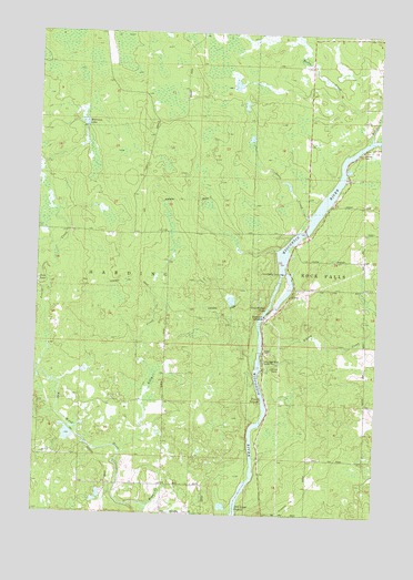
Grandfather Falls, WI USGS Topographic Map
Click on map above to begin viewing in our Map Viewer.

This topographic map contains these locations and features:
Feature Name Type Latitude Longitude GNIS ID View Map
Alery CreekStreamN45.3275°W89.7757°1560750View Map
Averill CreekStreamN45.2930°W89.8710°1561031View Map
Berry CreekStreamN45.3480°W89.7535°1561603View Map
Bill Cross RapidsRapidsN45.2519°W89.8007°1561789View Map
Camp New Wood County ParkParkN45.2900°W89.7918°1562642View Map
Grandfather DamDamN45.3130°W89.7857°1565720View Map
Grandfather FallsFallsN45.3039°W89.7904°1565721View Map
Grandfather Flowage 2295ReservoirN45.3186°W89.7837°1792962View Map
Grandmother School (historical)SchoolN45.3744°W89.7618°1838336View Map
Kelly CreekStreamN45.2664°W89.8437°1567391View Map
Morrison LakeLakeN45.3515°W89.8586°1569758View Map
New Wood School (historical)SchoolN45.2541°W89.8274°1838367View Map
Posey RapidsRapidsN45.2802°W89.7912°1571816View Map
Ripley CreekStreamN45.2880°W89.7924°1572333View Map
Town of HardingCivilN45.2934°W89.8575°1583349View Map
Upper Grandfather Falls 2WP357 DamDamN45.3133°W89.7851°1792961View Map
Wolf CreekStreamN45.2711°W89.8615°1576933View Map
Wright CreekStreamN45.2519°W89.8324°1577050View Map

Note: Coordinates in the location and feature list above are referenced to NAD83 datum.


Copyright (C) 2008-2024 Ryan Niemi / Sunset Dynamics ... All Rights Reserved