TopoQuest Logo
Do you find TopoQuest useful?
Help keep TopoQuest running and adding new maps/features by donating!
Bitcoin:  19c7KJd3qBynnjoSw5npx9KScwjBe4ifkT
Litecoin:  LXs6TkuXGGXo1vDsWCkWVdjQX94eUKd6ui
Home View Maps Find Maps Find Places Resources & Links


Grandfalls, Texas Topographic Map

USGS Map Title: Grandfalls, TX
USGS Map MRC: 31102C7
DRG (GeoTIFF) Download: o31102c7.tif


Neighboring USGS Topographic Map Quads:


  7 L Ranch, TX  
31102D8
 

  Ozark Lake, TX  
31102D7
 

  Imperial NW, TX  
31102D6
 

  Grandfalls SW, TX  
31102C8
 

  Grandfalls, TX  
31102C7
 

  Imperial, TX  
31102C6
 

  Diamond Y Spring NW, TX  
31102B8
 

  Diamond Y Spring NE, TX  
31102B7
 

  Buena Vista, TX  
31102B6


Map MRC Location:

N32°
W103°
N32°
W102°
H8 H7 H6 H5 H4 H3 H2 H1
G8 G7 G6 G5 G4 G3 G2 G1
F8 F7 F6 F5 F4 F3 F2 F1
E8 E7 E6 E5 E4 E3 E2 E1
D8 D7 D6 D5 D4 D3 D2 D1
C8 C7 C6 C5 C4 C3 C2 C1
B8 B7 B6 B5 B4 B3 B2 B1
A8 A7 A6 A5 A4 A3 A2 A1
N31°
W103°
N31°
W102°

Grandfalls, TX USGS 1:24K Topographic Map Preview:
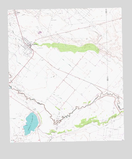
Grandfalls, TX USGS Topographic Map
Click on map above to begin viewing in our Map Viewer.

This topographic map contains these locations and features:
Feature Name Type Latitude Longitude GNIS ID View Map
Courtney CreekStreamN31.2576°W102.8313°1373247View Map
Cut Around CanalCanalN31.2846°W102.8527°1355498View Map
GrandfallsPopulated PlaceN31.3393°W102.8518°1358254View Map
Grandfalls - Royalty SchoolSchoolN31.3404°W102.8513°2009596View Map
Grandfalls CanalCanalN31.3479°W102.8740°1372153View Map
Grandfalls City HallBuildingN31.3409°W102.8530°2753805View Map
Grandfalls Post OfficePost OfficeN31.3412°W102.8548°2732275View Map
Grandfalls Volunteer Fire DepartmentBuildingN31.3414°W102.8530°2552039View Map
Imperial CanalCanalN31.2593°W102.8085°1359898View Map
Imperial DamDamN31.2618°W102.8471°1858441View Map
Imperial ReservoirReservoirN31.2677°W102.8523°1359900View Map
North LateralCanalN31.3249°W102.8127°1364084View Map
Payton Oil FieldOilfieldN31.3038°W102.8690°1364915View Map
RoyaltyPopulated PlaceN31.3724°W102.8671°1366987View Map
Shipley Oil FieldOilfieldN31.3657°W102.8104°1368197View Map
South LateralCanalN31.3265°W102.8660°1368707View Map
Tamarisk CemeteryCemeteryN31.3276°W102.8402°1369571View Map
Town of GrandfallsCivilN31.3405°W102.8545°2412703View Map
Van Carr CanalCanalN31.3126°W102.8240°1370568View Map

Note: Coordinates in the location and feature list above are referenced to NAD83 datum.


Copyright (C) 2008-2024 Ryan Niemi / Sunset Dynamics ... All Rights Reserved