TopoQuest Logo
Do you find TopoQuest useful?
Help keep TopoQuest running and adding new maps/features by donating!
Bitcoin:  19c7KJd3qBynnjoSw5npx9KScwjBe4ifkT
Litecoin:  LXs6TkuXGGXo1vDsWCkWVdjQX94eUKd6ui
Home View Maps Find Maps Find Places Resources & Links


Grand Canyon, Arizona Topographic Map

USGS Map Title: Grand Canyon, AZ
USGS Map MRC: 36112A2
DRG (GeoTIFF) Download: o36112a2.tif


Neighboring USGS Topographic Map Quads:


  Havasupai Point, AZ  
36112B3
 

  Shiva Temple, AZ  
36112B2
 

  Bright Angel Point, AZ  
36112B1
 

  Piute Point, AZ  
36112A3
 

  Grand Canyon, AZ  
36112A2
 

  Phantom Ranch, AZ  
36112A1
 

  Metzger Tank, AZ  
35112H3
 

  Tusayan West, AZ  
35112H2
 

  Tusayan East, AZ  
35112H1


Map MRC Location:

N37°
W113°
N37°
W112°
H8 H7 H6 H5 H4 H3 H2 H1
G8 G7 G6 G5 G4 G3 G2 G1
F8 F7 F6 F5 F4 F3 F2 F1
E8 E7 E6 E5 E4 E3 E2 E1
D8 D7 D6 D5 D4 D3 D2 D1
C8 C7 C6 C5 C4 C3 C2 C1
B8 B7 B6 B5 B4 B3 B2 B1
A8 A7 A6 A5 A4 A3 A2 A1
N36°
W113°
N36°
W112°

Grand Canyon, AZ USGS 1:24K Topographic Map Preview:
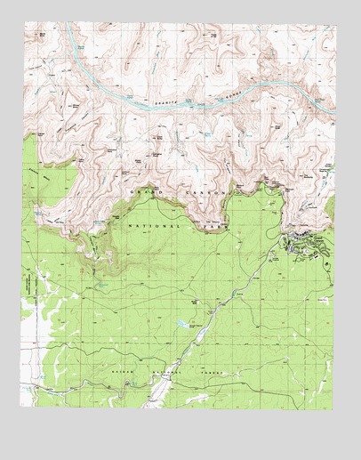
Grand Canyon, AZ USGS Topographic Map
Click on map above to begin viewing in our Map Viewer.

This topographic map contains these locations and features:
Feature Name Type Latitude Longitude GNIS ID View Map
Boucher CreekStreamN36.1153°W112.2307°1860View Map
Boucher RapidsRapidsN36.1163°W112.2300°1861View Map
Boucher TrailTrailN36.0833°W112.2285°23951View Map
Breezy PointCliffN36.0803°W112.2027°1948View Map
Bright Angel LodgeBuildingN36.0572°W112.1411°2500220View Map
Bright Angel TrailTrailN36.0691°W112.1329°1965View Map
Bright Angel WashStreamN36.0036°W112.2113°1966View Map
Brush TankReservoirN36.0097°W112.2425°2026View Map
Cathedral StairsCliffN36.0814°W112.1988°2571View Map
Cedar SpringSpringN36.0889°W112.1782°2654View Map
Coconino SidingLocaleN36.0028°W112.1957°20722View Map
Cocopa PointCliffN36.0880°W112.2460°3087View Map
Columbus PointCliffN36.0830°W112.2199°3138View Map
Cope ButteSummitN36.0876°W112.1974°3208View Map
Dana ButteSummitN36.0916°W112.1502°3686View Map
Dripping SpringSpringN36.0624°W112.2423°4113View Map
Dripping Springs TrailTrailN36.0603°W112.2405°4122View Map
El Cristo Rey Catholic ChurchChurchN36.0524°W112.1387°2670881View Map
El Tovar HotelBuildingN36.0575°W112.1371°43179View Map
Eremita MesaSummitN36.0760°W112.2314°4465View Map
Fourmile SpringSpringN36.0739°W112.2102°4791View Map
Grand CanyonPopulated PlaceN36.0544°W112.1393°5213View Map
Grand Canyon Elementary SchoolSchoolN36.0524°W112.1382°20780View Map
Grand Canyon High SchoolSchoolN36.0523°W112.1387°20781View Map
Grand Canyon Pioneer CemeteryCemeteryN36.0545°W112.1251°2789376View Map
Grand Canyon Railroad StationLocaleN36.0569°W112.1367°20785View Map
Grand Canyon Village Census Designated PlaceCensusN36.0492°W112.1566°2408314View Map
Granite RapidsRapidsN36.0986°W112.1836°5254View Map
Great Mohave WallCliffN36.0630°W112.1699°5344View Map
Hermit BasinBasinN36.0505°W112.2199°20798View Map
Hermit CreekStreamN36.0991°W112.2096°5736View Map
Hermit RapidsRapidsN36.1003°W112.2104°5737View Map
Hermit TrailTrailN36.0680°W112.2138°5738View Map
Hermits RestBuildingN36.0622°W112.2111°2500077View Map
Hermits RestLocaleN36.0619°W112.2110°5740View Map
Hopi HouseBuildingN36.0578°W112.1367°2499897View Map
Hopi PointCliffN36.0761°W112.1546°5933View Map
Hopi WallCliffN36.0697°W112.1616°5935View Map
Horn CreekStreamN36.0989°W112.1349°5937View Map
Horn Creek RapidsRapidsN36.0995°W112.1348°5938View Map
Horsethief TankReservoirN36.0398°W112.2201°6022View Map
Lookout PointCliffN36.0750°W112.2124°7367View Map
Lost Orphan MineMineN36.0711°W112.1507°24071View Map
Maricopa PointCliffN36.0700°W112.1463°7700View Map
Marsh ButteSummitN36.1207°W112.2451°7724View Map
Mary Jane Colter Lookout StudioBuildingN36.0581°W112.1425°2499898View Map
Mohave PointCliffN36.0722°W112.1660°8168View Map
Monument CreekStreamN36.0978°W112.1829°8237View Map
National Park Service Grand Canyon South Rim Wastewater Treatment FacilityLocaleN36.0275°W112.1860°2669382View Map
National Park Service Training CenterSchoolN36.0497°W112.1329°20918View Map
Ninetyfour Mile CreekStreamN36.0972°W112.1988°8665View Map
Ninetyone Mile CreekStreamN36.1064°W112.1471°8666View Map
North Country Community Health Center Grand Canyon ClinicHospitalN36.0479°W112.1288°20782View Map
O'Connell TankReservoirN36.0059°W112.2456°8842View Map
Pima PointCliffN36.0719°W112.2002°9442View Map
Powell PointCliffN36.0747°W112.1521°9721View Map
Road TankReservoirN36.0078°W112.2062°20988View Map
Rowe Well Picnic AreaParkN36.0314°W112.1741°20997View Map
Rowes TankReservoirN36.0339°W112.1791°20998View Map
Rowes WellWellN36.0344°W112.1804°10564View Map
Salt CreekStreamN36.0986°W112.1696°10746View Map
Salt Creek RapidsRapidsN36.0996°W112.1704°10750View Map
Santa Maria SpringSpringN36.0601°W112.2217°10946View Map
Sewer Number One TankReservoirN36.0194°W112.1939°21006View Map
Sewer Number Two TankReservoirN36.0206°W112.1920°21007View Map
The AbyssCliffN36.0611°W112.1743°21063View Map
The AlligatorCliffN36.0786°W112.1693°12281View Map
The BattleshipSummitN36.0758°W112.1385°12286View Map
The InfernoRidgeN36.0772°W112.1621°12337View Map
Topaz CanyonValleyN36.1105°W112.2408°12625View Map
Tower of SetSummitN36.1211°W112.1780°12656View Map
Trap TankReservoirN36.1028°W112.1952°38120View Map
Travertine CanyonValleyN36.1029°W112.2189°12692View Map
Trinity CreekStreamN36.1061°W112.1532°12719View Map
Waldron TrailTrailN36.0483°W112.2197°2091556View Map
West Rim TrailTrailN36.0636°W112.1461°2091557View Map
Whites ButteSummitN36.0976°W112.2312°13706View Map
Yuma PointCliffN36.0800°W112.2291°14119View Map

Note: Coordinates in the location and feature list above are referenced to NAD83 datum.


Copyright (C) 2008-2024 Ryan Niemi / Sunset Dynamics ... All Rights Reserved