TopoQuest Logo
Do you find TopoQuest useful?
Help keep TopoQuest running and adding new maps/features by donating!
Bitcoin:  19c7KJd3qBynnjoSw5npx9KScwjBe4ifkT
Litecoin:  LXs6TkuXGGXo1vDsWCkWVdjQX94eUKd6ui
Home View Maps Find Maps Find Places Resources & Links


Grady, Alabama Topographic Map

USGS Map Title: Grady, AL
USGS Map MRC: 31086H2
DRG (GeoTIFF) Download: o31086h2.tif


Neighboring USGS Topographic Map Quads:


  Sellers, AL  
32086A3
 

  Ramer, AL  
32086A2
 

  Pine Level, AL  
32086A1
 

  Lapine, AL  
31086H3
 

  Grady, AL  
31086H2
 

  Ansley, AL  
31086H1
 

  Fullers Crossroads, AL  
31086G3
 

  Petrey, AL  
31086G2
 

  Youngblood, AL  
31086G1


Map MRC Location:

N32°
W87°
N32°
W86°
H8 H7 H6 H5 H4 H3 H2 H1
G8 G7 G6 G5 G4 G3 G2 G1
F8 F7 F6 F5 F4 F3 F2 F1
E8 E7 E6 E5 E4 E3 E2 E1
D8 D7 D6 D5 D4 D3 D2 D1
C8 C7 C6 C5 C4 C3 C2 C1
B8 B7 B6 B5 B4 B3 B2 B1
A8 A7 A6 A5 A4 A3 A2 A1
N31°
W87°
N31°
W86°

Grady, AL USGS 1:24K Topographic Map Preview:
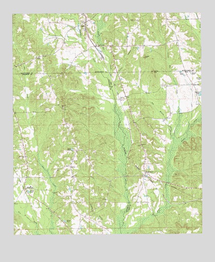
Grady, AL USGS Topographic Map
Click on map above to begin viewing in our Map Viewer.

This topographic map contains these locations and features:
Feature Name Type Latitude Longitude GNIS ID View Map
BradleytonPopulated PlaceN31.9018°W86.2422°114815View Map
Bradleyton ChurchChurchN31.9077°W86.2411°154625View Map
Bradleyton Post Office (historical)Post OfficeN31.9018°W86.2425°168363View Map
Briar HillPopulated PlaceN31.9590°W86.1300°114879View Map
Carter CemeteryCemeteryN31.9590°W86.1480°115661View Map
Carter HillSummitN31.9671°W86.1566°115668View Map
Carter School (historical)SchoolN31.9593°W86.1288°139833View Map
Chesser Post Office (historical)Post OfficeN31.9096°W86.1622°139837View Map
Clayton BranchStreamN31.8782°W86.1791°116207View Map
Collier BranchStreamN31.9574°W86.1847°116426View Map
Collier HillSummitN31.9746°W86.1622°116435View Map
Dry BranchStreamN31.9288°W86.1436°117498View Map
Fairview ChurchChurchN31.9468°W86.2169°118138View Map
Fannin CemeteryCemeteryN31.9957°W86.1691°118189View Map
Fannin Mill CreekStreamN31.9235°W86.1447°118191View Map
Garner CemeteryCemeteryN31.9740°W86.1819°118838View Map
GradyPopulated PlaceN31.9949°W86.2011°119205View Map
Grady Post OfficePost OfficeN31.9921°W86.2020°169041View Map
HeliconPopulated PlaceN31.9135°W86.2119°119933View Map
Helicon ChurchChurchN31.9168°W86.2111°133926View Map
Helicon SchoolSchoolN31.9079°W86.2111°133927View Map
Hudson CemeteryCemeteryN31.9371°W86.2475°154624View Map
KentPopulated PlaceN31.9527°W86.1747°156551View Map
Kent Bridge (historical)BridgeN31.9507°W86.1822°133939View Map
Little CreekStreamN31.8946°W86.1738°121751View Map
Mays PondReservoirN31.9232°W86.2110°122430View Map
Mount Canaan ChurchChurchN31.9193°W86.2425°123156View Map
OlusteePopulated PlaceN31.9029°W86.1625°139898View Map
Olusty Creek (historical)LocaleN31.9482°W86.1925°133953View Map
Petrey PondReservoirN31.8828°W86.2162°124654View Map
Pleasant Grove ChurchChurchN31.9818°W86.1930°152973View Map
Rising Star ChurchChurchN31.8849°W86.2197°154626View Map
Rockelvin ChurchChurchN31.9254°W86.1655°153186View Map
Russell PondReservoirN31.9657°W86.1313°126041View Map
Salter BridgeBridgeN31.8885°W86.1980°133969View Map
Sanders LakeReservoirN31.9535°W86.1252°126348View Map
Shady GrovePopulated PlaceN31.9096°W86.1625°153379View Map
Shady Grove Methodist ChurchChurchN31.9104°W86.1625°139920View Map
South Montgomery County AcademySchoolN31.9932°W86.2000°142867View Map
TaylorPopulated PlaceN31.9754°W86.2333°157144View Map
Trotter PondReservoirN31.8997°W86.2400°128083View Map
Tucker CreekStreamN31.9377°W86.2391°133980View Map
Vinson PondsReservoirN31.9668°W86.1387°128472View Map
Weaver Mill CreekStreamN31.9635°W86.1866°128672View Map
WIGC-FM (Troy)TowerN31.9757°W86.1627°161147View Map
Wiggins FarmsLocaleN31.9931°W86.2181°2649849View Map
WSFA-TV (Montgomery)TowerN31.9757°W86.1627°161245View Map

Note: Coordinates in the location and feature list above are referenced to NAD83 datum.


Copyright (C) 2008-2024 Ryan Niemi / Sunset Dynamics ... All Rights Reserved