TopoQuest Logo
Do you find TopoQuest useful?
Help keep TopoQuest running and adding new maps/features by donating!
Bitcoin:  19c7KJd3qBynnjoSw5npx9KScwjBe4ifkT
Litecoin:  LXs6TkuXGGXo1vDsWCkWVdjQX94eUKd6ui
Home View Maps Find Maps Find Places Resources & Links


Atlantic, North Carolina Topographic Map

USGS Map Title: Atlantic, NC
USGS Map MRC: 34076H3
DRG (GeoTIFF) Download: o34076h3.tif


Neighboring USGS Topographic Map Quads:


  Point of Marsh, NC  
35076A4
 

  North Bay, NC  
35076A3


  Long Bay, NC  
34076H4
 

  Atlantic, NC  
34076H3


  Davis, NC  
34076G4
 

  Styron Bay, NC  
34076G3


Map MRC Location:

N35°
W77°
N35°
W76°
H8 H7 H6 H5 H4 H3 H2 H1
G8 G7 G6 G5 G4 G3 G2 G1
F8 F7 F6 F5 F4 F3 F2 F1
E8 E7 E6 E5 E4 E3 E2 E1
D8 D7 D6 D5 D4 D3 D2 D1
C8 C7 C6 C5 C4 C3 C2 C1
B8 B7 B6 B5 B4 B3 B2 B1
A8 A7 A6 A5 A4 A3 A2 A1
N34°
W77°
N34°
W76°

Atlantic, NC USGS 1:24K Topographic Map Preview:
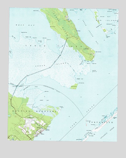
Atlantic, NC USGS Topographic Map
Click on map above to begin viewing in our Map Viewer.

This topographic map contains these locations and features:
Feature Name Type Latitude Longitude GNIS ID View Map
AtlanticPopulated PlaceN34.8849°W76.3405°1018873View Map
Atlantic Census Designated PlaceCensusN34.8823°W76.3441°2628611View Map
Atlantic Field Marine Corps Outlying FieldAirportN34.8878°W76.3540°1008342View Map
Atlantic Fire DepartmentBuildingN34.8815°W76.3402°2638624View Map
Atlantic Post OfficePost OfficeN34.8774°W76.3479°2505324View Map
Atlantic SchoolSchoolN34.8824°W76.3424°1002750View Map
Back BayBayN34.9943°W76.2652°980406View Map
Barry BayBayN34.9141°W76.3360°980590View Map
Bear HammockIslandN34.9818°W76.3263°980723View Map
Big GutGutN34.9507°W76.2785°981399View Map
Cedar IslandIslandN34.9504°W76.3310°982875View Map
Cedar Island BayBayN34.9813°W76.2852°982878View Map
Cedar Island National Wildlife RefugeParkN34.9473°W76.3392°1008599View Map
Cedar Island National Wildlife Refuge HeadquartersLocaleN34.9513°W76.2813°1002768View Map
Cedar Island PointCapeN34.9593°W76.2757°1027390View Map
Cedar Island Volunteer Fire DepartmentBuildingN34.9745°W76.2991°2639229View Map
Deep BendBayN34.9743°W76.3674°984045View Map
Deep Bend PointCapeN34.9766°W76.3616°984046View Map
Drum Inlet (historical)ChannelN34.8828°W76.2803°1020032View Map
Drum PondLakeN34.9972°W76.2534°984348View Map
Drum Pond PointCapeN34.9979°W76.2569°984349View Map
Dump IslandIslandN34.8929°W76.2852°984412View Map
Fish Hawk PointCapeN34.9296°W76.2949°985096View Map
Freewill ChurchChurchN34.9624°W76.2835°985399View Map
Gilgo CemeteryCemeteryN34.9888°W76.3094°985689View Map
Goose BayBayN34.9857°W76.2538°985812View Map
Goose Bay PointCapeN34.9863°W76.2563°985814View Map
Great DitchChannelN34.9793°W76.2557°986013View Map
Great PondLakeN34.9907°W76.3068°986035View Map
Green PointCapeN34.9213°W76.3335°986073View Map
Green PointCapeN34.9491°W76.2791°986074View Map
Green PointCapeN34.9710°W76.3319°986075View Map
Green Point CoveBayN34.9677°W76.3399°986079View Map
Hall PointCapeN34.9066°W76.3138°986317View Map
Hog Island NarrowsChannelN34.9841°W76.2707°986886View Map
Hog Island PointCapeN34.9749°W76.2632°986887View Map
Horse IslandIslandN34.8907°W76.2746°987103View Map
Ira Morris CampLocaleN34.8979°W76.2557°987394View Map
Jackson Private AirportAirportN34.8830°W76.3578°2679117View Map
John DitchCanalN34.9443°W76.3027°1008300View Map
Lewis CreekStreamN34.9477°W76.2805°988393View Map
Little PortPopulated PlaceN34.8821°W76.3355°1021229View Map
Little Port BrookStreamN34.8846°W76.3321°988742View Map
LolaPopulated PlaceN34.9579°W76.2794°1021269View Map
Long PointCapeN34.8996°W76.2635°988983View Map
Long PointCapeN34.9416°W76.2796°988984View Map
Lookout PointCapeN34.9235°W76.2977°1002767View Map
LuptonPopulated PlaceN34.9616°W76.2821°1018682View Map
Lupton CemeteryCemeteryN34.9629°W76.2844°989130View Map
Merkle Hammock CreekBayN34.9246°W76.3519°989739View Map
Morris MarinaHarborN34.8972°W76.3241°2506053View Map
Nameless BayBayN34.9716°W76.3519°990853View Map
Old Drum InletGutN34.8835°W76.2810°1002794View Map
Point of BeachCapeN34.8852°W76.2785°992609View Map
Point of GrassCapeN34.8804°W76.2824°992610View Map
Point of Grass CreekBayN34.8771°W76.2891°992612View Map
RoePopulated PlaceN34.9924°W76.3088°1022383View Map
Roe SchoolSchoolN34.9788°W76.2980°993640View Map
Rumley BayBayN34.9349°W76.2930°993800View Map
Rumley HammockIslandN34.9260°W76.2996°993801View Map
Sand Hill PointCapeN34.9974°W76.3407°994225View Map
Sand PointCapeN34.9718°W76.3477°994233View Map
South IslandIslandN34.9982°W76.2991°995169View Map
South PointCapeN34.9493°W76.2830°995186View Map
Southwest ProngStreamN34.9502°W76.2891°995259View Map
The PassageChannelN34.9993°W76.2516°996000View Map
ThorofareGutN34.9282°W76.3721°996067View Map
Thorofare BayBayN34.9274°W76.3299°996068View Map
Thorofare BridgeBridgeN34.9266°W76.3644°996069View Map
Township of AtlanticCivilN34.8764°W76.3191°1026498View Map
White PointCapeN34.8860°W76.3307°997200View Map
Wolf's Den AirportAirportN34.9769°W76.3006°2679131View Map
Wolves DenSwampN34.9807°W76.3080°1003599View Map

Note: Coordinates in the location and feature list above are referenced to NAD83 datum.


Copyright (C) 2008-2024 Ryan Niemi / Sunset Dynamics ... All Rights Reserved