TopoQuest Logo
Do you find TopoQuest useful?
Help keep TopoQuest running and adding new maps/features by donating!
Bitcoin:  19c7KJd3qBynnjoSw5npx9KScwjBe4ifkT
Litecoin:  LXs6TkuXGGXo1vDsWCkWVdjQX94eUKd6ui
Home View Maps Find Maps Find Places Resources & Links


Gordon, Wisconsin Topographic Map

USGS Map Title: Gordon, WI
USGS Map MRC: 46091B7
DRG (GeoTIFF) Download: o46091b7.tif


Neighboring USGS Topographic Map Quads:


  Buckety Creek, WI  
46091C8
 

  Solon Springs, WI  
46091C7
 

  Metzger Lake, WI  
46091C6
 

  Minong Flowage, WI  
46091B8
 

  Gordon, WI  
46091B7
 

  Chittamo, WI  
46091B6
 

  Horseshoe Lake, WI  
46091A8
 

  Minong, WI  
46091A7
 

  Stanberry West, WI  
46091A6


Map MRC Location:

N47°
W92°
N47°
W91°
H8 H7 H6 H5 H4 H3 H2 H1
G8 G7 G6 G5 G4 G3 G2 G1
F8 F7 F6 F5 F4 F3 F2 F1
E8 E7 E6 E5 E4 E3 E2 E1
D8 D7 D6 D5 D4 D3 D2 D1
C8 C7 C6 C5 C4 C3 C2 C1
B8 B7 B6 B5 B4 B3 B2 B1
A8 A7 A6 A5 A4 A3 A2 A1
N46°
W92°
N46°
W91°

Gordon, WI USGS 1:24K Topographic Map Preview:
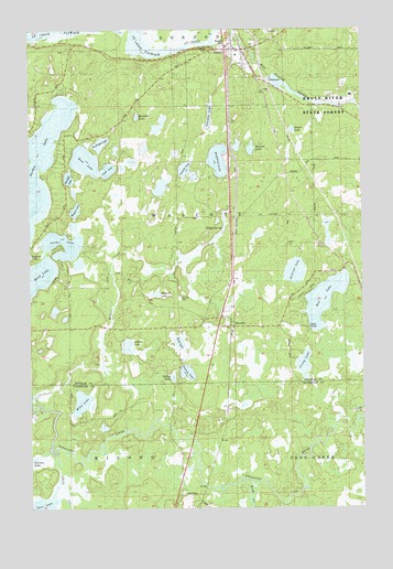
Gordon, WI USGS Topographic Map
Click on map above to begin viewing in our Map Viewer.

This topographic map contains these locations and features:
Feature Name Type Latitude Longitude GNIS ID View Map
Arrowhead LakeLakeN46.2185°W91.8426°1577386View Map
Bass LakeLakeN46.2157°W91.8541°1561272View Map
Beglinger LakeLakeN46.2201°W91.8483°1846496View Map
Bergen SpringsSpringN46.1977°W91.8021°1561589View Map
Bluegill LakeLakeN46.2112°W91.8604°1561974View Map
Bond LakeLakeN46.1834°W91.8745°1562051View Map
Brule River State Forest AnnexParkN46.2249°W91.7644°1562294View Map
Buffalo LakeLakeN46.1672°W91.8389°1562367View Map
Clear LakeLakeN46.2133°W91.8456°1563160View Map
Crotty LakeLakeN46.1626°W91.7724°1563563View Map
Eau Claire River Flowage 33ReservoirN46.2366°W91.7835°1791729View Map
Frog CreekStreamN46.1319°W91.7946°1565346View Map
GordonPopulated PlaceN46.2469°W91.7985°1565674View Map
Gordon 2WP49 DamDamN46.2366°W91.7835°1791728View Map
Gordon Census Designated PlaceCensusN46.2410°W91.7995°2586494View Map
Gordon Town ConstableBuildingN46.2450°W91.7971°2759923View Map
Gordon Volunteer Fire DepartmentBuildingN46.2475°W91.7840°2696741View Map
Gordon Wascott Emergency Medical ServicesBuildingN46.2342°W91.8017°2698436View Map
Grover LakeLakeN46.2237°W91.7762°1846537View Map
Harriet LakeLakeN46.2197°W91.7919°1566082View Map
Kreide LakeLakeN46.2131°W91.8160°1575835View Map
Leader LakeLakeN46.1941°W91.8624°1567915View Map
Miles LakeLakeN46.1527°W91.8561°1569458View Map
Muck LakeLakeN46.1682°W91.8191°1569875View Map
Northwood SchoolSchoolN46.1566°W91.8133°1833857View Map
One Mile LakeLakeN46.2273°W91.8072°1570837View Map
Peterson LakeLakeN46.1605°W91.8165°1571271View Map
Rainbow LakeLakeN46.2272°W91.8346°1572040View Map
Red LakeLakeN46.1794°W91.7645°1572143View Map
Rice LakeLakeN46.1257°W91.8710°1572272View Map
Shell CreekStreamN46.1399°W91.8671°1574005View Map
Sullivan LakeLakeN46.1868°W91.7756°1575047View Map
Town of WascottCivilN46.2005°W91.8007°1584348View Map
Two Mile LakeLakeN46.2157°W91.8041°1565981View Map
Wagner LakeLakeN46.2028°W91.8579°1576140View Map
WascottPopulated PlaceN46.1724°W91.7982°1576227View Map
Wascott CemeteryCemeteryN46.1797°W91.8191°1576228View Map
Wascott LakeLakeN46.1809°W91.8277°1576229View Map
Whitefish LakeLakeN46.2158°W91.8721°1561162View Map
Yoekel LakeLakeN46.1590°W91.8219°1577099View Map

Note: Coordinates in the location and feature list above are referenced to NAD83 datum.


Copyright (C) 2008-2024 Ryan Niemi / Sunset Dynamics ... All Rights Reserved