TopoQuest Logo
Do you find TopoQuest useful?
Help keep TopoQuest running and adding new maps/features by donating!
Bitcoin:  19c7KJd3qBynnjoSw5npx9KScwjBe4ifkT
Litecoin:  LXs6TkuXGGXo1vDsWCkWVdjQX94eUKd6ui
Home View Maps Find Maps Find Places Resources & Links


Gonzales South, Texas Topographic Map

USGS Map Title: Gonzales South, TX
USGS Map MRC: 29097D4
DRG (GeoTIFF) Download: o29097d4.tif


Neighboring USGS Topographic Map Quads:


  Ottine, TX  
29097E5
 

  Gonzales North, TX  
29097E4
 

  Dilworth, TX  
29097E3
 

  Cost, TX  
29097D5
 

  Gonzales South, TX  
29097D4
 

  Hamon, TX  
29097D3
 

  Pilgrim, TX  
29097C5
 

  Cheapside, TX  
29097C4
 

  Hochheim, TX  
29097C3


Map MRC Location:

N30°
W98°
N30°
W97°
H8 H7 H6 H5 H4 H3 H2 H1
G8 G7 G6 G5 G4 G3 G2 G1
F8 F7 F6 F5 F4 F3 F2 F1
E8 E7 E6 E5 E4 E3 E2 E1
D8 D7 D6 D5 D4 D3 D2 D1
C8 C7 C6 C5 C4 C3 C2 C1
B8 B7 B6 B5 B4 B3 B2 B1
A8 A7 A6 A5 A4 A3 A2 A1
N29°
W98°
N29°
W97°

Gonzales South, TX USGS 1:24K Topographic Map Preview:
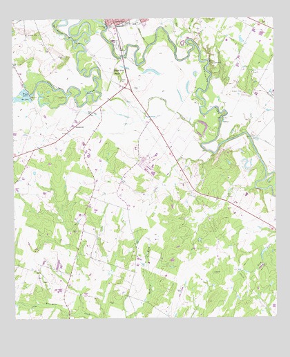
Gonzales South, TX USGS Topographic Map
Click on map above to begin viewing in our Map Viewer.

This topographic map contains these locations and features:
Feature Name Type Latitude Longitude GNIS ID View Map
Berry CreekStreamN29.4950°W97.4164°1330453View Map
Carson - Powe - Gescheidle CemeteryCemeteryN29.3819°W97.4528°1349547View Map
Cost-Wrightsboro DivisionCivilN29.3771°W97.4547°1938792View Map
Cottle CreekStreamN29.4439°W97.4042°1333407View Map
Cross Timber CreekStreamN29.4480°W97.4089°1333725View Map
DeWitt CemeteryCemeteryN29.4747°W97.4478°1334131View Map
Gonzales CountyCivilN29.4567°W97.4925°1383874View Map
Gonzales DamDamN29.4971°W97.4553°1863670View Map
Gonzales LakeReservoirN29.4979°W97.4547°1863671View Map
Independence ParkParkN29.4877°W97.4550°2029156View Map
Kerr CreekStreamN29.4894°W97.4161°1339053View Map
Pioneer VillageBuildingN29.4836°W97.4303°2014072View Map
San Marcos RiverStreamN29.4908°W97.4708°1375972View Map
Santa Anna MoundSummitN29.4783°W97.4508°1346621View Map
Stahl LakeLakeN29.4609°W97.4635°1347789View Map
SummervillePopulated PlaceN29.4552°W97.4705°1348062View Map
Terrysville CemeteryCemeteryN29.3941°W97.4050°1348388View Map
Tinsley CreekStreamN29.4891°W97.4350°1348588View Map
Union CemeteryCemeteryN29.4322°W97.4486°1349038View Map
Wood Lake DamDamN29.4683°W97.4921°1858016View Map

Note: Coordinates in the location and feature list above are referenced to NAD83 datum.


Copyright (C) 2008-2024 Ryan Niemi / Sunset Dynamics ... All Rights Reserved