TopoQuest Logo
Do you find TopoQuest useful?
Help keep TopoQuest running and adding new maps/features by donating!
Bitcoin:  19c7KJd3qBynnjoSw5npx9KScwjBe4ifkT
Litecoin:  LXs6TkuXGGXo1vDsWCkWVdjQX94eUKd6ui
Home View Maps Find Maps Find Places Resources & Links


Gold Park, Nevada Topographic Map

USGS Map Title: Gold Park, NV
USGS Map MRC: 39117B5
DRG (GeoTIFF) Download: o39117b5.tif


Neighboring USGS Topographic Map Quads:


  Carroll Summit, NV  
39117C6
 

  Carroll Summit SE, NV  
39117C5
 

  Iron Mountain, NV  
39117C4
 

  Campbell Creek Ranch, NV  
39117B6
 

  Gold Park, NV  
39117B5
 

  North Shoshone Peak, NV  
39117B4
 

  Midas Spring, NV  
39117A6
 

  South Shoshone Peak, NV  
39117A5
 

  Barrett Canyon, NV  
39117A4


Map MRC Location:

N40°
W118°
N40°
W117°
H8 H7 H6 H5 H4 H3 H2 H1
G8 G7 G6 G5 G4 G3 G2 G1
F8 F7 F6 F5 F4 F3 F2 F1
E8 E7 E6 E5 E4 E3 E2 E1
D8 D7 D6 D5 D4 D3 D2 D1
C8 C7 C6 C5 C4 C3 C2 C1
B8 B7 B6 B5 B4 B3 B2 B1
A8 A7 A6 A5 A4 A3 A2 A1
N39°
W118°
N39°
W117°

Gold Park, NV USGS 1:24K Topographic Map Preview:
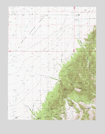
Gold Park, NV USGS Topographic Map
Click on map above to begin viewing in our Map Viewer.

This topographic map contains these locations and features:
Feature Name Type Latitude Longitude GNIS ID View Map
Arctic MineMineN39.1271°W117.5498°852947View Map
Dry CanyonValleyN39.1902°W117.5604°859559View Map
Dry CreekStreamN39.1994°W117.5704°846928View Map
Gold ParkFlatN39.1391°W117.5393°859844View Map
Gold Park (historical)LocaleN39.1399°W117.5373°862169View Map
Gold Park MineMineN39.1335°W117.5587°854135View Map
Gold Park Post Office (historical)Post OfficeN39.1391°W117.5393°864456View Map
Jackson Mining DistrictCivilN39.1310°W117.5379°858364View Map
Lakeview (historical)Populated PlaceN39.2449°W117.5315°857543View Map
Lakeview Post Office (historical)Post OfficeN39.2449°W117.5315°864933View Map
Park CreekStreamN39.2055°W117.5668°860884View Map
Peterson CreekStreamN39.2363°W117.5265°860930View Map
Peterson Maintenance StationLocaleN39.2402°W117.5326°846962View Map
Peterson MineMineN39.1269°W117.5504°862167View Map
Peterson SpringSpringN39.1271°W117.6153°860931View Map
Peterson StationLocaleN39.2410°W117.5301°860932View Map
Pilot (historical)LocaleN39.1338°W117.5726°846973View Map
Pilot Basin MineMineN39.1335°W117.5587°854140View Map
Pilot Post Office (historical)Post OfficeN39.1338°W117.5726°864453View Map
Rock CreekStreamN39.2496°W117.5557°863082View Map
San Francisco MineMineN39.1310°W117.5640°854136View Map
Star of the West MineMineN39.1330°W117.5437°862168View Map
Sunday MineMineN39.1335°W117.5587°854137View Map
Tule SpringSpringN39.1658°W117.6043°846963View Map
War Eagle CanyonValleyN39.1363°W117.5734°861880View Map
Willow CreekStreamN39.1571°W117.6157°862038View Map

Note: Coordinates in the location and feature list above are referenced to NAD83 datum.


Copyright (C) 2008-2024 Ryan Niemi / Sunset Dynamics ... All Rights Reserved