TopoQuest Logo
Do you find TopoQuest useful?
Help keep TopoQuest running and adding new maps/features by donating!
Bitcoin:  19c7KJd3qBynnjoSw5npx9KScwjBe4ifkT
Litecoin:  LXs6TkuXGGXo1vDsWCkWVdjQX94eUKd6ui
Home View Maps Find Maps Find Places Resources & Links


Glennonville, Missouri Topographic Map

USGS Map Title: Glennonville, MO
USGS Map MRC: 36090E2
DRG (GeoTIFF) Download: o36090e2.tif


Neighboring USGS Topographic Map Quads:


  Hanleyville, MO  
36090F3
 

  Broseley, MO  
36090F2
 

  Powe, MO  
36090F1
 

  Oglesville, MO  
36090E3
 

  Glennonville, MO  
36090E2
 

  Valley Ridge, MO  
36090E1
 

  Pollard, AR  
36090D3
 

  Piggott, AR  
36090D2
 

  Campbell, MO  
36090D1


Map MRC Location:

N37°
W91°
N37°
W90°
H8 H7 H6 H5 H4 H3 H2 H1
G8 G7 G6 G5 G4 G3 G2 G1
F8 F7 F6 F5 F4 F3 F2 F1
E8 E7 E6 E5 E4 E3 E2 E1
D8 D7 D6 D5 D4 D3 D2 D1
C8 C7 C6 C5 C4 C3 C2 C1
B8 B7 B6 B5 B4 B3 B2 B1
A8 A7 A6 A5 A4 A3 A2 A1
N36°
W91°
N36°
W90°

Glennonville, MO USGS 1:24K Topographic Map Preview:
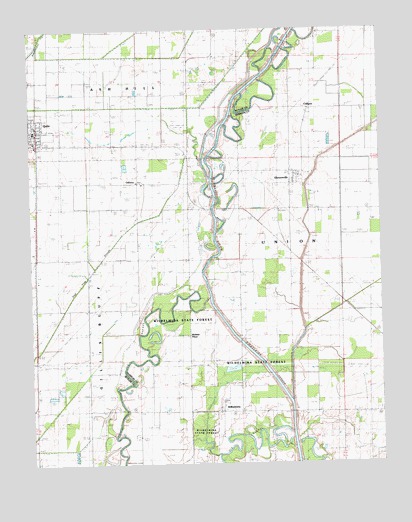
Glennonville, MO USGS Topographic Map
Click on map above to begin viewing in our Map Viewer.

This topographic map contains these locations and features:
Feature Name Type Latitude Longitude GNIS ID View Map
CaligoaPopulated PlaceN36.6014°W90.1504°715201View Map
CeltisLocaleN36.6231°W90.1929°740131View Map
Cora Davis SchoolSchoolN36.5148°W90.2315°716307View Map
Davis SchoolSchoolN36.5453°W90.2307°716735View Map
Dekyns FerryLocaleN36.5848°W90.1851°716822View Map
Dekyns GageLocaleN36.5714°W90.1840°716823View Map
Ditch Number 30CanalN36.6237°W90.1651°755100View Map
Ditch Number 31CanalN36.6023°W90.2187°755101View Map
Ditch Number 34CanalN36.5523°W90.2482°755103View Map
Ditch Number 37CanalN36.5214°W90.2340°755106View Map
Gentzen School (historical)SchoolN36.5812°W90.2107°735313View Map
GlennonvillePopulated PlaceN36.5809°W90.1557°718518View Map
Holmes PlacePopulated PlaceN36.5387°W90.1934°740937View Map
Lateral Number 1CanalN36.5887°W90.1432°755265View Map
Little Lake (historical)LakeN36.6145°W90.1412°721261View Map
Lone Prairie ChurchChurchN36.5448°W90.2290°721457View Map
Main DitchCanalN36.5242°W90.1570°721763View Map
McElyea PlacePopulated PlaceN36.5009°W90.1393°741052View Map
OsbornPopulated PlaceN36.5806°W90.2115°723860View Map
ParagonLocaleN36.5695°W90.1614°740388View Map
QulinPopulated PlaceN36.5959°W90.2473°735814View Map
Side DitchCanalN36.5626°W90.1384°726431View Map
Webb SchoolSchoolN36.6164°W90.1837°728462View Map
WilhelminaPopulated PlaceN36.5148°W90.1826°728855View Map
Wilhelmina CutoffCanalN36.5301°W90.1690°738513View Map
Wilhelmina Fagus FerryLocaleN36.5173°W90.2184°728856View Map
Wilhelmina School (historical)SchoolN36.5153°W90.1857°730261View Map
Wilhelmina State ForestForestN36.5284°W90.1832°743095View Map

Note: Coordinates in the location and feature list above are referenced to NAD83 datum.


Copyright (C) 2008-2024 Ryan Niemi / Sunset Dynamics ... All Rights Reserved