TopoQuest Logo
Do you find TopoQuest useful?
Help keep TopoQuest running and adding new maps/features by donating!
Bitcoin:  19c7KJd3qBynnjoSw5npx9KScwjBe4ifkT
Litecoin:  LXs6TkuXGGXo1vDsWCkWVdjQX94eUKd6ui
Home View Maps Find Maps Find Places Resources & Links


Glennie, Michigan Topographic Map

USGS Map Title: Glennie, MI
USGS Map MRC: 44083E6
DRG (GeoTIFF) Download: o44083e6.tif


Neighboring USGS Topographic Map Quads:


  Curran, MI  
44083F7
 

  Bucks Pond, MI  
44083F6
 

  Barton City, MI  
44083F5
 

  Alcona Dam Pond, MI  
44083E7
 

  Glennie, MI  
44083E6
 

  Sprinkler Lake, MI  
44083E5
 

  Hale, MI  
44083D7
 

  Loud Dam, MI  
44083D6
 

  Sid Town, MI  
44083D5


Map MRC Location:

N45°
W84°
N45°
W83°
H8 H7 H6 H5 H4 H3 H2 H1
G8 G7 G6 G5 G4 G3 G2 G1
F8 F7 F6 F5 F4 F3 F2 F1
E8 E7 E6 E5 E4 E3 E2 E1
D8 D7 D6 D5 D4 D3 D2 D1
C8 C7 C6 C5 C4 C3 C2 C1
B8 B7 B6 B5 B4 B3 B2 B1
A8 A7 A6 A5 A4 A3 A2 A1
N44°
W84°
N44°
W83°

Glennie, MI USGS 1:24K Topographic Map Preview:
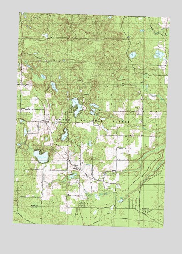
Glennie, MI USGS Topographic Map
Click on map above to begin viewing in our Map Viewer.

This topographic map contains these locations and features:
Feature Name Type Latitude Longitude GNIS ID View Map
Bear LakeLakeN44.5484°W83.6876°620858View Map
Bliss LakeLakeN44.6018°W83.6550°621591View Map
BryantPopulated PlaceN44.5250°W83.6658°622151View Map
Bryant LakeLakeN44.5157°W83.6599°622157View Map
CheviersPopulated PlaceN44.5681°W83.7369°1617487View Map
Curtis First RespondersBuildingN44.5593°W83.7245°2662057View Map
Curtis LakeLakeN44.5816°W83.7192°624240View Map
Curtis Township Fire DepartmentBuildingN44.5603°W83.7267°2626910View Map
Curtis Township HallBuildingN44.5603°W83.7269°2498749View Map
Curtis Township LibraryBuildingN44.5600°W83.7217°2498748View Map
Eagle Ridge Golf CourseLocaleN44.5564°W83.7217°2498747View Map
GlenniePopulated PlaceN44.5606°W83.7258°626886View Map
Glennie CemeteryCemeteryN44.5436°W83.7177°626887View Map
Glennie Post OfficePost OfficeN44.5633°W83.7264°2498752View Map
Glennie SchoolSchoolN44.5608°W83.7411°1617115View Map
Glennie Station (historical)LocaleN44.5603°W83.7256°2498753View Map
Hayes Lookout TowerTowerN44.6122°W83.6869°1623399View Map
Hunters LakeLakeN44.5530°W83.7092°628839View Map
Indian LakesLakeN44.5685°W83.6860°629006View Map
Jenkins LakeLakeN44.5872°W83.7287°629255View Map
KurtzPopulated PlaceN44.5611°W83.6455°1617664View Map
Kurtz Post Office (historical)Post OfficeN44.5611°W83.6456°2498692View Map
Little Bear LakeLakeN44.5466°W83.7468°630553View Map
Little LakeLakeN44.5291°W83.7014°630661View Map
Little Trout LakeLakeN44.6237°W83.6745°630801View Map
Lott ChurchChurchN44.5353°W83.7008°631115View Map
Lott Post Office (historical)Post OfficeN44.5353°W83.7011°2498689View Map
Lott Station (historical)LocaleN44.5356°W83.7011°2498684View Map
North LakeLakeN44.5663°W83.7001°633594View Map
Our Savior ChurchChurchN44.5614°W83.7261°1617113View Map
Poplar LakeLakeN44.6010°W83.7359°635242View Map
Saint Francis ChurchChurchN44.5328°W83.6978°1617114View Map
Stier Airstrip (historical)AirportN44.5222°W83.6830°1623920View Map
Thompson LakeLakeN44.5540°W83.7421°1614774View Map
Tubbs LakeLakeN44.6027°W83.6333°1615145View Map
Twin LakeLakeN44.5607°W83.7455°1615242View Map
Vaughn LakeLakeN44.5399°W83.7279°1615530View Map
WallacePopulated PlaceN44.5320°W83.6655°1615708View Map
Wilber United Methodist ChurchChurchN44.5608°W83.7300°2498746View Map

Note: Coordinates in the location and feature list above are referenced to NAD83 datum.


Copyright (C) 2008-2024 Ryan Niemi / Sunset Dynamics ... All Rights Reserved