TopoQuest Logo
Do you find TopoQuest useful?
Help keep TopoQuest running and adding new maps/features by donating!
Bitcoin:  19c7KJd3qBynnjoSw5npx9KScwjBe4ifkT
Litecoin:  LXs6TkuXGGXo1vDsWCkWVdjQX94eUKd6ui
Home View Maps Find Maps Find Places Resources & Links


Glen Elder South, Kansas Topographic Map

USGS Map Title: Glen Elder South, KS
USGS Map MRC: 39098D3
DRG (GeoTIFF) Download: o39098d3.tif


Neighboring USGS Topographic Map Quads:


  Cawker City, KS  
39098E4
 

  Glen Elder North, KS  
39098E3
 

  Jewell SW, KS  
39098E2
 

  Mill Creek, KS  
39098D4
 

  Glen Elder South, KS  
39098D3
 

  Solomon Rapids, KS  
39098D2
 

  Tipton, KS  
39098C4
 

  Blue Hill, KS  
39098C3
 

  Beloit SW, KS  
39098C2


Map MRC Location:

N40°
W99°
N40°
W98°
H8 H7 H6 H5 H4 H3 H2 H1
G8 G7 G6 G5 G4 G3 G2 G1
F8 F7 F6 F5 F4 F3 F2 F1
E8 E7 E6 E5 E4 E3 E2 E1
D8 D7 D6 D5 D4 D3 D2 D1
C8 C7 C6 C5 C4 C3 C2 C1
B8 B7 B6 B5 B4 B3 B2 B1
A8 A7 A6 A5 A4 A3 A2 A1
N39°
W99°
N39°
W98°

Glen Elder South, KS USGS 1:24K Topographic Map Preview:
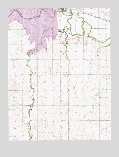
Glen Elder South, KS USGS Topographic Map
Click on map above to begin viewing in our Map Viewer.

This topographic map contains these locations and features:
Feature Name Type Latitude Longitude GNIS ID View Map
Excelsior (historical)LocaleN39.3933°W98.3587°482377View Map
Excelsior CemeteryCemeteryN39.3968°W98.3580°472323View Map
Excelsior SchoolSchoolN39.3933°W98.3587°472322View Map
Fairview CemeteryCemeteryN39.4665°W98.3065°472313View Map
Frog CreekStreamN39.4842°W98.2848°472177View Map
Glen ElderPopulated PlaceN39.4986°W98.3087°472182View Map
Glen Elder City HallBuildingN39.4976°W98.3074°2694382View Map
Glen Elder DamDamN39.4964°W98.3159°480283View Map
Glen Elder Fire DepartmentBuildingN39.4976°W98.3068°2111364View Map
Glen Elder LibraryBuildingN39.4986°W98.3086°2694731View Map
Glen Elder Post OfficePost OfficeN39.4992°W98.3081°2693739View Map
Glen Elder Senior CenterBuildingN39.4986°W98.3086°2692761View Map
Glen Elder Sewer Treatment PlantLocaleN39.4951°W98.2955°2692047View Map
Glen Elder State Park Pawnee CampgroundLocaleN39.4989°W98.3192°2624960View Map
Glen Elder United Methodist ChurchChurchN39.4998°W98.3047°2689429View Map
Glen Elder Wildlife AreaParkN39.4964°W98.3159°479780View Map
Glenview ChurchChurchN39.4667°W98.3392°472316View Map
Granite CreekStreamN39.4920°W98.3570°472172View Map
Grellet SchoolSchoolN39.4808°W98.3492°472315View Map
Grellett CemeteryCemeteryN39.4814°W98.3509°472314View Map
High Prairie CemeteryCemeteryN39.3936°W98.3109°472324View Map
Honey Creek CemeteryCemeteryN39.4328°W98.2518°472325View Map
Limestone CreekStreamN39.4931°W98.2970°471989View Map
Little Walnut CreekStreamN39.4797°W98.3023°472318View Map
Naomi CemeteryCemeteryN39.4156°W98.3591°2673316View Map
Naomi ChurchChurchN39.4156°W98.3587°472321View Map
Naomi SchoolSchoolN39.4231°W98.3676°472320View Map
Township of Walnut CreekCivilN39.4369°W98.3207°472302View Map
Waconda LakeReservoirN39.4910°W98.3729°479836View Map
Walnut CreekStreamN39.4795°W98.2992°472317View Map
Walnut Creek CemeteryCemeteryN39.4520°W98.3627°472319View Map

Note: Coordinates in the location and feature list above are referenced to NAD83 datum.


Copyright (C) 2008-2024 Ryan Niemi / Sunset Dynamics ... All Rights Reserved