TopoQuest Logo
Do you find TopoQuest useful?
Help keep TopoQuest running and adding new maps/features by donating!
Bitcoin:  19c7KJd3qBynnjoSw5npx9KScwjBe4ifkT
Litecoin:  LXs6TkuXGGXo1vDsWCkWVdjQX94eUKd6ui
Home View Maps Find Maps Find Places Resources & Links


Glasgow Butte, Oregon Topographic Map

USGS Map Title: Glasgow Butte, OR
USGS Map MRC: 44117G4
DRG (GeoTIFF) Download: o44117g4.tif


Neighboring USGS Topographic Map Quads:


  Sawtooth Ridge, OR  
44117H5
 

  Balm Creek Reservoir, OR  
44117H4
 

  Sparta Butte, OR  
44117H3
 

  Keating, OR  
44117G5
 

  Glasgow Butte, OR  
44117G4
 

  Sparta, OR  
44117G3
 

  Oxman, OR  
44117F5
 

  Lawrence Creek, OR  
44117F4
 

  Little Lookout Mountain, OR  
44117F3


Map MRC Location:

N45°
W118°
N45°
W117°
H8 H7 H6 H5 H4 H3 H2 H1
G8 G7 G6 G5 G4 G3 G2 G1
F8 F7 F6 F5 F4 F3 F2 F1
E8 E7 E6 E5 E4 E3 E2 E1
D8 D7 D6 D5 D4 D3 D2 D1
C8 C7 C6 C5 C4 C3 C2 C1
B8 B7 B6 B5 B4 B3 B2 B1
A8 A7 A6 A5 A4 A3 A2 A1
N44°
W118°
N44°
W117°

Glasgow Butte, OR USGS 1:24K Topographic Map Preview:
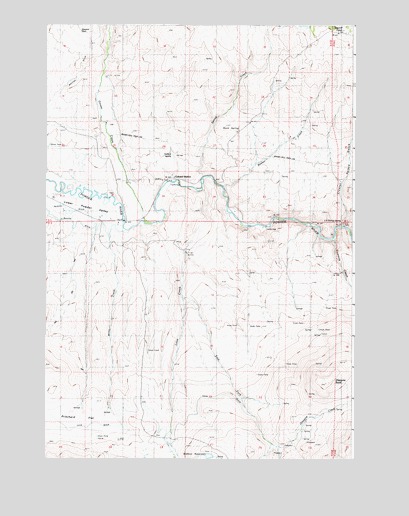
Glasgow Butte, OR USGS Topographic Map
Click on map above to begin viewing in our Map Viewer.

This topographic map contains these locations and features:
Feature Name Type Latitude Longitude GNIS ID View Map
Bacher CreekStreamN44.8282°W117.4291°1117126View Map
Bacher Creek ReservoirReservoirN44.8317°W117.4199°1130911View Map
Bacher SpringSpringN44.8235°W117.4123°1130912View Map
Colvard StationLocaleN44.8310°W117.4488°1119172View Map
Corral GulchValleyN44.8171°W117.3788°1119298View Map
Crenshaw GulchValleyN44.8179°W117.3955°1129434View Map
Crystal Palace GulchValleyN44.8174°W117.3807°1119608View Map
East Fork Love CreekStreamN44.7971°W117.4455°1120313View Map
Fivemile CreekStreamN44.8135°W117.3844°1120807View Map
Glascow CreekStreamN44.7540°W117.4010°1129436View Map
Glasgow ButteSummitN44.7718°W117.3860°1121150View Map
Goose CreekStreamN44.8190°W117.4605°1142852View Map
Goose Creek CemeteryCemeteryN44.8462°W117.4726°1129438View Map
Gover ReservoirReservoirN44.8750°W117.3960°1142883View Map
J N Bishop SpringSpringN44.8181°W117.3793°1122311View Map
Love CreekStreamN44.8288°W117.4369°1123533View Map
Love Family CemeteryCemeteryN44.8267°W117.4722°1129437View Map
Magpie SpringSpringN44.8591°W117.4077°1116581View Map
Miller CreekStreamN44.8207°W117.4802°1129435View Map
Pritchard FlatFlatN44.7618°W117.4852°1125676View Map
Range Post Office (historical)Post OfficeN44.7624°W117.4760°1164626View Map
Rock SpringSpringN44.8448°W117.4221°1126210View Map
Spring CreekStreamN44.8318°W117.4366°1150179View Map
Steward DitchCanalN44.8721°W117.4844°1129433View Map
Surface SpringSpringN44.8386°W117.4468°1133295View Map
Widman DamDamN44.7509°W117.4351°1133718View Map
Widman ReservoirReservoirN44.7508°W117.4337°1159142View Map

Note: Coordinates in the location and feature list above are referenced to NAD83 datum.


Copyright (C) 2008-2024 Ryan Niemi / Sunset Dynamics ... All Rights Reserved