TopoQuest Logo
Do you find TopoQuest useful?
Help keep TopoQuest running and adding new maps/features by donating!
Bitcoin:  19c7KJd3qBynnjoSw5npx9KScwjBe4ifkT
Litecoin:  LXs6TkuXGGXo1vDsWCkWVdjQX94eUKd6ui
Home View Maps Find Maps Find Places Resources & Links


Gilmanton, Wisconsin Topographic Map

USGS Map Title: Gilmanton, WI
USGS Map MRC: 44091D6
DRG (GeoTIFF) Download: o44091d6.tif


Neighboring USGS Topographic Map Quads:


  Tarrant, WI  
44091E7
 

  Mondovi, WI  
44091E6
 

  Rossman Creek, WI  
44091E5
 

  Modena, WI  
44091D7
 

  Gilmanton, WI  
44091D6
 

  Lookout, WI  
44091D5
 

  Cream, WI  
44091C7
 

  Waumandee, WI  
44091C6
 

  Swinns Valley, WI  
44091C5


Map MRC Location:

N45°
W92°
N45°
W91°
H8 H7 H6 H5 H4 H3 H2 H1
G8 G7 G6 G5 G4 G3 G2 G1
F8 F7 F6 F5 F4 F3 F2 F1
E8 E7 E6 E5 E4 E3 E2 E1
D8 D7 D6 D5 D4 D3 D2 D1
C8 C7 C6 C5 C4 C3 C2 C1
B8 B7 B6 B5 B4 B3 B2 B1
A8 A7 A6 A5 A4 A3 A2 A1
N44°
W92°
N44°
W91°

Gilmanton, WI USGS 1:24K Topographic Map Preview:
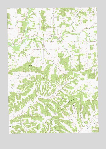
Gilmanton, WI USGS Topographic Map
Click on map above to begin viewing in our Map Viewer.

This topographic map contains these locations and features:
Feature Name Type Latitude Longitude GNIS ID View Map
02 ReservoirReservoirN44.4983°W91.7152°1793270View Map
Bennett ValleyValleyN44.4765°W91.6453°1561568View Map
Bohlinger ValleyValleyN44.3900°W91.6596°1562023View Map
Churches CreekStreamN44.4742°W91.6590°2760543View Map
Eagle PeakSummitN44.4430°W91.7218°1564255View Map
Elk CreekStreamN44.4733°W91.6732°1564519View Map
Fisken ValleyValleyN44.4711°W91.6402°1565030View Map
Four Corners School (historical)SchoolN44.4227°W91.6507°1837509View Map
Gilman CreekStreamN44.4629°W91.7446°2760541View Map
Gilman ValleyValleyN44.4645°W91.7412°1565536View Map
Gilman Valley School (historical)SchoolN44.4805°W91.7357°1837512View Map
GilmantonPopulated PlaceN44.4708°W91.6760°1565537View Map
Gilmanton CemeteryCemeteryN44.4663°W91.6913°1565538View Map
Gilmanton Census Designated PlaceCensusN44.4738°W91.6786°2586490View Map
Gilmanton Elementary SchoolSchoolN44.4727°W91.6775°2715867View Map
Gilmanton High SchoolSchoolN44.4671°W91.6740°2715759View Map
Griffin School (historical)SchoolN44.4400°W91.7457°1837514View Map
Hadley CreekStreamN44.4708°W91.6871°1565958View Map
Helwig H1605 DamDamN44.4983°W91.7152°1793269View Map
Hutchinson ValleyValleyN44.4217°W91.7492°1566838View Map
Lee ValleyValleyN44.4668°W91.6782°1567930View Map
Leek ValleyValleyN44.3818°W91.6435°1567939View Map
Lincoln CemeteryCemeteryN44.4108°W91.6854°1568068View Map
Lincoln Church (historical)ChurchN44.4130°W91.6857°1837519View Map
Oak Grove School (historical)SchoolN44.4636°W91.7007°1837544View Map
Pratt CreekStreamN44.4686°W91.7171°1571905View Map
Sharp Corner School (historical)SchoolN44.3855°W91.6596°1837555View Map
South Fork Elk CreekStreamN44.4766°W91.6449°1574445View Map
Stage ValleyValleyN44.4129°W91.6860°1574781View Map
Three Mile CreekStreamN44.4696°W91.6822°2760542View Map
Threemile CreekStreamN44.4666°W91.6257°1575421View Map
Threemile Creek School (historical)SchoolN44.4658°W91.6279°1837559View Map
Tom MountainSummitN44.4797°W91.6993°1575490View Map
Town of GilmantonCivilN44.4662°W91.7109°1583277View Map
Turner ValleyValleyN44.4746°W91.6594°1575726View Map
Whelan School (historical)SchoolN44.4077°W91.7088°1837565View Map
Wolf ValleyValleyN44.3828°W91.7495°1576949View Map

Note: Coordinates in the location and feature list above are referenced to NAD83 datum.


Copyright (C) 2008-2024 Ryan Niemi / Sunset Dynamics ... All Rights Reserved